
Folklore & Haunted Locations Guide:
Massachusetts, USA
"The Bay State"
Established: February 6, 1788
Population: 6,794,422 (2015)
Haunted Locations Documented: 248
Haunted Locations Indexed: 326
Established: February 6, 1788
Population: 6,794,422 (2015)
Haunted Locations Documented: 248
Haunted Locations Indexed: 326
Be sure to check out my new book, The Folklore & Haunted Locations Guide: Massachusetts, available now on Amazon in eBook and Paperback!! Please also read this SAFETY AND LEGAL DISCLAIMER before visiting any allegedly haunted location.
Adams
Plunkett Hill Condominiums
"W.B. Plunkett Memorial Hospital"
Coordinates: 42.616857°, -73.120292°
Location Address: 4 Edmunds Street, Adams, Massachusetts
The Plunkett Hill Condominiums in Adams, Massachusetts were constructed in 1918 as the W.B. Plunkett Memorial Hospital. The hospital was closed in 1973, and remained abandoned until the early 2000's, when it was remodeled into condominiums for a senior living facility. Although some locals still refer to the Plunkett Hill Condominiums as "The Old Asylum," the location has no record of ever being used as a mental institution, or exclusively treating patients with mental illness. Residents at the Plunkett Hill Condominiums report encountering a number of unidentified spirits and shadowy figures, including a legless man whose apparition is allegedly seen floating through the hallways at night. Others report hearing the sounds of disembodied voices, whispers, and screams, as well as experiencing other unexplained paranormal phenomena, such as sudden cold spots, and feeling the presence of an unseen entity.
Turn Hall
Coordinates: 42.630507°, -73.109743°
Location Address: 6 Turners Avenue, Adams, Massachusetts
Turn Hall in Adams, Massachusetts contains a bar, gymnasium, and bowling alley, as well as an upstairs area used as apartments. It is said to be haunted by the spirits of several former patrons at the bar, as well as the spirit of a former gymnastics coach who committed suicide. She and the other spirits who haunt the location are often encountered in the downstairs area, usually at the bar or the gym. Residents of the upstairs apartment also report having strange paranormal experiences throughout the building, such as lights flickering, feeling sudden cold spots, or feeling the presence of an unseen entity.
Allston
West End House Boys & Girls Club
"Allston Boys And Girls Club"
Coordinates: 42.349993°, -71.137362°
Location Address: 105 Allston Street, Allston, Massachusetts
Founded in 1906 as a clubhouse for men, the West End House Boys & Girls Club in Allston, Massachusetts is believed to be haunted by several unidentified spirits. Members swimming at the Boys & Girls Club report witnessing apparitions and hearing the disembodied sounds of splashing when the pool is empty, as well as experiencing other unexplained paranormal phenomena, such as cold spots, lights flickering, and showers in the locker rooms turning on and off by themselves. Employees working at the West End House Boys & Girls Club have also reported encountering the spirits of several unidentified older gentlemen, who are believed to have been founding members of the old gentleman's club who passed away.
Amesbury
Lake Gardner Beach
"Lake Gardner"
Coordinates: 42.861121°, -70.940969°
Location Address: 80 High Street, Amesbury, Massachusetts
Lake Gardner in Amesbury, Massachusetts is believed by many to be haunted by the spirits of a number of men and women who have drowned over the years. Hikers on nearby trails report witnessing apparitions on the lake's shores and in the surrounding woods, as well as experiencing feelings of being watched or followed by an unseen entity.
Andover
Harold Parker State Forest
"Harold Parker Forest"
Coordinates: 42.607779°, -71.101671°
Location Address: 133 Jenkins Road, Andover, Massachusetts
Harold Parker State Forest in Andover, Massachusetts is a publicly owned forest that spans over 3,300 acres. It was previously occupied by the Penacook Native American tribe until being discovered by European settlers in the late 1600's. The location contains over thirty-five miles of back roads and walking trails, eleven ponds, vast marshlands, as well as dozens of campsites, and the remnants of an abandoned 1700's farming community. Hikers at Harold Parker State Forest often report witnessing a mysterious green orb in the woods late at night, accompanied by the sounds of disembodied voices and footsteps. Many also claim to encounter the spirits of former farmers and settlers who once occupied the forest, or feel a strange presence, as if being watched by an unseen entity. Additionally, campers in the park report encountering the ghost of a weeping woman, whose apparition is allegedly seen slowly walking into a nearby pond until she becomes completely submerged, and finally disappears. Another legend claims the park is haunted by the spirits of former settlers who were buried in unmarked graves throughout the forest. Harold Parker State Forest was established in 1916, and named for the Massachusetts State Forest Commission's first chairman, Harold Parker, who passed away that year.
Arlington
The Whittemore-Robbins House
"The William Whittemore House"
Coordinates: 42.414948°, -71.155319°
Location Address: 670R Massachusetts Avenue, Arlington, Massachusetts
Constructed in 1800 as the William Whittemore House, the Whittemore-Robbins House in Arlington, Massachusetts was later used as an all-girls' school, and then again as a private home for the Robbins family. It was donated to the town of Arlington in 1931 by Ida, Caira, and Eliza Robbins, and now serves as a special events venue. The location is said to be haunted by the spirit of a former servant, whose apparition is seen by employees wearing an 1800's-era dress and attire. Although the woman's apparition has been seen countless times over the years, her identity and the reason for her presence is unknown. Others at the house have also reported feeling the presence of an unseen entity, as well as feeling sudden, unexplained cold spots. Sometimes also referred to as "The Whittemore-Robbins Mansion," or "Whittemore Mansion."
Ashland
Stone's Public House Restaurant
"Stone's Public Tavern"
Coordinates: 42.259758°, -71.464595°
Location Address: 179 Main Street, #1, Ashland, Massachusetts
Stone's Public House in Ashland, Massachusetts was constructed by a man named John Stone in 1832 as a hotel and rest stop for stagecoach and railway travelers. Over the years the building began to fall into a state of disrepair, but in 1976 was remodeled and reopened as an Irish pub and restaurant, which eventually came to be Stone's Public House. Employees at Stone's Public House report experiencing a variety of paranormal activity, such as lights turning on and off by themselves, and doors unexpectedly bursting open or slamming shut. Others report witnessing objects such as plates and glasses being thrown across the room by an unseen entity, and some even report feeling as if being touched by invisible hands. In 1984, an article was published detailing the strange occurrences at Stone's Public House, giving it a reputation among locals as being haunted. Paranormal investigators at Stone's Public House believe that at least seven different spirits haunt the location, including the ghost of John Stone and several other men who were allegedly involved in a murder conspiracy, whose spirits remain to make sure that evidence of their crimes is never discovered. Another spirit said to haunt the location is that of a young girl who was hit by a train nearby, as well as the spirit of a man named Burt Phillips, who passed away in the house during the 1890's. Stone's Public House was featured on the popular television show Ghost Hunters in 2004, where cast members allegedly recorded evidence of several unexplained paranormal events.
Athol
Mt. Pleasant Street
"The Seven Gates Of Hell"
Coordinates: 42.593703°, -72.245443°
Location Address: Mt. Pleasant Street, Athol, Massachusetts
Sometimes simply referred to as "The Gates Of Hell," The Seven Gates Of Hell is a remote, wooded area located near Mt. Pleasant Street in Athol, Massachusetts. The location is rumored to be used as a meeting spot for a satanic cult, where animal sacrifices and other dark occult rituals are allegedly performed. Those brave enough to venture to the clearing in the woods where the rituals are performed report hearing the sounds of disembodied whispers and moans, as well as feeling a dark, oppressive energy. Others report witnessing the silhouettes of dead, mutilated animals that were used in satanic rituals hanging from trees near the clearing, as well as experiencing feelings of depression and hopelessness that subside upon leaving the location. Sometimes also referred to as "The Seven Gates To Hell."
Attleboro
Grace Baptist Church & Christian Academy
"Grace Baptist Church"
Coordinates: 41.912807°, -71.264903°
Location Address: 1000 Oak Hill Avenue, Attleboro, Massachusetts
Grace Baptist Church & Christian Academy in Attleboro, Massachusetts is said to be haunted by the spirits of several unidentified young children. It was used until 2001 as the Bristol Nursing Home, where former residents and employees have reported witnessing apparitions, as well as feeling a strange presence in certain areas, as if being watched by an unseen entity.
St. Stephens Catholic Cemetery
"Saint Stephens Cemetery"
Coordinates: 41.916745°, -71.306136°
Location Address: 683 S. Main Street, Attleboro, Massachusetts
Established in 1889, St. Stephens Cemetery in Attleboro, Massachusetts is said to be haunted by the spirit of a young girl named Doris, as well as her mother, Albertine, and father, Eugene. Those visiting the cemetery often report witnessing the family standing together wearing clothing from the late 1800's, and others report hearing the disembodied sounds of a child's footsteps and laughter late at night. Although many have reported encountering these three apparitions at St. Stephen's Cemetery, the reason for their presence is unknown.
Baldwinville
Otter River State Forest
"New Boston Cemetery"
Coordinates: 42.630541°, -72.085777°
Location Address: Otter River State Forest, 86 Winchendon Road, Baldwinville, Massachusetts
Located deep within the Otter River State Forest in Baldwinville, Massachusetts, the New Boston Cemetery is all that remains of the rural farming town of New Boston, which was abandoned during the 1940's to make room for the nearby Birch Hill Dam. The old cemetery is said to be haunted by the spirit of a man named Rudy, whose apparition is allegedly seen by hikers and other explorers walking in the area. Others report witnessing the apparition of a man hanging from a tree in the cemetery, as well as feeling the presence of an unseen entity. Sometimes also referred to as "Otter River State Forest Cemetery."
Barnstable
Bacon Farm
"The Haunted Barn"
Coordinates: PRIVATE RESIDENCE
Location Address: PRIVATE RESIDENCE
Sometimes also referred to as "The Bacon Barn." Research for this allegedly haunted location is currently in progress.
Beechwood Inn Bed & Breakfast
"Beechwood Manor"
Coordinates: PRIVATE RESIDENCE
Location Address: PRIVATE RESIDENCE
The Beechwood Inn Bed & Breakfast in Barnstable, Massachusetts is now a PRIVATE RESIDENCE located on PRIVATE PROPERTY, and trespassers risk being arrested or prosecuted by law enforcement and/or property owners. Additional research for this allegedly haunted location is currently in progress.
Cobb Hill Cemetery
"Godspeed's Hill Cemetery"
Coordinates:
Location Address:
Sometimes also referred to as "Cobb's Hill Cemetery," or otherwise simply "Cobb's Hill." Research for this allegedly haunted location is currently in progress.
The Allyn House
"The Liza Tower Hill House"
Coordinates:
Location Address:
Research for this allegedly haunted location is currently in progress.
The Barnstable House
Coordinates:
Location Address:
Research for this allegedly haunted location is currently in progress.
The Lamb & Lion Inn
"The Chair Man"
Coordinates:
Location Address:
Sometimes also referred to as "Lamb & Lion Luxury Inn." Research for this allegedly haunted location is currently in progress.
Becket
Becket Land Trust Historic Quarry & Forest
"Becket Quarry"
Coordinates: 42.250875°, -73.020192°
Location Address: 456 Quarry Road, Becket, Massachusetts
Becket Quarry in Becket, Massachusetts was constructed during the 1860's, and was closed in the 1960's after remaining active for nearly one-hundred years. In 2005, the quarry was filled with water and reopened as a tourist destination called the Becket Land Trust Historic Quarry & Forest, with walking trails, swimming locations, and a self-guided history tour. The location is said to be haunted by the spirits of over two-hundred workers who were killed during the quarry's construction, and while working in the quarry during the following years. Tourists visiting Becket Quarry report witnessing the apparitions of former workers, and some even report feeling as if being touched by an unseen entity. Hikers who visit the quarry at night also report feeling a strange presence, as well as experiencing unexplained issues with electronic devices, such as flashlights turning on and off unexpectedly, or batteries being drained.
Belchertown
Belchertown State School
"Belchertown State School For The Feeble-Minded"
Coordinates: 42.272768°, -72.415439°
Location Address: 6 Berkshire Avenue, Belchertown, Massachusetts
Belchertown State School in Belchertown, Massachusetts was constructed in 1922 as the Belchertown State School For The Feeble-Minded, and spans over 845 acres. It is said to be haunted by the spirits of former mental patients who were neglected and subjected to a variety of experimental, inhumane medical procedures, such as lobotomies and electroshock therapy. Over the years, living conditions at the Belchertown State School began to decline, and staff numbers began to dwindle. In 1972, a class action lawsuit was launched against the Belchertown State School after it was discovered that patients were being abused by caretakers, and left isolated in deplorable conditions. In some cases, nurses were so overwhelmed by the number of patients at Belchertown State School that they were unable to adequately care for everyone, and many patients were left in solitary confinement for long periods without access to bathrooms, medical attention, food, and water. Urban explorers at the abandoned mental asylum report witnessing apparitions and hearing the sounds of disembodied moans, voices, whispers, footsteps, and screams. Others report witnessing heavy doors being slammed shut by themselves, and experiencing sudden cold spots or unexpected drops in temperature. Many also report feeling a strange presence, as if being watched by an unseen entity. One urban legend tells of a young boy and girl who fell in love while being treated at Belchertown State School, however due to their mental illness they were forbidden from seeing each other. Despite caretakers' efforts to keep the young couple separated, they still managed to sneak away from their dormitories at night to see each other secretly. It's said that even in death their spirits still find a way to rendezvous late at night, and paranormal investigators often report encountering the spirits of the young couple, who are seen embracing. Belchertown State School remained open until 1992, and was added to the National Register Of Historic Places in 1994.
Clapp Memorial Library
"Belchertown Public Library"
Coordinates:
Location Address:
Research for this allegedly haunted location is currently in progress.
Tadgell Hall Elementary School
"Tadgell Hall"
Coordinates: 42.271946°, -72.414772°
Location Address: 7 Berkshire Avenue, Belchertown, Massachusetts
Tadgell Hall Elementary School in Belchertown, Massachusetts is located on the Belchertown State School campus, and was used as an elementary school until 2006. Former students and faculty members at the location report witnessing objects being moved or thrown across the room by an unseen entity, and others report feeling a strange, unsettling presence. On some nights a trail of blood allegedly appears on the floor of the school's basement which later disappears without a trace. Although many have reported encountering spirits at Tadgell Hall Elementary School, the reason for their presence is unknown.
Berkley
Dighton Rock State Park
"Dighton Rock"
Coordinates:
Location Address:
Research for this allegedly haunted location is currently in progress.
"Dighton Rock"
Coordinates:
Location Address:
Research for this allegedly haunted location is currently in progress.
Beverly
[TAP OR CLICK TO LEARN MORE]
A&B Burgers
"The Old Beverly Prison"
Coordinates:
Location Address: Beverly, Massachusetts
Research for this allegedly haunted location is currently in progress.
Assisted Living At Ocean View
"Ocean View Senior Living Center"
Coordinates: 42.549544°, -70.877123°
Location Address: 3 Essex Street, Beverly, Massachusetts
The Ocean View Senior Living Center in Beverly, Massachusetts was constructed in 1874 as the Briscoe School. Employees working on the building's upper floors report witnessing apparitions and shadow figures, and many report experiencing feelings of paranoia and fear that subside upon leaving the area. Although many employees and residents report encountering spirits at Ocean View Senior Living Center, the reason for their presence is unknown.
Endicott College
Coordinates: 42.553192°, -70.840809°
Location Address: 376 Hale Street, Beverly, Massachusetts
Established in 1939, Endicott College is a 235-acre private college located in Beverly, Massachusetts. Brindle Hall is said to be haunted by the spirit of a former student named Julie, who went missing while attending Endicott College and was never seen again. Since her disappearance, residents at Brindle Hall report witnessing the apparition of a young woman believed to be Julie, as well as experiencing other unexplained paranormal phenomena, such as hearing disembodied voices and other strange sounds coming from the roof, or other empty parts of the building. Others report witnessing objects being moved by an unseen entity, as well as feeling a strange presence. In Reynolds Hall, students report encountering the ghost of a young girl whose apparition is allegedly seen reflected in mirrors and windows. Others report witnessing objects moving by themselves, as well as hearing the disembodied sounds of a piano being played late at night. Winthrop Hall is also said to be haunted by the spirit of a woman in a white gown, who committed suicide after discovering that her husband had been killed at sea. Her forlorn ghost is often seen by residents at night, allegedly still waiting for her lost husband to return.
Old North Beverly Cemetery
"Conant Street Cemetery"
Coordinates: 42.579034°, -70.896592°
Location Address: 27-29 Conant Street, Beverly, Massachusetts
Established in 1715, Old North Beverly Cemetery in Beverly, Massachusetts is sometimes also referred to as "Ancient North Beverly Cemetery," or simply "Conant Street Cemetery." Paranormal investigators at this location often report witnessing glowing orbs and apparitions at night, as well as hearing the sounds of disembodied voices, whispers, and other strange sounds. Others report feeling sudden cold spots, as well as feeling the presence of an unseen entity. The last burial at the Old North Beverly Cemetery took place in June of 1800, at which point the location began to see a sharp decline in visitation.
The John Hale House
Coordinates:
Location Address: Beverly, Massachusetts
Research for this allegedly haunted location is currently in progress.
Billerica
Dudley Road
Coordinates: 42.524153°, -71.299690°
Location Address: Dudley Road, Billerica, Massachusetts
Dudley Road in Billerica is said to be haunted by several different spirits, and is believed by many to be one of the most haunted roads in the state of Massachusetts. At night, motorists report witnessing the apparitions of a group of nuns belonging to the Daughters Of St. Paul Convent, who were hanged in a nearby field after being accused of practicing witchcraft in the early 1800's. One common urban legend claims that Dudley Road is haunted by another nun who was hit by a car during the 1950's while returning to the nearby St. Thecla Retreat Center. Paranormal investigators at the location also report witnessing the spirit of a former nun who committed suicide hanging from a tree. Pedestrians walking on Dudley Road at night often report hearing disembodied voices, whispers, and screams, as well as feeling the presence of an unseen entity. Another spirit said to haunt Dudley Road is that of a man wearing old farmer's clothing, whose face appears blank and featureless.
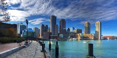
Boston
[TAP OR CLICK TO LEARN MORE]
Berklee College Of Music
"Berklee College"
Coordinates: 42.346693°, -71.087090°
Location Address: Mass Avenue Dorms, 150 Massachusetts Avenue, Boston, Massachusetts
Berklee College of Music in Boston, Massachusetts was established in 1945 and is renowned as being the largest independent music college in the United States. The Massachusetts Avenue Dorms were originally constructed as the Sherry Biltmore Hotel, and are said to be haunted by several spirits who were killed in 1963 when the hotel caught fire. Ever since, hotel guests have reported encountering the apparitions of a number of men and women who were killed in the fire, as well as experiencing a variety of other paranormal activity. In 1972, the Sherry Biltmore Hotel was purchased by Berklee College of Music and converted into a dormitory for undergraduate students, who continue to report encountering apparitions, as well as experiencing other paranormal phenomena such as hearing disembodied voices and witnessing objects being moved around or thrown violently by an unseen entity.
Boston Athenaeum Library
"The Boston Athenaeum"
Coordinates:
Location Address: Boston, Massachusetts
Research for this allegedly haunted location is currently in progress.
Boston Common
Coordinates: 42.354954°, -71.065489°
Location Address: 139 Tremont Street, Boston, Massachusetts
Established in 1634 by Puritan settlers, the Boston Common spans over fifty acres of land in central Boston, Massachusetts, and is renowned as being the first city park in the United States. It was used until 1817 to hang criminals, lawbreakers, people accused of witchcraft, and others who disobeyed the strict Puritan laws of the Massachusetts Bay Colony. In recent years Boston Common has been used for concerts and other public gatherings and events, and Frog Pond located on the northern end of the common is a popular location for ice skating during the winter. Those walking on the common late at night often report witnessing the apparitions of two women strolling through the park wearing 1800's style dresses, who mysteriously vanish when approached.
Boston Conservatory At Berklee
"The Boston Conservatory"
Coordinates: 42.346215°, -71.090006°
Location Address: 4099 8, Fenway, Boston, Massachusetts
The Boston Conservatory at Berklee was established in 1867 as The Boston Conservatory, which merged with Berklee College of Music in 2016. Students and guests at the Boston Conservatory at Berklee often report encountering the spirits of unidentified men and women, who many believe were patients at a hospital that once occupied the location. Others living in the building's old dorms report hearing disembodied voices and whispers, as well as witnessing doors opening and closing by themselves, and objects that go missing and reappear in strange places.
Boston University
Coordinates: 42.350309°, -71.097017°
Location Address: Kilachand Hall, 91 Bay State Road, Boston, Massachusetts
Established in 1839, Boston University (also referred to as simply, BU) is a private research university in Boston, Massachusetts that spans over 135 acres. Kilachand Hall was constructed in 1923 as the Sheraton Hotel, and is said to be haunted by the spirit of a famous American playwright named Eugene O'Neill who passed away on the building's 4th floor in November of 1953. In 1954, Boston University purchased the hotel and changed the name to Shelton Hall, and in 2010 the name was again changed to Kilachand Hall. Students living in Kilachand Hall report encountering the apparition of a man believed to be Mr. O'Neill, as well as experiencing other paranormal phenomena, such as unexplained cold spots and lights flickering. Residents also report being woken in the middle of the night by an unseen entity pounding on the door, while others report witnessing the building's elevator moving by itself and stopping on the 4th floor, as if being controlled by an invisible rider.
Boylston Subway Station
"Boylston Station"
Coordinates: 42.353279°, -71.064361°
Location Address: Tremont Street at Boylston Station, Boston, Massachusetts
Boylston Station in Boston, Massachusetts first opened on September 3, 1897, and is renowned as being the first subway station in the United States. Boylston Station and many of its surrounding tunnels are believed to be haunted by the spirits of over nine-hundred British soldiers who were discovered buried in a mass grave during its construction, as well as six men and women who were killed in a gas line explosion in March of 1897. Passengers on the subway frequently report witnessing apparitions and hearing disembodied voices, as well as experiencing feelings of being watched by an unseen entity, especially at night when the location is less populated. In 2013, a group of paranormal investigators was filmed investigating Boylston Station for a television show called Haunted Encounters. During the investigation the group reported experiencing unexplained technical difficulties with electronic equipment, such as devices turning on and off by themselves, and batteries being drained unexpectedly.
Central Burying Ground
Coordinates: 42.352894°, -71.065934°
Location Address: Boylston Street, Boston, Massachusetts
Central Burying Ground in Boston, Massachusetts was established in 1756, and is believed to be haunted by the spirits of dozens of unidentified men and women who were found buried in a mass grave during the construction of the nearby Tremont Street Subway in the late 1800's. The newly discovered bodies were then buried in another mass grave at Central Burying Ground, where their restless spirits are allegedly seen wandering the cemetery and its surrounding area wearing Colonial-era clothing. Pedestrians walking near the cemetery late at night also report witnessing mysterious glowing orbs and flashing lights, in addition to feeling a strange presence, as if someone or something is lurking in the shadows nearby.
Charlesgate Luxury Apartments
"The Charlesgate Hotel"
Coordinates: 42.350079°, -71.091504°
Location Address: 4 Charlesgate East, Boston, Massachusetts
The Charlesgate Luxury Apartments in Boston, Massachusetts were constructed in 1901 as The Charlesgate Hotel. The hotel was purchased by Boston University in 1947 for use as a women's dormitory, and in 1994 was sold again and converted into luxury condos. The old building is said to be haunted by several spirits, including one man who committed suicide with a revolver in March of 1908, as well as a young girl who was crushed to death in the building's elevator shaft. One urban legend claims that several men were killed in the basement during a flood, and another claims that the hotel was used during the early 1900's as a meeting place for a satanic cult to perform dark magic rituals. Residents at The Charlesgate Luxury Apartments report allegedly witnessing mysterious orbs, and apparitions, as well as experiencing a variety of other paranormal activity, such as hearing disembodied voices, and feeling the presence of an unseen entity. Those who enter the basement also report experiencing unexplained feelings of paranoia and fear that subside upon leaving the location.
Charlestown Navy Yard
"The USS Constitution"
Coordinates:
Location Address: Boston, Massachusetts
Sometimes also referred to as "Old Ironsides." Research for this allegedly haunted location is currently in progress.
Copp's Hill Burying Ground
"Old North Burying Ground"
Coordinates: 42.367256°, -71.055951°
Location Address: 21 Hull Street, Boston, Massachusetts
Established in 1659 as North Burying Ground, Copp's Hill Burying Ground is a historic cemetery located in northern Boston, Massachusetts. It is believed to be haunted by the spirits of numerous unidentified men wearing uniforms from the American Revolutionary War and Civil War, who often appear in photographs taken by visitors at night. Another spirit said to haunt the old cemetery is that of a Puritan minister named Reverend Increase Mather, who famously campaigned for the prosecution of over 200 men and women during the Salem Witch Trials of 1692. Paranormal enthusiasts investigating the location at night also report witnessing strange glowing balls of light, and feeling an eerie presence, as if being watched by an unseen entity. During the late 1700's, Copp's Hill Burying Ground was used by British soldiers as a hideout, where infantrymen repeatedly used the headstones of American patriots as targets for musket practice and committed other acts of vandalism. The location was added to the National Register of Historic Places in April of 1974.
East Boston Public Library
"East Boston Library"
Coordinates: 42.377810°, -71.028035°
Location Address: 365 S. Bremen Street, Boston, Massachusetts
Opened in 1870, the East Boston Public Library in Boston, Massachusetts is renowned as being the first branch library in the United States. Employees working at the library report hearing the sounds of disembodied voices and movement coming from the basement, where a former librarian is rumored to have been killed. Others report feeling a strange presence in the basement, as if being watched by an unseen entity.
Emerson Cutler Majestic Theatre
"The Majestic Theatre"
Coordinates: 42.351633°, -71.065295°
Location Address: 219 Tremont Street, Boston, Massachusetts
The Emerson Cutler Majestic Theatre was constructed in 1903 as the Majestic Theatre, and is one of the oldest and most lavishly decorated theaters in the state of Massachusetts. It was remodeled in the 1920's to accommodate vaudeville shows, and in the 1950's was redesigned again for use as a movie theater. The theater was bought by Emerson College during the mid-1980's and restored to its previous Beaux-Arts design, and in 2003 was renamed as the Emerson Cutler Majestic Theatre. The location is said to be haunted by several different spirits, including that of a former Boston mayor who died of a heart attack during a performance in the early 1900's, as well as a married couple who were killed in a car crash during the 1930's after attending a show. Guests at the Majestic Theater also report encountering the spirit of a young girl whose apparition is seen and heard crying in certain areas, and performers backstage have nicknamed one room "The Nightmare Room" due to reports of people experiencing feelings of fear and shortness of breath.
Everett Square Theatre
Coordinates: 42.255300°, -71.120876°
Location Address: 11 Fairmount Avenue, Hyde Park, Boston, Massachusetts
The Everett Square Theatre in Boston, Massachusetts was constructed in 1915. It hosted a variety of vaudeville and musical performances as well as motion pictures before permanently closing in the mid-1980's. The abandoned theater is rumored to be haunted by several ghosts, and urban explorers often report witnessing mysterious glowing orbs and flickering lights, as well as hearing the sounds of disembodied voices and footsteps. Others claim to feel a strange presence, as if being watched or followed by an unseen entity. One popular urban legend claims that a group of guests seated in the balcony were killed after the stage lights above were cut down, however no historical evidence is currently available to support this legend.
Faneuil Hall Marketplace
"Faneuil Hall"
Coordinates: 42.360189°, -71.055114°
Location Address: 4 S. Market Street, Boston, Massachusetts
Faneuil Hall in Boston, Massachusetts was constructed in 1742 as a town marketplace and business hub for merchants to sell goods and other products, such as meat and produce. African slaves brought to the United States were also auctioned off at Faneuil Hall for a short time, however slavery became illegal in the state of Massachusetts during the 1780's. The building also included a large room on its second floor which was used as a meeting hall by New England colonists to discuss town issues and other business. It was rebuilt after a large fire in March of 1761, at which point it was expanded to almost double its original size. The historic location was also used by many of America's founding fathers to deliver important speeches, and rally patriot militia forces during the American Revolution. It was later given the nickname, "The Cradle of Liberty," and was used for town meetings until 1822. Devine's Irish Pub, located within the Quincy Market at Faneuil Hall, is said to be haunted by the spirit of a dark-skinned woman wearing old, Colonial-era clothing. She is believed to have been a former African slave who died under mysterious circumstances, and whose identity is unknown. She is also believed to be responsible for a variety of unexplained paranormal phenomena at the pub, such as objects being moved around or rearranged by an unseen entity, or sudden cold spots and drops in temperature. Another spirit said to haunt the Quincy Market area of Faneuil Hall is that of a man named Victor Hendrickson, who was killed in 1907 in a heavy machinery accident while working at Ames Plow Company, which occupied a large portion of the market from 1862 until 1909. An article published by The Boston Globe in September of 1907 reports that Victor Hendrickson was killed at the age of thirty-five when his shirt became caught in a piece of rotating machinery, causing him to be dragged through the machine, and breaking every bone in the man's body. When an autopsy was performed on the man's disfigured and partially dismembered corpse, it was unable to be determined if he was crushed to death, or if he later died of strangulation when the machine caused the vest he was wearing to become so tightly wound around his neck that he was nearly decapitated. Ever since his death, Victor Hendrickson's mutilated apparition has reportedly been seen by shoppers at Faneuil Hall, or others walking on the streets nearby at night. Others report hearing the sounds of disembodied screams, and feeling a strange presence. Many also report encountering a number of other unidentified apparitions and shadow figures, with some also claiming that the location is haunted by five Boston men who were killed by British troops on nearby State Street on March 5, 1770, in an event that later became known as The Boston Massacre.
Georges Island
"Fort Warren"
Coordinates: 42.320385°, -70.927777°
Location Address: Georges Island, Boston Harbor, Boston, Massachusetts
Ft. Warren was constructed between 1833 and 1861 to protect Boston Harbor from Confederate soldiers during the American Civil War and was used as an active military base until 1947. It is said to be haunted by the spirit of a woman named Mrs. Melanie Lanier, who was sentenced to death by hanging during the mid-1800's after she was caught by Union soldiers attempting to free her captured Confederate husband, Lieutenant Andrew Lanier. She was hanged wearing a black dress, and according to legend, her spirit haunts the location of her death, still searching for her captured husband. Over the years, her spirit has come to be known as, "The Lady In Black." For more information see: Ft. Devens Main Post Cemetery in Ft. Devens, Massachusetts.
Granary Burying Ground
Coordinates: 42.357476°, -71.061721°
Location Address: Tremont Street, Boston, Massachusetts
Established in 1660, the Granary Burying Ground in Boston, Massachusetts consists of over 2,300 burial plots and is known as being the final resting place of many of America's patriots and founding fathers, including Paul Revere, Samuel Adams, and John Hancock. Those visiting the old cemetery at night report witnessing mysterious glowing orbs and apparitions, as well as capturing images of shadowy faces and figures in photographs and videos.
The Liberty, A Luxury Collection Hotel
"The Liberty Hotel"
Coordinates:
Location Address: Boston, Massachusetts
Research for this allegedly haunted location is currently in progress.
The Omni Parker House Hotel
"The Parker House Hotel"
Coordinates: 42.357730°, -71.060130°
Location Address: 60 School Street, Boston, Massachusetts
Constructed in 1927 as the Parker House Hotel, the Omni Parker House is a historic hotel located in Boston, Massachusetts, and is said to be one of the most haunted hotels in the United States. It is said to be haunted by the spirit of Harvey Parker, who founded the original Parker House Hotel in 1855, as well as the spirits of several other unidentified men and women. Guests at the Omni Parker House report witnessing orbs and apparitions, as well as hearing disembodied voices, and feeling the presence of an unseen entity. The third floor of the Omni Parker House is also said to be haunted by the spirit of the American actress Charlotte Cushman, who died of pneumonia while staying at the hotel, and the novel 1408 was allegedly based on events experienced by author Stephen King while staying in Room 303 where a former guest committed suicide. Employees at the Omni Parker House report witnessing elevators opening and closing by themselves, and unexpectedly stopping at the third floor, as well as experiencing other unexplained paranormal phenomena, such as lights flickering, and bathroom faucets turning on and off by themselves.
Brewster
Bramble Inn & Restaurant
"The Bramble Inn"
Coordinates:
Location Address:
Research for this allegedly haunted location is currently in progress.
The Captain Freeman Inn
"The Captain Freeman Perry House"
Coordinates: 41.754579°, -70.094646°
Location Address: 1531 MA-6A, Brewster, Massachusetts
Constructed during the early 1900's as the Captain Freeman Perry House, the Captain Freeman Inn is said to be haunted by the spirit of a woman named Roberta, whose apparition has been seen by many of its guests and residents throughout the years. Many also report hearing the ghostly sounds of a piano playing late into night, accompanied by the unexplained scent of women's perfume. Although many report encountering Roberta's ghost, the reason for her presence at the house is unknown. Previously the site of the Captain Freeman Perry House Antique Shop.
The Crosby Mansion Museum
"Crosby Mansion"
Coordinates: 41.780282°, -70.034831°
Location Address: 163 Crosby Lane, Brewster, Massachusetts
The Crosby Mansion in Brewster, Massachusetts was constructed in 1888 by a wealthy businessman named Albert Crosby, who passed away in 1906. The three-story, 35-room mansion was then opened to the public for guided tours, where guests and employees report witnessing apparitions reflected in windows and mirrors, as well as glowing orbs and strange flashing lights late at night when the building is vacant. Others report witnessing a trail of blood on the stairs outside that later disappears.
Bridgewater
[TAP OR CLICK TO LEARN MORE]
Bridgewater State University
"Bridgewater University"
Coordinates: 41.987155°, -70.965071°
Location Address: 131 Summer Street, Bridgewater, Massachusetts
Bridgewater State University in Bridgewater, Massachusetts was founded in 1840 as the Bridgewater Normal School, and many of the old buildings on campus are rumored to be haunted. The Campus Center Auditorium is said to be haunted by the spirit of a man named George, whose apparition is seen by students playing different instruments in the orchestra pit late at night. Shea-Durgin Hall is said to be haunted by the spirit of a young woman who was strangled to death in Room 208 by a jealous boyfriend after it was discovered she was having an affair. In addition to witnessing the young woman's apparition, residents at Shea-Durgin Hall report experiencing a variety of poltergeist activity, such as lights flickering, and objects being moved or thrown by an unseen entity. Tillinghast Hall is also said to be haunted by the spirit of a former headmistress who died after falling from the building's rooftop. Students at Bridgewater State University have reported experiencing paranormal activity throughout its campus dating back to the school's construction during the 1800's.
Camp Titicut Reservation
"Camp Titicut"
Coordinates: 41.931820°, -70.999631°
Location Address: 190 Beech Street, Bridgewater, Massachusetts
Camp Titicut Reservation in Bridgewater, Massachusetts was first settled by Native Americans during the 1500's, and was used as a boy's summer camp starting in the 1930's. In 1946, the site was excavated by the Massachusetts Archaeological Society, which uncovered numerous Native American burial sites, as well as over 6,000 other tribal artifacts and relics. Hikers at Camp Titicut report witnessing the apparitions of former tribesmen and women, as well as the spirit of a young boy who drowned in a nearby lake while camping. Others report feeling sudden cold spots, as well as feeling the presence of an unseen entity in the woods. One urban legend claims that King Phillip was executed at Camp Titicut, however these claims have been debunked as being historically inaccurate. Despite this information, some still claim to encounter the ghost of King Phillip wandering the woods late at night.
Lake Nippenicket
"The Nip"
Coordinates: 41.968345°, -71.040255°
Location Address: Lakeside Drive, Bridgewater, Massachusetts
Sometimes referred to as simply "The Nip," Lake Nippenicket in Bridgewater, Massachusetts is said to be haunted by the spirit of an elderly man who drowned while fishing. The man's apparition is often seen by swimmers at night paddling a small boat before disappearing into the night.
William H. McElwain School
"McElwain School Apartments"
Coordinates: 41.995442°, -70.981405°
Location Address: 250 Main Street, Bridgewater, Massachusetts
The William H. McElwain School in Bridgewater, Massachusetts was constructed in 1912, and served as a public school until 1997. The location is rumored to be haunted by the ghost of a former student whose spirit remains at the school for unknown reasons. Former students at William H. McElwain School have reported encountering the young boy's apparition in one of the bathrooms, as well as experiencing other unexplained paranormal phenomena such as faucets turning on and off by themselves, and stall doors being pushed open or shut unexpectedly. Paranormal investigators at the school report feeling the presence of an unseen entity, or experiencing feelings of being watched. The William H. McElwain School was added to the National Register of Historic Places in January of 2013, and now serves as The McElwain School Apartments.
Brockton
Cape Cod Café & Pizza
"The Cape Cod Café"
Coordinates: 42.066069°, -71.016579°
Location Address: 979 Main Street, Brockton, Massachusetts
Opened in 1947, the Cape Cod Café in Brockton, Massachusetts is rumored to be haunted by the spirit of an infant child who choked to death while his or her mother sat at the bar drinking. Although many speculate that this urban legend may have been made up to discourage negligent parenting, employees and patrons often report hearing the disembodied sounds of a baby crying.
Melrose Cemetery
Coordinates: 42.093168°, -71.066889°
Location Address: 88 N. Pearl Street, Brockton, Massachusetts
Melrose Cemetery in Brockton, Massachusetts was established during the 1850's. Paranormal investigators at the cemetery report allegedly witnessing foggy apparitions, as well as hearing the sounds of disembodied footsteps, voices, and laughter at night. Others report feeling the presence of an unseen entity, or feeling as if being followed by someone or something. Although many residents of Brockton have reported encountering spirits at Melrose Cemetery, their identities are unknown.
Brookline
Holyhood Cemetery
Coordinates: 42.320297°, -71.167480°
Location Address: Heath Street, Brookline, Massachusetts
Holyhood Cemetery in Brookline, Massachusetts was established in 1857, and added to the National Register Of Historic Places in October of 1985. Visitors over the years have reported witnessing the apparitions of several young children who are allegedly seen playing and hiding among the headstones, in addition to hearing the disembodied sounds of a woman singing late at night. Despite these claims, their identities remain unknown.
Burlington
Burlington Shopping Mall
"The Burlington Mall"
Coordinates: 42.482480°, -71.213701°
Location Address: 75 Middlesex Turnpike, Burlington, Massachusetts
The old Sears department store at the Burlington Mall in Burlington, Massachusetts is said to be haunted by an unknown spirit, whose apparition is allegedly responsible for a variety of paranormal phenomena, such as objects moving by themselves, and merchandise being knocked violently from shelves. Sears closed in 2018, and the location was turned into a lifestyle center, where shoppers often report hearing the sounds of disembodied voices, and other strange noises.
Sawmill Road
"The Sawmill Road House"
Coordinates: 42.524131°, -71.181387°
Location Address: Sawmill Road, Burlington, Massachusetts
Burlington locals tell stories of an abandoned house at the end of Sawmill Road, where the spirit of an elderly man is allegedly seen. The man is believed to be a former owner of the home, though his identity has never been confirmed. The house was abandoned during the late 1990's and razed in the early 2000's, however its stone foundation remains. Other rumors claim that the Sawmill Road House is haunted by the spirit of a man who committed suicide, however these stories are thought to be nothing more than urban legends.
Cambridge
[TAP OR CLICK TO LEARN MORE]
Café Luna Catering
"Café Luna"
Coordinates: 42.396004°, -71.128965°
Location Address: 2344 Massachusetts Avenue, Cambridge, Massachusetts
Employees working at Café Luna Catering in Cambridge, Massachusetts report witnessing shadow figures and other unidentified apparitions, as well as feeling the presence of an unseen entity, especially in the basement. The location was previously a coffee shop called Verna's Coffee & Donut Shop, which opened in 1951 and closed in 2016 due to financial issues. Previous employees at Verna's Coffee Shop have also reported experiencing paranormal activity, with many employees allegedly refusing to go into the basement alone.
Cambridgeport Baptist Church
"Emanuel Baptist Church"
Coordinates: 42.358856°, -71.110908°
Location Address: 459 Putnam Avenue, Cambridge, Massachusetts
Constructed during the 1800's as Emanuel Baptist Church, the Cambridgeport Baptist Church in Cambridge, Massachusetts is said to be haunted by the spirit of a woman named Ann Hopkins, who was allegedly burned at the stake for practicing witchcraft. According to legend, she placed a curse on the townsfolk with her final breath, saying, "the curse of fire shall be upon this spot forever!" In 1865, the Cambridgeport Baptist Church burned down in a mysterious fire, and in 1881 was devastated by fire again. According to an article published by The Boston Globe in March of 1881, townsfolk present during both fires reported hearing the sounds of disembodied moans and screams of agony that continued for weeks. Although skeptics at the time tried to debunk the allegedly paranormal activity at Cambridgeport Baptist Church, many claim that the vengeful spirit of Ann Hopkins still lingers. Sometimes also referred to as "The Old Emanuel Baptist Church."
Cambridge Rindge & Latin School
"Rindge School"
Coordinates: 42.374404°, -71.111610°
Location Address: 459 Broadway, Cambridge, Massachusetts
Also known as CRLS or simply Rindge School, the Cambridge Rindge & Latin School in Cambridge, Massachusetts was formed in 1977 with the merging of Rindge Technical School and Cambridge High & Latin School. It is said to be haunted by the spirit of an elderly man, whose apparition is seen by students in the area near the school's World War II memorial. Others report feeling unexplained cold spots and sudden drops in temperature, as well as feeling the presence of an unseen entity in certain areas. Although many report encountering the old man's ghost at the Cambridge Ridge & Latin School, the reason for his presence is unknown.
Cambridge YMCA
"The YMCA"
Coordinates: 42.366823°, -71.106666°
Location Address: 820 Massachusetts Avenue, Cambridge, Massachusetts
The Cambridge YMCA in Cambridge, Massachusetts is said to be haunted by the spirit of a man who passed away under mysterious circumstances in the old locker rooms downstairs. His ghost is now said to haunt the basement area where the locker rooms were once located. YMCA members report witnessing the apparition of a man in the basement who appears to be glowing bright green, while others exercising in the basement area report feeling a strange presence, as if an unseen entity is lurking just beyond sight. Although many have allegedly encountered the man's apparition, very little additional information is currently available regarding this alleged haunting.
Christ Church Cambridge
"Christ Episcopal Church"
Coordinates: 42.375597°, -71.120810°
Location Address: 0 Garden Street, Cambridge, Massachusetts
Constructed in 1761, Christ Church Cambridge in Cambridge, Massachusetts was used during the American Revolutionary War as an outpost for British soldiers. It was attacked several times by Colonial militia troops, and is said to be haunted by the spirit of a former British soldier who was killed in a skirmish with Patriot forces and buried beneath the church. His restless spirit is allegedly seen by churchgoers wandering the pews, still performing his duties as a soldier. Christ Church Cambridge was added to the National Register of Historic Places in 1966.
Harvard University
"Harvard College"
Coordinates:
Location Address: Cambridge, Massachusetts
Research for this allegedly haunted location is currently in progress.
Matignon Roman Catholic High School
"Matignon High School"
Coordinates: 42.401603°, -71.131355°
Location Address: 1 Matignon Road, Cambridge, Massachusetts
Established in 1945, Matignon High School in Cambridge, Massachusetts is a Roman Catholic private school facilitated by the Roman Catholic Archdiocese of Boston. The location is said to be haunted by the spirit of a former nun, whose apparition is often seen by students and staff members, as well as the spirit of a student who committed suicide in Room 204. Students staying after school for sports or other activities report experiencing a variety of unexplained paranormal activity, such as lights flickering, objects moving by themselves, and the sounds of disembodied voices or footsteps. Others report feeling the presence of an unseen entity, as well as catching glimpses of apparitions reflected in windows and mirrors.
The Hooper-Lee-Nichols House Museum
"The Hooper-Lee-Nichols House"
Coordinates: 42.377582°, -71.134198°
Location Address: 159 Brattle Street, Cambridge, Massachusetts
Constructed by Dr. Richard Hooper in 1685, the Hooper-Lee-Nichols House is renowned as being one of the oldest houses in the city of Cambridge, Massachusetts. It was purchased by a British loyalist named Judge Joseph Lee in 1758, and is said to be haunted by the spirits of five Hessian soldiers who were employed by the British army. Although many guests at the Hooper-Lee-Nichols House have reported witnessing the apparitions of the five soldiers playing cards, the reason for their presence is unknown. The Hooper-Lee-Nichols House was added to the National Register of Historic Places in 1979 and now serves as the headquarters for the Cambridge Historical Society.
The Porcellian Club Of Harvard University
"The Porcellian Club"
Coordinates: 42.372888°, -71.117788°
Location Address: 1234 Massachusetts Avenue, Cambridge, Massachusetts
The Porcellian Club in Cambridge, Massachusetts is a historic all-male club at Harvard University. It was founded in 1791 and is often associated with Yale's secretive Skull & Bones Club, and Princeton's Ivy Club. Sometimes referred to as "The Porc," or simply The P.C, the Porcellian Club was added to the National Register of Historic Places in 1983. One popular urban legend claims that the clubhouse is haunted by the spirit of a young man who died of fright after one of the other members of the Porcellian Club dressed up as a ghost for a prank. Members of the Porcellian Club pass down tales of the alleged haunting, however many speculate the stories to be made up as a way of scaring new members.
Canton
Canton Corner Cemetery
"Canton Cemetery"
Coordinates: 42.179130°, -71.130307°
Location Address: Washington Street, Canton, Massachusetts
Canton Corner Cemetery is a historic burial ground in Canton, Massachusetts dating back to the mid 1700's. It was added to the 170-acre Canton Corners Historic District in 2009, and is believed by many to be haunted. Visitors often report witnessing the shadowy apparition of a man standing ominously in the cemetery at night, while others report feeling a strange presence, as if something sinister is lurking nearby. Many also report hearing the sounds of disembodied laughter coming from the back of the cemetery.
The Paul Revere Heritage Site Museum
"Paul Revere's Workshop"
Coordinates:
Location Address:
Research for this allegedly haunted location is currently in progress.
Washington Street
Coordinates:
Location Address:
Research for this allegedly haunted location is currently in progress.
Cape Cod
Georges Bank
"The Ghost Andrew Johnson"
Coordinates:
Location Address:
Sometimes also referred to as "The Georges Bank Ghost Ship," "The Ghost Ship Of Georges Bank," or "The Cape Cod Ghost Ship." Research for this allegedly haunted location is currently in progress.
"The Ghost Andrew Johnson"
Coordinates:
Location Address:
Sometimes also referred to as "The Georges Bank Ghost Ship," "The Ghost Ship Of Georges Bank," or "The Cape Cod Ghost Ship." Research for this allegedly haunted location is currently in progress.
Carver
Myles Standish State Forest
"Myles Standish Forest"
Coordinates: 41.839191°, -70.691455°
Location Address: 194 Cranberry Road, Carver, Massachusetts
Myles Standish State Forest is located in Carver, Massachusetts, with some parts extending into the nearby town of Plymouth. The 12,000-acre forest contains a number of amenities for nature enthusiasts, such as hiking trails, campsites, ponds for swimming, fishing areas, and hunting sites. It is said to be haunted by the spirit of a woman named Ruth Masters, who was murdered on May 14, 1977 while riding her bicycle on a remote trail in the woods. According to police reports, Ruth's body was found stabbed and mutilated the following day, with her throat cut deeply. Her ghost is now said to haunt the forest, as well as several other unidentified specters whose identities are unknown. Hikers in Myles Standish Forest report witnessing apparitions, feeling sudden drops in temperature, and feeling the presence of an unseen entity. One urban legend claims that an abandoned mental asylum exists deep in the forest, which is haunted by a number of evil spirits and dark entities, however these stories are widely disregarded as being fictitious.
Charlemont
Charlemont Inn Bed & Breakfast
"The Charlemont Inn"
Coordinates: 42.627980°, -72.875654°
Location Address: 107 Main Street, Charlemont, Massachusetts
The Charlemont Inn Bed & Breakfast in Charlemont, Massachusetts was constructed in 1787 as a hotel, tavern, and stagecoach stop. The historic inn is believed to be haunted by the spirit of a young woman named Elizabeth, who is said to be responsible for a variety of unexplained paranormal activity, such as doors slamming shut unexpectedly, and objects being moved or thrown across the room by an unseen entity. Guests at The Charlemont Inn have also reported encountering the spirit of a former Civil War soldier in the hallways upstairs, as well as hearing the sounds of disembodied voices and footsteps late at night. The Charlemont Inn Bed & Breakfast was permanently closed in December of 2011.
Chelmsford
The Establishment Restaurant & Bar
"The Establishment"
Coordinates: 42.635721°, -71.379434°
Location Address: 75 Princeton Street, Chelmsford, Massachusetts
Constructed during the 1920's as a wool processing mill, The Establishment Restaurant & Bar in Chelmsford, Massachusetts is said to be haunted by the spirit of a weeping woman, as well as several unidentified children whose apparitions are seen and heard playing in empty areas. Employees working at The Establishment often report experiencing other paranormal phenomena, such as sudden cold spots or drops in temperature, as well as witnessing objects such as dishes and paintings being moved by an unseen entity. Others report feeling a strange presence, as if being followed or watched. The Establishment was previously known as Bainbridge's Restaurant, and later as Aprile's European Restaurant, where former employees have also reported experiencing similar paranormal activity.
Chelsea
Governor Bellingham-Cary House
"The Bellingham-Cary House"
Coordinates: 42.398327°, -71.028034°
Location Address: 34 Parker Street, Chelsea, Massachusetts
The Governor Bellingham-Cary House in Chelsea, Massachusetts was constructed in 1724, and added to the National Register of Historic Places in September of 1974. It is said to be haunted by the spirits of two former Union and Confederate army soldiers who were killed during a confrontation after it was discovered they were both competing for the affection of the same woman. Ever since, residents at the Bellingham-Cary House have reported witnessing the apparitions of the two soldiers, as well as hearing the unexplained sounds of disembodied voices and laughter. Others report feeling cold spots, and feeling a strange presence at the location, as if being watched by an unseen entity. See also: American Civil War Ghosts (Folklore Encyclopedia).
Voke Park Playground
"Voke Park"
Coordinates: 42.409018°, -71.031391°
Location Address: Washington Avenue, Chelsea, Massachusetts
Voke Park in Chelsea, Massachusetts is said to be haunted by the ghost of a young boy who was mauled to death by two dogs. His mangled apparition is allegedly seen by children playing at the park, as well as pedestrians walking on nearby Washington Avenue.
Chestnut Hill
Pine Manor College
"Pine Manor School For Women"
Coordinates: 42.320072°, -71.158067°
Location Address: 400 Heath Street, Chestnut Hill, Massachusetts
Pine Manor College in Chestnut Hill, Massachusetts was founded in 1911 as a women's-only school called Pine Manor Junior College. The Administration Building is said to be haunted by a mysterious, unidentified apparition. Students walking near the building late at night report witnessing lights in the empty building turning on and off by themselves, as well as feeling a strange presence, as if being watched by an unseen entity. Others report witnessing foggy apparitions throughout the school's 50-acre campus, especially in less populated or wooded areas.
Clinton
Clinton Railroad Tunnel
"The Clinton Tunnel"
Coordinates: 42.405088°, -71.684010°
Location Address: Boylston Street, Clinton, Massachusetts
The Clinton Tunnel in Clinton, Massachusetts was constructed during the early 1900's to divert excess railway traffic from the nearby Wachusett Reservoir. The tunnel was last used in 1958, and over the years has fallen into a state of disrepair. It is said to be haunted by the spirit of a young girl who was murdered, and whose body was found in the tunnel. Urban explorers report feeling unexplained cold spots, as well as hearing the disembodied sounds of a train on the unused tracks, and other mysterious, unexplained noises. Some even claim that the Clinton Tunnel stretches on forever due to an optical illusion which causes the end of the tunnel to appear further away as a person travels closer to the end.
Cohasset
Bates Ship Chandlery & Maritime Museum
"Bates Ship Chandlery"
Coordinates:
Location Address:
Sometimes also referred to as "The Bates Ship Chandlery Museum." Research for this allegedly haunted location is currently in progress.
Cohasset Town Hall
"Town Hall"
Coordinates: 42.243028°, -70.802411°
Location Address: 41 Highland Avenue, Cohasset, Massachusetts
Constructed in the mid-1850's, the Cohasset Town Hall in Cohasset, Massachusetts is believed to be haunted by two unidentified male spirits. Employees at the town hall report hearing disembodied voices, banging, and footsteps, as well as witnessing doors opening and slamming shut by themselves. Others report feeling cold spots or feeling the presence of an unseen entity, as well as hearing the sounds of metal chains in the basement where the old jail cells are located. In 2008, a group of paranormal investigators were called by the town of Cohasset to uncover evidence of paranormal activity, and after several nights declared the building to be officially haunted.
Concord
Concord's Colonial Inn
"The Colonial Inn"
Coordinates: 42.461624°, -71.349580°
Location Address: 48 Monument Square, Concord, Massachusetts
Concord's Colonial Inn in Concord, Massachusetts was constructed in 1716, and is renowned as being one of the oldest hotels in the United States. It was used during the American Revolutionary War as a makeshift hospital for injured soldiers, many of whom died from their wounds. Guests staying at The Colonial Inn often report witnessing mysterious orbs and apparitions, as well as experiencing other unexplained paranormal phenomena such as lights flickering, and doors opening or slamming shut by themselves. According to local historians, Room 24 was used as an operating room by Dr. Timothy Minot to perform emergency surgery on injured Patriot soldiers, many of which did not survive. Guests staying in Room 24 report witnessing a spirit known as "The Grey Ghost," whose apparition is thought to care for those sleeping in the room. Many suspect that The Grey Ghost is in fact the spirit of Dr. Minot, who returns to the old hotel to comfort and check on his former patients. Room 27 was also used as a temporary morgue where the bodies of deceased soldiers were prepared for burial. Concord's Colonial Inn was featured on several popular ghost hunting television shows, including Ghost Hunters, Ghost Village, and Psychic Kids.
Danvers
[TAP OR CLICK TO LEARN MORE]
Danvers State Mental Hospital
"Danvers State Lunatic Asylum"
Coordinates: 42.585062°, -70.981717°
Location Address: 1101 Kirkbride Drive, Danvers, Massachusetts
Constructed in 1878 as the State Lunatic Hospital At Danvers, the Danvers State Hospital was added to the National Register of Historic Places in 1984, and was permanently shut down in 1992. The hospital and its series of underground tunnels are said to have inspired works such as H.P. Lovecraft's novel, Arkham Sanitarium, and Batman's Arkham Asylum. Although most of the old buildings at Danvers State Hospital were demolished in 2007, the administration building and cemetery remain. The remainder of the seventy-seven acre campus was redesigned as The Bradlee Danvers Apartments, which are rumored to be haunted. Urban explorers who have entered the old administration building and residents of the Bradlee Danvers Apartments report witnessing the spirits of former mental patients who were abused and neglected by caretakers, and subjected to inhumane medical procedures such as electroshock therapy and lobotomies. In its later years, Danvers State Hospital began to admit criminally insane patients and became heavily overcrowded, which helped to further the atmosphere of abuse, neglect, and violence. Locals also report witnessing mysterious orbs and flashing lights coming from the abandoned administration building late at night, and residents also report hearing the sounds of disembodied voices, screams, and moaning. Others often report feeling a strange presence, as if being watched by an unseen entity. Sometimes also referred to as "The Old Danvers State Hospital," or "The Old Danvers State Mental Hospital."
Endicott Family Burial Ground
"Endicott Family Cemetery"
Coordinates: 42.554783°, -70.930696°
Location Address: 25-55 Clinton Avenue, Danvers, Massachusetts
Established during the 1840's as a private family burial ground, the Endicott Family Cemetery in Danvers, Massachusetts is said to be haunted by three members of the Endicott family; a woman named Margaret, and her two sons, Jeremy and Alex. Paranormal investigators at the old cemetery report witnessing the three forlorn spirits dressed in clothing from the 1800's, as well as experiencing other paranormal phenomena, such as unexplained cold spots and drops in temperature, and feeling a strange presence. Over the years, the Endicott Family Cemetery was abandoned and fell into a state of disrepair. Many believe that the three Endicott family spirits remain at the cemetery to protect their final resting places from further vandalism, with some noting that the headstones of Margaret, Jeremy, and Alex are some of the only burial sites that haven't been vandalized. Sometimes also referred to as "Endicott Burial Ground," or "Endicott Cemetery."
Peabody Institute Library
"Danvers Public Library"
Coordinates: 42.561625°, -70.940961°
Location Address: 15 Sylvan Street, Danvers, Massachusetts
The Peabody Institute Library was constructed in 1891 and has served as the Danvers town library ever since. It was added to the National Register of Historic Places in 1997, and is said by many to be haunted by the spirit of an elderly man. Guests on the library's third floor often report witnessing the man's apparition, as well as feeling a strange presence, as if being watched by an unseen entity. Others have even reported being "shooshed" by a disembodied voice. Although many patrons at the Peabody Institute Library have reported encountering the old man's spirit over the years, his identity and the reason for his presence remain unknown.
Rebecca Nurse Homestead Museum
"The Rebecca Nurse Homestead"
Coordinates:
Location Address:
Research for this allegedly haunted location is currently in progress.
Dartmouth
Lincoln Park Amusement Park
"Lincoln Park"
Coordinates: 41.637976°, -71.044143°
Location Address: MA-177 & US Route 6, Dartmouth, Massachusetts
Lincoln Park Amusement Park in Dartmouth, Massachusetts was constructed in 1894 as Midway Park, which remained open for nearly a century. It was permanently closed in December of 1987 after a series of safety concerns began to cause a decline in attendance. On August 17, 1986, a 27-year-old electrical worker named Michael Lynch was killed after falling from a roller coaster called The Comet. The following year on September 29, 1987 the brake lines on The Comet failed, again causing injuries to several passengers. The Comet was immediately shut down, and the crashed passenger cars remained in that exact position until Lincoln Park was demolished in July of 2012. Urban explorers and paranormal investigators who visit the site of the former amusement park report witnessing the spirit of a man believed to be Michael Lynch, as well as the spirit of a former security guard named Raymond Santos who was shot and killed in March of 1982 by an intruder armed with a stolen shotgun. Others report hearing the disembodied sounds of laughter and carnival music playing, as well as smelling the scent of carnival food wafting on the breeze. Although most of the former 40-acre lot has been sold and converted into apartment buildings some spots remain vacant, and many also believe that paranormal activity continues for residents of the newly constructed housing units nearby.
Round Hill Point
"Round Hill Beach"
Coordinates:
Location Address:
Sometimes also referred to as "Buzzards Bay," or simply as "Round Hill." Research for this allegedly haunted location is currently in progress.
University Of Massachusetts, Dartmouth
"The University Of Massachusetts"
Coordinates:
Location Address:
Sometimes also referred to as "UMASS," or "UMASS Dartmouth." Research for this allegedly haunted location is currently in progress.
Deerfield
Deerfield Inn & Restaurant
"The Deerfield Inn"
Coordinates:
Location Address:
Research for this allegedly haunted location is currently in progress.
"The Deerfield Inn"
Coordinates:
Location Address:
Research for this allegedly haunted location is currently in progress.
Dover
The Dover Demon
"The Demon Of Dover"
Coordinates:
Location Address:
Research for this alleged haunting is currently in progress.
"The Demon Of Dover"
Coordinates:
Location Address:
Research for this alleged haunting is currently in progress.
Dracut
Village Inn & Restaurant
"The Village Inn"
Coordinates: 42.683728°, -71.282279°
Location Address: 544 Broadway Road, Dracut, Massachusetts
The Village Inn in Dracut, Massachusetts was constructed in 1880, and is noted as being one of the oldest standing buildings in town. It is said to be haunted by the spirit of a young boy and girl who remain attached to the inn for unknown reasons. Employees at The Village Inn often report witnessing the young boy's spirit in the lounge area late at night, and guests who encounter the young boy wandering the hallways claim that he quickly disappears when approached by the living. The young girl's apparition is allegedly sighted by employees lurking in an underground tunnel that connects the inn to a nearby building.
Duxbury
Sun Tavern Restaurant & Fine Dining
"The Sun Tavern"
Coordinates: 42.057761°, -70.742186°
Location Address: 500 Congress Street, Duxbury, Massachusetts
The Sun Tavern in Duxbury, Massachusetts was built in 1741 as a private residence. It is said to be haunted by the spirit of a man named Lysander Walker, who committed suicide on October 3, 1928 after a life of solitude within the old building. Many also believe that the location is haunted by two young girls who died of scarlet fever in 1745. During the early 1930's, the house was purchased and turned into a restaurant, which became The Sun Tavern in 1987. Employees working at the tavern over the years have reported encountering orbs and apparitions, as well as hearing disembodied voices, feeling sudden cold spots, and feeling the presence of an unseen entity. Some employees even report hearing the disembodied sounds of a young girl's voice calling their name. Previous owners have also reported hearing disembodied footsteps when the tavern is empty, as well as hearing motion sensor alarms being triggered in the middle of the night for no explainable reason. Police officers who respond to the alarms report hearing disembodied footsteps and voices, as well as experiencing other strange paranormal activity, such as lights flickering or being turned on and off by an unseen entity. In 2014, a group of paranormal investigators called Worcester Paranormal were permitted to investigate The Sun Tavern, where they allegedly captured the disembodied sounds of a young girl humming a song on an audio recorder, as well as the voice of an older man telling the group to "get out!" In November of 2014, a short news segment aired on the local television station, PACTV Community News, detailing the alleged paranormal activity experienced by employees at The Sun Tavern.
East Bridgewater
East Bridgewater Town Hall
"Town Hall"
Coordinates: 42.028963°, -70.955255°
Location Address: 175 Central Street, East Bridgewater, Massachusetts
The East Bridgewater Town Hall in East Bridgewater, Massachusetts is believed to be haunted by the spirit of an elderly woman whose apparition is allegedly seen by employees during times when the building is vacant. Others report hearing the sounds of disembodied footsteps and knocking, and feeling the presence of an unseen entity. Although many have reported encountering the old woman's apparition over the years, her identity and the reason for her presence is unknown.
Mrs. Swift's & Moore Antiques
"Prophett And Flynn Funeral Parlor"
Coordinates: 42.032633°, -70.959896°
Location Address: 16 W. Union Street, East Bridgewater, Massachusetts
Mrs. Swift's & Moore Antiques in East Bridgewater, Massachusetts was constructed as a Masonic Temple in 1892. Beginning in 1908, the building also hosted the Prophett & Flynn Funeral Parlor, and now serves as a shop for antique items and collectibles. Those working at the old antique shop report witnessing shadow figures, and the apparitions of previous shop keepers and other occupants who remain at the location for unknown reasons. Others report feeling sudden cold spots or a strange presence within the building, or smelling the unexplained scent of perfume and pipe tobacco. On several occasions, customers have even reported witnessing objects moving by themselves, or feeling as if being touched by an unseen entity. Passersby also claim to witness ghostly silhouettes and shadowy figures staring out the windows of the empty shop late at night. Mrs. Swift's & Moore Antiques also serves as headquarters for the Massachusetts Area Paranormal Society ("MAPS").
Eastham
Penny House Inn Bed & Breakfast
"The Penny House Inn"
Coordinates:
Location Address:
Research for this allegedly haunted location is currently in progress.
"The Penny House Inn"
Coordinates:
Location Address:
Research for this allegedly haunted location is currently in progress.
Easton
Stonehill College
Coordinates: 42.059043°, -71.080622°
Location Address: 320 Washington Street, Easton, Massachusetts
Established in 1948, Stonehill College is a non-profit Roman Catholic liberal arts college located in Easton, Massachusetts. The campus was originally built as a private residence and mansion for the Fredrick Lothrop Ames family. There are many well-known myths and urban legends surrounding the old college that have been passed down by alumni throughout the years. One popular story claims that the spirit of Fredrick Lothrop's son, Freddy, who died in a plane crash in November of 1932, haunts Ames Pond where his plane allegedly crashed. Although research in later years has revealed that Freddy's plane actually crashed in nearby Randolph, Massachusetts, many students report allegedly witnessing Freddy Ames' spectral plane crashing into the pond on the anniversary of his death, along with a thick, mysterious fog that engulfs the surrounding area. Another legend claims that the Holy Cross Center is haunted by the spirits of numerous unidentified men and women whose bodies are either buried beneath the building, or whose bodies were discovered during its construction. Despite students who claim to experience paranormal activity at the Holy Cross Center, no historical evidence is currently available to support the existence of a mass grave beneath the location. Alumni Hall is also said to be haunted by the spirit of Mr. Ames' daughter, Mary, who allegedly drowned while swimming in a pool located in the family mansion, however town records indicate that Mary instead passed away from natural causes at the age of seventy-four. Alumni and faculty members at Alumni Hall have reported witnessing the spirit of an elderly woman believed to be Mary, as well as experiencing other unexplained paranormal phenomena, such as unexplained cold spots, and feeling the presence of an unseen entity.
East Otis
Knox Trail Inn & Restaurant
"The Knox Trail Inn"
Coordinates: 42.173490°, -73.035376°
Location Address: 1898 E. Otis Road, East Otis, Massachusetts
Constructed in 1776, the Knox Trail Inn in East Otis, Massachusetts is said to be haunted by the spirit of a former soldier, nicknamed "Jake," who was injured in battle during the American Revolutionary War, and died from his injuries after retreating to the inn. His apparition is often seen by employees and guests, and many claim that his ghost is responsible for a variety of other unexplained paranormal activity throughout the old building, such as lights flickering, or electronic devices turning on and off by themselves. Other guests at the Knox Trail Inn report feeling sudden cold spots, as well as feeling the presence of an unseen entity in certain areas. Sometimes also referred to as "The Knox Trail Inn Restaurant."
Essex
Windward Grille Restaurant
"The Windward Grille"
Coordinates:
Location Address:
Research for this allegedly haunted location is currently in progress.
"The Windward Grille"
Coordinates:
Location Address:
Research for this allegedly haunted location is currently in progress.
Everett
Pope John XXIII High School
"Pope John High School"
Coordinates: 42.420439°, -71.044856°
Location Address: 888 Broadway, Everett, Massachusetts
Established in 1965, Pope John XXIII High School (sometimes referred to simply as PJHS) is a Roman Catholic college preparatory school located in Everett, Massachusetts. It was closed in May of 2019 due to financial issues, and now stands abandoned. The location is said to be haunted by the spirit of a nun who passed away, and who is believed to be responsible for a variety of paranormal activity. Former custodians working at night have reported witnessing apparitions, as well as hearing the sounds of disembodied footsteps, and furniture being rearranged in empty rooms. Others have reported witnessing elevators opening and closing by themselves and moving to different floors as if being operated by an unseen entity. Pedestrians walking by the abandoned building also report feeling a strange presence, as if being watched by an unseen entity.
Fairhaven
[TAP OR CLICK TO LEARN MORE]
Atlas Tack Company
"Atlas Tack"
Coordinates:
Location Address: Fairhaven, Massachusetts
Research for this allegedly haunted location is currently in progress.
Fairhaven Public High School
"Fairhaven High School"
Coordinates: 41.643594°, -70.905382°
Location Address: 12 Huttleston Avenue, Fairhaven, Massachusetts
Fairhaven High School in Fairhaven, Massachusetts was constructed in 1905, and was added to the National Register of Historic Places in January of 1981. The location is said to be haunted by a poltergeist, and students at the old school often report experiencing strange paranormal phenomena, such as cold spots, doors slamming shut by themselves, and furniture being moved or rearranged by an unseen entity. Although many claim Fairhaven High School is haunted, the identity of the alleged poltergeist remains unknown.
Millicent Library
Coordinates: 41.635685°, -70.903399°
Location Address: 45 Center Street, Fairhaven, Massachusetts
Constructed between 1891 and 1893, Millicent Library was donated to the town of Fairhaven, Massachusetts by a wealthy entrepreneur and oil tycoon named H.H. Rogers to commemorate his daughter Millicent, who died of heart failure in 1890 at the age of seventeen. Patrons at the old library often report witnessing the apparition of a young woman believed to be Millicent, and passersby report seeing a woman's silhouette standing in the windows late at night. Others report witnessing objects such as books and paintings moving by themselves as well as experiencing a strange presence, as if being watched by an unseen entity. Millicent Library is also said to be haunted by the spirit of a former custodian who died in the basement after slipping on a wet floor. Patrons often report witnessing the man's apparition in the basement area, as well as hearing the sounds of disembodied footsteps. Police officers on several occasions have even responded to motion sensor alarms in the middle of the night only to find that the location is empty. One popular urban legend claims that Millicent Rogers' remains are buried beneath the library's foundation, however town records indicate that she was in fact buried in the nearby Riverside Cemetery, along with several other members of the Rogers family.
Royal Of Fairhaven Nursing Center
"Nichols House Nursing Home"
Coordinates: 41.646062°, -70.908612°
Location Address: 184 Main Street, Fairhaven, Massachusetts
The Nichols House Nursing Home in Fairhaven, Massachusetts was built in 1900 by a young couple named Edward and Mary Knowles. There are several urban legends and ghost stories about the location that have been passed down by Fairhaven locals over the years, including one which claims the old house is haunted by the spirit of a former sea captain who allegedly lived there. Another common rumor claims that an elderly woman who once resided at the home died tragically after being struck by a car on the street outside, however these rumors were debunked in an article published by a local newspaper called The Standard-Times in October of 2004, titled "Haunted Nursing Home May Be Changing Its Tune." Despite this, employees at Nichols House Nursing Home still report feeling sudden cold spots, as well as feeling a strange presence. Others have reported visiting elderly patients who appear to be talking to an unseen entity, and when asked, they claim they are talking to the spirit of an unidentified man. Nichols House Nursing Home is now owned and operated by the Royal Of Fairhaven Nursing Center.
Fall River
[TAP OR CLICK TO LEARN MORE]
Fall River Central Congregational Church
"Central Congregational Church"
Coordinates:
Location Address: Fall River, Massachusetts
Research for this allegedly haunted location is currently in progress.
Kimwell Nursing & Rehabilitation Center
"Revolution Kimwell Nursing Home"
Coordinates:
Location Address: Fall River, Massachusetts
Research for this allegedly haunted location is currently in progress.
Lizzie Borden House Bed & Breakfast Museum
"The Lizzie Borden Axe Murder House"
Coordinates: 41.698928°, -71.156196°
Location Address: 230 2nd Street, Fall River, Massachusetts
On August 4, 1892, Andrew and Abby Borden were found dead in their Fall River, Massachusetts house, leading to what later became one of the most infamous unsolved murder cases in United States history. According to police reports, Andrew Borden was found dead in the downstairs sitting room after receiving eleven blows to the head with a sharp hatchet, and Mrs. Borden was found upstairs lying face down in a pool of blood. She was killed instantly after being hit in the head from the front with an axe and fell to the floor, at which point she was struck in the back of the head an additional seventeen times. Their daughter, Lizzie Borden, was put to trial for the two murders but was eventually acquitted on all charges. Despite popular misconceptions, Lizzie Borden was not immediately seen as a suspect in the murders, but she became a person of interest after giving several false and conflicting statements to the police. The Borden House was sold to a different owner after the murders, and eventually in 1996 the location was bought and opened as a tourist attraction called the Lizzie Borden House Bed & Breakfast. Guests staying at the Lizzie Borden House Bed & Breakfast often report encountering the spirit of an older man and woman, believed to be Mr. and Mrs. Borden. Others report hearing the disembodied sounds of a woman crying, as well as witnessing lights flickering, and electronic equipment being turned on and off by an unseen entity. Employees also report feeling a strange presence in the house, as well as experiencing sudden unexplained chills and cold spots. Sometimes also referred to as "The Lizzie Borden House Bed & Breakfast," "The Lizzie Borden House Museum," "The Lizzie Borden House Inn," "The Lizzie Borden House Hotel," or otherwise simply "The Lizzie Borden House."
Oak Grove Cemetery
"Oak Grove"
Coordinates: 41.706377°, -71.136796°
Location Address: 765 Prospect Street, Fall River, Massachusetts
The historic Oak Grove Cemetery was established in 1855 as a burial ground for influential and upper-class citizens of Fall River, Massachusetts and spans over one-hundred acres. The location is infamously known for being the final resting place of Andrew and Abby Borden, who were found dead on August 4, 1892 after being brutally murdered with a hatchet. It is also the final resting place of their daughter, Lizzie Borden, who was accused of murdering Mr. and Mrs. Borden but was later found not guilty. The old cemetery is said to be haunted by the three members of the Borden family, whose restless spirits are allegedly seen by visitors. Paranormal investigators report witnessing strange glowing orbs just past the cemetery gates at night, as well as hearing the sounds of disembodied moans and cries. Others who visit the cemetery report feeling the presence of an unseen entity, as well as a dark energy that permeates the surrounding area. Oak Grove Cemetery was added to the National Register of Historic Places in February of 1983.
Quequechan Gentleman's Club
"The Quequechan Club"
Coordinates:
Location Address: Fall River, Massachusetts
Research for this allegedly haunted location is currently in progress.
Falmouth
[TAP OR CLICK TO LEARN MORE]
Highfield Hall & Gardens
"The Beebe Family Mansion"
Coordinates: 41.557305°, -70.629143°
Location Address: 56 Highfield Drive, Falmouth, Massachusetts
Highfield Hall & Gardens in Falmouth, Massachusetts was constructed in 1878 as the Beebe family mansion. The mansion was abandoned during the late 1900's and fell into a state of disrepair, but was purchased by the town of Falmouth in 2001 and restored for use as a museum, art exhibit, and music venue. The location is said to be haunted by the spirit of the mansion's former owner, Mary Louisa Beebe, who died of stomach cancer on the 2nd floor in November of 1883. Her apparition is often seen by guests visiting Highfield Hall, as well as by passersby, who report witnessing a woman's silhouette in the windows late at night when the building is believed to be empty. One popular urban legend claims that a group of people all committed suicide together at Highfield Hall, however no historical evidence is currently available to verify these claims.
Old Village Green Inn
"The Village Green Inn Lady In White"
Coordinates: PRIVATE PROPERTY
Location Address: PRIVATE PROPERTY, Falmouth, Massachusetts
Constructed in 1804 by the Dimmick family, the old Village Green Inn in Falmouth, Massachusetts was closed in 2003, and is now located on PRIVATE PROPERTY, and trespassers risk being arrested or prosecuted by law enforcement and/or property owners. The old house is said to be haunted by the spirit of several former members of the Dimmick family, whose apparitions are allegedly seen by residents and former guests at the inn. The most infamous spirit at the old Village Green Inn is that of a young woman named Sarah Dimmick, who passed away in March of 1823 at the age of twenty-two. Her spirit is often seen by residents at the house wearing a white dress, and is commonly referred to as The Lady In White.
Feeding Hills
Robinson State Park & Recreation Area
"Robinson State Park"
Coordinates: 42.083255°, -72.659722°
Location Address: 428 North Street, Feeding Hills, Massachusetts
Established in 1934, Robinson State Park in Feeding Hills, Massachusetts is a state-owned recreational forest area with over twenty miles of paved hiking and bicycle trails. The park spans over 1,000 acres of woodlands and is maintained by the Massachusetts Department of Conservation and Recreation. Hikers at Robinson State Park report feeling the presence of an unseen entity, as well as encountering the spirit of a young woman who was murdered, and whose body was allegedly disposed of at the park. Paranormal investigators also report hearing disembodied voices, whispers, and footsteps late at night when the park is closed, as well as the sounds of children's laughter in the distance.
Fitchburg
Dean Hill Cemetery
"Fitchburg Revolutionary Cemetery"
Coordinates: 42.614652°, -71.849272°
Location Address: 304 Caswell Road, Fitchburg, Massachusetts
Often referred to as "The Revolutionary Cemetery," or sometimes simply "The Rev," Dean Hill Cemetery in Fitchburg, Massachusetts was used as a burial ground from 1791 until 1901. It was abandoned shortly after, and quickly fell into a state of disuse and disrepair. Paranormal investigators at the old cemetery report witnessing the apparitions of American soldiers dressed in old military uniforms, and others claim the location is haunted by more sinister entities, such as a number of shadowy, humanoid figures, and spectral hounds with glowing, red eyes. Others report hearing the sounds of disembodied footsteps and screams coming from the surrounding woods, or feeling a malevolent presence. In March of 2003, the body of a young man was found at Dean Hill Cemetery, who according to police reports had been shot three times and then set on fire. One urban legend claims that two teenage boys went exploring in the cemetery, and were never seen again. Some even claim that the location is used by a satanic cult to perform dark magic rituals and animal sacrifices. Psychics and mediums who investigate Dean Hill Cemetery also claim that the location is a spiritual vortex, or a portal to another dimension where spirits can freely travel between the world of the living and the dead.
Foxborough
Foxborough State Hospital
"The Massachusetts Hospital For Dipsomaniacs And Inebriates"
Coordinates: 42.073945°, -71.259749°
Location Address: Chestnut Street & Main Street, Foxborough, Massachusetts
Established in 1889 as The Massachusetts Hospital For Dipsomaniacs & Inebriates, the Foxborough State Hospital in Foxborough, Massachusetts first began admitting psychiatric patients in 1905. The facility remained open until 1975, at which point it was used by other government entities for various purposes before being abandoned in 1996. In 2005, many of the state hospital's old buildings were torn down and replaced with a shopping center, and in 2009 the remaining buildings were converted into condominiums. Despite these changes, many claim that the location of the old Foxborough State Hospital is haunted by the spirits of former mental patients who were abused by caretakers and subjected to experimental medical procedures, such as electroshock therapy, hydrotherapy, and lobotomies. Pedestrians on nearby Chestnut Street and Main Street also report witnessing apparitions at night, as well as feeling sudden cold spots and chills, or feeling the presence of an unseen entity. Foxborough State Hospital was added to the National Register of Historic Places in July of 1994.
Framingham
Framingham State University
"Framingham University"
Coordinates: 42.297738°, -71.437081°
Location Address: 100 State Street, Framingham, Massachusetts
Established in 1839 as The Normal School In Lexington, Framingham State University is a private research university in Framingham, Massachusetts. Pierce Hall and Horace Mann Hall are both said to be haunted by the spirit of a student who died in a fire in one of the underground tunnels connecting the two buildings. Students in both halls report witnessing ghostly entities and orbs, as well as feeling sudden chills or cold spots. Others report hearing disembodied voices and other unexplained noises coming from empty areas of the old buildings. Residents at Pierce Hall also report experiencing objects like mirrors and furniture being moved around or rearranged by an unseen entity.
The Learning Center For The Deaf
"Framingham School For The Deaf"
Coordinates: 42.306944°, -71.428191°
Location Address: 848 Central Street, Framingham, Massachusetts
Established in 1970, The Learning Center For The Deaf (sometimes referred to simply as TLC) is located on fourteen acres of land in Framingham, Massachusetts, and teaches hearing-impaired students from infancy through twelfth grade. The school is said to be haunted by a ghost named Max, whose apparition is allegedly seen by students throughout campus. Despite these claims, very little additional information is known about Max's identity, or the reason for his presence.
Freetown
Freetown-Fall River State Forest
"Freetown State Forest"
Coordinates:
Location Address:
Research for this allegedly haunted location is currently in progress.
"Freetown State Forest"
Coordinates:
Location Address:
Research for this allegedly haunted location is currently in progress.
Ft. Devens (Fort Devens)
Ft. Devens Main Post Cemetery
"Fort Devens Cemetery"
Coordinates: 42.528704°, -71.621999°
Location Address: 35 Patton Road, Ft. Devens, Massachusetts
The Ft. Devens Main Post Cemetery is said to be haunted by the spirit of a woman named Mrs. Melanie Lanier, who was sentenced to death by hanging during the American Civil War after she was caught by Union Army soldiers attempting to free her captured Confederate husband from nearby Ft. Warren, which strategically protects Boston Harbor. She was hanged wearing a long black dress, and in the mid-1900's her grave was relocated to the Ft. Devens Post Cemetery, where her spirit is allegedly seen by visitors wearing the same black dress. Over the years she has come to be known as "The Lady In Black." Her spirit is also allegedly seen at Ft. Warren, where she was initially executed and buried. For more information see: Ft. Warren in Boston, Massachusetts.
Gardner
[TAP OR CLICK TO LEARN MORE]
Bridge Street
Coordinates: 42.589428°, -72.037089°
Location Address: Bridge Street, Gardner, Massachusetts
Bridge Street in Gardner, Massachusetts is rumored to be haunted by a woman who was killed in a car accident during a snowstorm in 1995. According to legend, her spirit still lingers at the site of her death, sometimes following pedestrians and motorists driving on the road at night before mysteriously vanishing. Although stories of the Bridge Street ghost have been told for many years, no records exist of a woman being killed in a snowstorm during the 1990's.
North Central Correctional Institution
"Gardner State Mental Hospital"
Coordinates: 42.578701°, -71.940303°
Location Address: 500 Colony Road, Gardner, Massachusetts
North Central Correctional Institution is a medium-security prison located in Gardner, Massachusetts. It was established in 1902 as a self-sustained psychiatric hospital called Gardner State Colony, which later became Gardner State Mental Hospital. Patients at the old hospital were subjected to a variety of experimental and inhumane medical procedures, such as lobotomies and electroshock therapy, and lived in conditions of squalor and neglect. Gardner State Mental Hospital was closed in 1975, and was reopened as the North Central Correctional Institution in 1983. The location is said to be haunted by the spirits of former mental patients who died violent or otherwise unnatural deaths at the hands of hospital caretakers. Inmates and Security guards at North Central Correctional Institution often report witnessing shadow figures and apparitions, as well as experiencing other paranormal phenomena, such as hearing disembodied voices and screams, as well as feeling the presence of an unseen entity.
S.K. Pierce Haunted Victorian Mansion
"The S.K. Pierce Mansion"
Coordinates: 42.557559°, -71.980796°
Location Address: 4 W. Broadway, Gardner, Massachusetts
The S.K. Pierce Mansion in Gardner, Massachusetts was constructed in 1875 by a wealthy businessman named Sylvester Knowlton Pierce. It is said to be haunted by the spirits of several former residents, including Mr. Pierce, who passed away in 1888, as well as his first wife, Susan, who died suddenly of a bacterial illness within a month of the mansion's completion. Due to financial difficulties during the 1930's, the S.K. Pierce Mansion was remodeled and used as a boarding house, which then became a haven for illegal drinking, gambling, and prostitution. It's rumored that during this time a prostitute staying on the second floor was strangled to death, and her killer was never discovered. The woman's spirit is said to haunt the old mansion, and is most often seen by guests on the second floor in the room where she was killed. Another ghost said to haunt the S.K. Pierce Mansion is that of a man named Eino Saari, who is believed to have died of spontaneous combustion in 1963 after his charred remains were found in the master bedroom without any visible damage to the surrounding area. The S.K. Pierce Mansion was sold in 2015 at a fraction of its estimated value after multiple consecutive residents were allegedly driven from the house by the violent nature of the spirits there. It opened the following year as a haunted tourist attraction, called "The S.K. Pierce Haunted Victorian Mansion," which offers guided tours and overnight stays to paranormal investigators, who are first required to sign a liability waiver before entering the location. Those who are brave enough to stay overnight at the haunted mansion report experiencing a variety of unexplained poltergeist activity, including ghostly voices, footsteps, and whispers, and objects being moved or thrown across the room without warning. Others report being pushed or otherwise physically attacked by an unseen entity, as well as experiencing lights flickering, doors slamming shut, and electronic devices such as televisions turning on and off by themselves. The S.K. Pierce Mansion is also believed to be haunted by several other unidentified spirits, including that of a former maid, and a young girl believed to be Sylvester Pierce's granddaughter. The S.K. Pierce Haunted Victorian Mansion is considered to be one of the most haunted houses in the state of Massachusetts, and was featured on an episode of the popular television series, Ghost Adventures, in September of 2013.
Gloucester
[TAP OR CLICK TO LEARN MORE]
Cape Ann
"The Gloucester Sea Serpent"
Coordinates:
Location Address: Gloucester, Massachusetts
Sometimes also referred to as "The Cape Ann Sea Serpent," "The Cape Ann Serpent," "The Ipswitch Serpent," or "The Gloucester Serpent." Research currently in progress.
Dogtown
"The Common Settlement"
Coordinates: 42.636206°, -70.664767°
Location Address: Dogtown Road, Gloucester, Massachusetts
Dogtown was established in 1693 as The Common Settlement, where it's estimated over 100 families resided at one point. By the end of the War of 1812 most of the settlement's community had resettled, and by 1830 the village was almost completely abandoned. The only residents who remained were widows and other outcasts who had no family to follow, and it's during this time that strange rumors began to circulate about the town. Many of the women who were forced to stay behind at The Common Settlement were accused of practicing witchcraft as a means of survival, and residents began to witness shadowy figures and strange flickering lights in the surrounding woods at night. One woman named Thomazine Younger, also known by locals as Tammy, had developed such an infamous reputation that traveling merchants and others passing through the abandoned settlement would often leave offerings of fish and corn for the alleged witch in hopes of avoiding her wrath or receiving her blessing. The Common Settlement was also a popular spot for vagrants and homeless people to seek refuge, causing the remaining residents to keep guard dogs for protection. It's said that as the last remaining residents passed away, their pet dogs were left to fend for themselves in the woods. Over time, the population of feral dogs began to grow, and thus the old settlement was given the name, Dogtown. The last remaining home in Dogtown was razed in 1845, at which point the settlement was used by locals as grazing land for livestock until the 1920's. Dogtown and the surrounding forest is now used as a recreational area for hikers, bicyclists, and other nature enthusiasts, who often claim to hear the distant howls of feral dogs and coyotes at night. Others hiking in the woods have reported feeling a strange presence, as if being followed or watched by an unseen entity. One popular urban legend claims that Dogtown is home to a werewolf, or some type of half-human, half-canine creature, which has allegedly been seen by Gloucester residents numerous times beginning in the 1980's. On the evening of March 17, 1984 - the night of a full moon - three separate individuals reported witnessing a monstrous, canine-like beast walking on two feet in the woods near Dogtown, and several days later a mutilated deer carcass was found at the location where the sightings occurred. Over the years countless witnesses have come forward with firsthand experiences of paranormal activity at Dogtown, which has made it one of the most well-known ghost towns in the state of Massachusetts.
The Hammond Castle Museum
"Hammond Castle"
Coordinates: 42.585204°, -70.692371°
Location Address: 80 Hesperus Avenue, Gloucester, Massachusetts
Hammond Castle in Gloucester, Massachusetts was constructed in 1929 as the private home and laboratory for a man named John Hays Hammond Jr., who was renowned as being a pioneering scientist in the field of electronics and remote control technology. Mr. Hammond was often referred to as "the father of radio control," and held over four-hundred unique patents at the time of his death in February of 1965. After his death, Hammond Castle was turned into a museum, which is said to be haunted by Mr. Hammond as well as several other spirits. Custodians and other employees working at the location late at night have reported witnessing the spirits of Mr. Hammond, his wife, Mrs. Irene Hammond, and another male figure who is believed to be a former servant or groundskeeper. Guests touring the old castle also report experiencing issues with cellphones and other electronic devices, as well as feeling a strange presence, as if being watched by an unseen entity. Hammond Castle was added to the National Register of Historic Places in May of 1973.
Greenfield
Eunice Williams Covered Bridge
"The Deerfield Massacre"
Coordinates: 42.646536°, -72.620160°
Location Address: 26 Eunice Williams Drive, Greenfield, Massachusetts
Early on the morning of February 29, 1704, in an event later referred to as The Deerfield Massacre, a group of three-hundred French and Native American soldiers invaded the defenseless town of Deerfield, Massachusetts, killing fifty-six villagers and taking 112 hostages. The remaining hostages were forced to walk over three-hundred miles north to Montreal, and those unable to make the journey were executed and left at the site of their death. One such villager was a young woman named Eunice Williams, who was unable to make the journey after giving birth the previous day. She collapsed while crossing the Green River, and was executed with a hatchet by a Native American soldier in front of her husband, Reverend John Williams, and their five children. The Eunice Williams Covered Bridge was constructed during the 1870's and named in honor of the late Eunice Williams, along with a sign commemorating The Deerfield Massacre. The area is said to be haunted by the ghost of Eunice Williams, whose apparition is allegedly seen by pedestrians and motorists at night. Others report witnessing her apparition in the water below the bridge, or near the dam just upstream, where many also claim to hear the disembodied sounds of a woman's screams.
Groton
Groton Inn & Restaurant
"The Groton Inn"
Coordinates: 42.606676°, -71.568648°
Location Address: 128 Main Street, Groton, Massachusetts
Constructed in 1678 as The Stagecoach Inn, The Groton Inn in Groton, Massachusetts is renowned as being the oldest operating inn in the United States. It served as a gathering place for Patriot forces during the American Revolutionary War, and was used from 1797 until 1847 as a meeting place for a group of Free Masons led by Paul Revere. The location is said to be haunted by several different spirits, including a former Civil War soldier, and a woman referred to as "The Grey Lady." Guests staying at the inn have reported witnessing these apparitions, as well as several other unidentified spirits. Others report hearing the disembodied sounds of Native American chanting and war cries, as well as witnessing lights and other electronics turning on and off by themselves. Employees at The Groton Inn also report witnessing dishes or other objects being moved, thrown, or rearranged by an unseen entity, and many even claim the location is haunted by a mischievous poltergeist. The Groton Inn was added to the National Register Of Historic Places in 1976.
Prescott School Community Center
"Prescott Elementary School"
Coordinates: 42.607044°, -71.570178°
Location Address: 145 Main Street, Groton, Massachusetts
The Prescott School Community Center in Groton, Massachusetts is said to be haunted by a mysterious, unidentified ghost. Visitors and employees at the community center report hearing the sounds of disembodied footsteps, as well as witnessing lights throughout the building turning on and off unexpectedly. Security guards working at the location at night have also reported witnessing motion detector alarms being set off without explanation. The Prescott School Community Center was previously the site of the Prescott Elementary School, which was also believed to be haunted.
Groveland
Riverview Cemetery
Coordinates: 42.770398°, -71.023098°
Location Address: Main Street, Groveland, Massachusetts
Visitors at Riverview Cemetery in Groveland, Massachusetts often report witnessing apparitions and spirits on the cemetery's western edge, especially where the older headstones are located. Others report feeling sudden chills or cold spots, as well as feeling the presence of an unseen entity.
Hanover
Hanover House
"The Barker Family Home"
Coordinates: PRIVATE PROPERTY
Location Address: PRIVATE PROPERTY, Hanover, Massachusetts
The Hanover House in Hanover, Massachusetts was constructed in 1831 as the Barker family home. In 1938, the house was purchased by the National Fireworks Company, which manufactured explosives and munitions for use by allied forces during World War II. During this time, the Hanover House was used as a hotel, restaurant, and lodging area for company executives and others visiting the National Fireworks Company. After World War II, the house was sold to the Neustadt family who turned the property into a private hospital for those suffering from depression, addiction, and other minor personality disorders and mental illnesses. The location is rumored to be haunted by the spirits of several unidentified men and women who are believed to be former residents, guests, or patients of the Neustadt family. The Hanover House is located on PRIVATE PROPERTY, and trespassers risk being arrested or prosecuted by law enforcement and/or property owners.
Hanson
Historical Camp Kiwanee
"Camp Kiwanee"
Coordinates: 42.058027°, -70.850248°
Location Address: Camp Kiwanee Road, Hanson, Massachusetts
Constructed in 1905, Camp Kiwanee is a 68-acre summer camp located in Hanson, Massachusetts. It is rumored to be haunted by the spirit of a woman named Alice, who was allegedly hung at the camp long ago. One popular urban legend also claims that a young camper many years ago discovered a human skeleton at the camp, however neither of these claims are verifiable through historical evidence or documents. Despite this, campers at Camp Kiwanee still report witnessing apparitions at night, as well as hearing the sounds of disembodied voices and screams in the surrounding woods. Others report witnessing objects such as furniture being moved by an unseen entity, as well as feeling unexplained cold spots and drops in temperature. Camp Kiwanee was added to the National Register of Historic Places in February of 2005.
Plymouth County Hospital
"Hanson Tuberculosis Hospital"
Coordinates: 42.046743°, -70.871929°
Location Address: 266 High Street & County Institution Road, Hanson, Massachusetts
Plymouth County Hospital in Hanson, Massachusetts was established in 1919 as Hanson Tuberculosis Hospital, which was renowned at the time for its state of the art children's ward. It is sometimes also referred to as "The Cranberry Specialist Hospital." In 1965, the hospital was redesigned for use as a senior living facility, which closed in 1992 due to financial difficulties. Over the years, rumors began to spread that the old hospital was haunted by the spirits of former tuberculosis patients who died slow, painful deaths. Many patients were also subjected to painful, experimental medical procedures such as the Bronchoscopic Balloon Dilatation, where a small rubber balloon was inserted into the patient's lungs to facilitate proper breathing. Those brave enough to enter the decaying buildings of Plymouth County Hospital have reported witnessing apparitions and shadow figures, as well as hearing the sounds of disembodied voices, whispers, and screams. Others report hearing the sounds of children's laughter, as well as experiencing sudden cold spots and chills. Urban explorers also report objects such as rocks and debris being thrown by an unseen entity. The Plymouth County Hospital was torn down in 2017 after a series of fires destroyed most of the remaining buildings, however many still believe the surrounding location to be haunted.
Haverhill
[TAP OR CLICK TO LEARN MORE]
Hilldale Cemetery
Coordinates: 42.789135°, -71.095845°
Location Address: 337 Hilldale Avenue, Haverhill, Massachusetts
Established in 1859, Hilldale Cemetery in Haverhill, Massachusetts is a twenty-acre cemetery containing over four-thousand burial plots. It is said to be haunted by spirits of the men and women who first settled the area, and who devoted their lives to building the town of Haverhill. Visitors at the old cemetery also report witnessing the apparitions of former Civil War soldiers in the area known as Soldier's Hill. Others report feeling sudden cold spots or drops in temperature, as well as feeling the presence of an unseen entity. In the early 2000's, a nonprofit organization called the Hilldale Cemetery Association was formed to restore the cemetery and repair damages sustained after it was abandoned during the early 1900's. See also: American Civil War Ghosts (Folklore Encyclopedia).
Northpoint Bible College & Seminary
"Northpoint Bible College"
Coordinates:
Location Address: Haverhill, Massachusetts
Research for this allegedly haunted location is currently in progress.
Walnut Cemetery
"The Walnut Cemetery Woman In White"
Coordinates: 42.789079°, -71.037282°
Location Address: 1830 Kenoza Street, Haverhill, Massachusetts
Walnut Cemetery in Haverhill, Massachusetts is said to be haunted by the spirit of a woman known as "The Woman In White," whose apparition is allegedly seen by visitors and nearby motorists at night. The Woman In White is believed to be the spirit of a young woman named Lydia Ayer, who passed away in 1827 at the age of fourteen, however the reason for her presence at the cemetery is unknown. Over the years many Haverhill locals have reported encountering the spirit of The Woman In White, as well as experiencing other unexplained paranormal phenomena, such as sudden cold spots or drops in temperature, as well as feeling the presence of an unseen entity.
Hingham
Bare Cove Park
"Bare Cove"
Coordinates: 42.240964°, -70.913821°
Location Address: Fort Hill Street, Hingham, Massachusetts
Bare Cove Park is a 484-acre riverside park located in Hingham, Massachusetts, with miles of hiking trails, and vast natural surroundings. The location is rumored to be used as a meeting place by a satanic cult to perform dark magic and occult rituals, especially on nights when the moon is full. During the day, hikers report feeling an unsettling presence in the woods, or otherwise report experiencing feelings of fear and paranoia that only subside upon leaving the area. Hikers also report witnessing the apparitions of mysterious robed men walking in the woods late at night. In 2005, two homeless men were found beaten and stabbed to death in an abandoned bunker at Bare Cove Park, which some suspect was part of a satanic ritual. However, these claims are largely dismissed as being nothing more than urban legends.
Hockomock Swamp
Coordinates: 41.995576°, -71.076433°
Location Address: Towns of Bridgewater, Easton, Norton, Raynham, Taunton, and West Bridgewater
The Hockomock Swamp, which translates to "the place where spirits dwell," is a 6,950-acre freshwater swamp that spans six towns in southeastern Massachusetts. It was used as a burial ground for Native American tribesmen and women of the Wampanoag tribe, as well as a location for hunting, and later as a fortress during King Philip's War during the late 1600's. From 1946 to 1951, the Massachusetts Archaeology Society conducted an expedition in the Hockomock Swamp which uncovered thousands of ancient Native American artifacts dating as far back as 6,000 BCE. The location is said to be haunted by the spirits a number of members of the Wampanoag tribe who were virtually eradicated from the area by European settlers. Hunters who venture into the swamp report witnessing the spirits of Native American men and women who were killed in battle, as well as witnessing strange glowing orbs and other mysterious flashes of light. Others report encountering the spirits of large, canine-like creatures with glowing red eyes, as well as other unidentified cryptids. During the late 1970's, several locals reported encountering a giant half-man, half-ape creature thought to be Sasquatch lurking in the swamp, and on several occasions, hunters have reported witnessing a mysterious flying creature described as resembling a pterodactyl. In the early 1900's, residents in the area began to report encountering mysterious unidentified flying objects (UFOs) in the sky above the Hockomock Swamp, which they described as resembling large, floating lanterns with blinking, swirling lights. Reports of UFO activity in the swamp continues to present day, with many also claiming to witness unmarked black military helicopters which appear in the skies shortly after. The Hockomock Swamp is also believed by many parapsychologists to be some type of energy vortex, ley line, or portal, which many believe may cause increased paranormal activity in the area. For additional information see: The Bridgewater Triangle.
Hull
Boston Light Station
"The Boston Light"
Coordinates: 42.327936°, -70.890140°
Location Address: Little Brewster Island, Hull, Massachusetts
The Boston Light in Hull, Massachusetts was constructed to help sailors traveling through Boston Harbor navigate the hazardous, rocky seas along the Massachusetts coastline. The original light station was constructed in 1716, and was noted as being the first lighthouse ever built in what would later become the United States. It was replaced by the current Boston Light in 1783, which then became the second oldest lighthouse in the United States. The old light station and the surrounding island are said to be haunted by the ghost of the lighthouse's first keeper, George Worthylake, and his family, who were killed when the boat carrying them ashore capsized just off the island's coast. Ever since, lightkeepers and tourists at The Boston Light report hearing the sounds of disembodied voices and whispers, as well as cries for help coming from the nearby ocean. Many also report feeling sudden cold spots, or witnessing objects in the lighthouse moving by themselves. Native American folklore even claims the seas around The Boston Light are cursed by a fearsome demon, named "Hobomock," who summons great gales to destroy passing ships. The Boston Light was automated in 1998, and still serves as an active lighthouse. Sometimes also referred to as "Boston Harbor Lighthouse," or "The Brewster Island Lighthouse." See also: Native American Legends (Folklore Encyclopedia).
Ft. Revere State Park
"Fort Revere"
Coordinates: 42.304580°, -70.905103°
Location Address: 60 Farina Road, Hull, Massachusetts
Constructed in 1776 as Ft. Independence, Ft. Revere was built by French marines and Patriot militia forces to defend the state of Massachusetts from British invasion during the American Revolutionary War. It remained an active military base until 1947 and now serves as a walking park, picnic area, and military history museum. The location is said to be haunted by the spirits of two-hundred French soldiers who were captured by British forces during the American Revolution. The soldiers were later released in a prisoner exchange and returned to Ft. Revere, however it was soon discovered that the men had been infected with smallpox, and most passed away shortly after. Ever since, soldiers stationed at Ft. Revere have reported witnessing apparitions and shadow figures, as well as hearing the sounds of disembodied footsteps, voices, and whispers. Tourists visiting the old fortress also report feeling a strange presence, as well as hearing the disembodied sounds of men speaking in French, and paranormal investigators often report detecting high levels of electromagnetic energy despite the location having no electricity.
Hyannis
John F. Kennedy Hyannis Museum
"Old Hyannis Town Hall"
Coordinates:
Location Address:
Sometimes also referred to as "The John F. Kennedy Museum," or otherwise simply "The J.F.K. Museum." Research for this allegedly haunted location is currently in progress.
"Old Hyannis Town Hall"
Coordinates:
Location Address:
Sometimes also referred to as "The John F. Kennedy Museum," or otherwise simply "The J.F.K. Museum." Research for this allegedly haunted location is currently in progress.
Hyde Park
Riverside Theatre Works
"French's Opera House"
Coordinates: 42.255209°, -71.120769°
Location Address: 45 Fairmount Avenue, Hyde Park, Massachusetts
Constructed in 1897 as French's Opera House, Riverside Theatre Works in Hyde Park, Massachusetts is said to be haunted by the spirit of a woman named Esmeralda, who died in a fire during the early 1900's. According to legend, Esmeralda's spirit (sometimes referred to by the nickname "Essie") is said to linger at the location of her death, with many actors and actresses at the theater claiming to witness the woman's apparition during rehearsals and performances. One popular urban legend claims that if staff members forget to leave an empty seat with flowers for Esmeralda, her ghost becomes angry and attempts to sabotage the performance by causing lights to flicker or other electronic devices to malfunction.
Lake Nagog
Coordinates: 42.515659°, -71.440908°
Lake Nagog is used by the nearby town of Concord, Massachusetts as a source of clean drinking water and sits between the towns of Acton and Littleton. According to Native American legends, the lake is home to a fearsome sea monster called Ap'cinic, which is described as having long tentacles, giant horns, and a sharp, gnashing beak. Ap'cinic is said to use its long tentacles to snatch and eat swimmers and boaters who venture too far from shore. Although tales of the creature date back to the early 1600's, the legend of Ap'cinic in modern times is regarded as nothing more than fiction.
Lake Nagog is used by the nearby town of Concord, Massachusetts as a source of clean drinking water and sits between the towns of Acton and Littleton. According to Native American legends, the lake is home to a fearsome sea monster called Ap'cinic, which is described as having long tentacles, giant horns, and a sharp, gnashing beak. Ap'cinic is said to use its long tentacles to snatch and eat swimmers and boaters who venture too far from shore. Although tales of the creature date back to the early 1600's, the legend of Ap'cinic in modern times is regarded as nothing more than fiction.
Lakeville
Lakeville State Hospital
"Lakeville Tuberculosis Hospital"
Coordinates: 41.875550°, -70.927693°
Location Address: 43 Main Street, Lakeville, Massachusetts
Lakeville State Hospital in Lakeville, Massachusetts was constructed between 1907 and 1910 as the Lakeville State Sanatorium. The facility was used as a tuberculosis hospital until 1963, at which point it began admitting patients with physical disabilities and other crippling conditions. It was closed in 1992 due to a lack of state funding, and has remained vacant ever since. Urban explorers who venture into the abandoned hospital report witnessing the apparitions of former tuberculosis patients and others who passed away. Many report hearing the sounds of disembodied voices, whispers, and screams, as well as witnessing doors being opened and closed by an unseen entity. Security guards working at Lakeville State Hospital also report witnessing the silhouettes of former hospital patients that appear in the windows late at night, but when they check inside, the location is found to be empty. Sometimes also referred to as "Lakeville Sanatorium," or "Lakeville State Tuberculosis Hospital."
Lancaster
Lancaster State Forest
"Blood Town Forest"
Coordinates: 42.465123°, -71.706671°
Location Address: Brockelman Road, Lancaster, Massachusetts
Originally known as the Arthur Blood Town Forest, the Lancaster State Forest was donated to the town of Lancaster, Massachusetts by Arthur Blood in 1946. It was renamed to Lancaster State Forest after being combined with several smaller forests in the surrounding area. Campers and hikers at the location report witnessing apparitions, as well as hearing disembodied voices, whispers, and screams. Others report experiencing aggressive paranormal activity, such as being tripped or pushed by an unseen entity, or objects such as rocks and camping equipment being thrown violently by a ghostly entity. Many who experience this activity believe the forest to be haunted by a poltergeist, or some other malicious spirit. Although many report encountering spirits at the Lancaster State Forest, the reason for their presence is unknown. However, one common story tells of two campers who were murdered in the forest, and whose vengeful spirits now haunt the location. Another tells of a ghostly serial killer known as "Old Man Blood," who according to legend hung the corpses of his victims from trees throughout the Lancaster State Forest, however these stories are believed to be nothing more than urban legends.
Leicester
Friends Cemetery
"Spider Gates Cemetery"
Coordinates: 42.263414°, -71.895969°
Location Address: 15 Earle Street, Leicester, Massachusetts
Established in 1740, Friends Cemetery in Leicester, Massachusetts is also known as "Quaker Cemetery," and more commonly among folklore enthusiasts as "Spider Gates Cemetery." It is said to be haunted by the spirit of a young man who committed suicide by hanging himself from a tree in 1943. Among superstitious individuals the location is referred to as "The Gates To Hell," where it is said that the devil himself can enter and leave the world of the living at will. Many also claim that the old cemetery is used by a satanic cult to perform dark occult rituals, however these rumors are largely disregarded as being urban legends. Paranormal investigators exploring the old cemetery at night report witnessing apparitions, and hearing the sounds of disembodied voices and laughter. Others report feeling the presence of an unseen entity, with many psychics who also claim the cemetery is surrounded by a permeating aura of negative energy. One popular folklore tale claims that the spirit of a man named Earl Marmaduke, who passed away in 1839, haunts the location of his tombstone, where visitors allegedly report hearing the sounds of disembodied moans coming from beneath the ground.
Lenox
[TAP OR CLICK TO LEARN MORE]
Elm Court Estate
Coordinates:
Location Address: Lenox, Massachusetts
Research for this allegedly haunted location is currently in progress.
The Mount, Edith Wharton's Home
"Foxhollow School For Girls"
Coordinates: 42.330989°, -73.282019°
Location Address: 2 Plunkett Street, Lenox, Massachusetts
The Mount is a historic home in Lenox, Massachusetts constructed in 1902 by the famous American novelist, short story writer, and playwright, Edith Wharton, whose spirit is said to haunt the location along with two other unidentified male specters. After Mrs. Wharton's death in 1937, The Mount was purchased by the Foxhollow School For Girls, at which point students and faculty members began to report witnessing apparitions dressed in clothing from the early 1900's, as well as experiencing strange disembodied voices and other sounds. In 2009, The Mount was featured on an episode of the popular television show, Ghost Hunters, and was investigated by members of The Atlantic Paranormal Society (also known as "TAPS") over the course of several days. The team returned to the location in 2015 to perform another investigation, at which point the crew became convinced of the location's haunted reputation.
Ventfort Hall Mansion & Gilded Age Museum
"Ventfort Hall"
Coordinates: 42.352843°, -73.280008°
Location Address: 104 Walker Street, Lenox, Massachusetts
Constructed in 1893 as the George & Sarah Morgan family home, the Ventfort Hall Mansion & Gilded Age Museum in Lenox, Massachusetts contains over fifty rooms and spans over 28,000 square feet. It was added to the National Register of Historic Places in March of 1993, and in 1997 it was renovated and opened as a museum by a nonprofit organization called The Ventfort Hall Association. The location is said to be haunted by the spirit of its first owners, George and Sarah Morgan, sister of the wealthy American banker and financier, J.P. Morgan. Visitors at the historic museum report witnessing the apparition of a man and woman believed to be Mr. and Mrs. Morgan, as well as heavy wooden doors closing by themselves, and others report hearing the disembodied sounds of voices, whispers, and footsteps. Employees working at Ventfort Hall Mansion also report being touched by an unseen entity, as well as witnessing the face of a spectral woman that appears to float down the hallways and staircases. In 2012, the Ventford Hall Mansion was featured on the popular television show, Ghost Hunters, where crew members experienced a variety of paranormal phenomena and allegedly supernatural activity.
Whistler's Inn
"The Ross And Theo Whistler House"
Coordinates: 42.362908°, -73.282984°
Location Address: 5 Greenwood Street, Lenox, Massachusetts
Constructed in 1870 as the Ross & Theo Whistler Family Home, the Whistler's Inn in Lenox, Massachusetts is said to be haunted by the spirits of several unidentified men and women whose apparitions are seen by employees and guests staying overnight. Many also claim to experience other unexplained paranormal phenomena, such as disembodied voices and whispers, lights flickering, and electronic devices turning on and off by themselves. Additionally, guests staying in Room 12 report being woken in the middle of the night by a tall, shadowy figure standing above the bed. The historic Whistler's Inn has been featured in numerous television series, magazines, and other publications such as National Geographic Traveler, Yankee Magazine, and Lady's Home Journal.
Lexington
Battle Road Trail
"Battle Road"
Coordinates: 42.448040°, -71.256587°
Location Address: Battle Road Trailhead, Old Massachusetts Avenue, Lexington, Massachusetts
Battle Road is a 5-mile hiking trail in Lexington, Massachusetts, where many of the first skirmishes of the American Revolutionary War occurred between American minutemen and British military forces. The historic roadway is said to be haunted by the spirits of a group of British soldiers who were ambushed and killed by United States patriot forces. Hikers on Battle Road at dusk or after dark often report witnessing apparitions, as well as hearing the disembodied sounds of muskets being fired, and men shouting in the distance. Others report feeling a strange presence, or experiencing sudden, unexplained feelings of dizziness and nausea that subside upon leaving the area. One commonly told story claims that the bodies of several British soldiers who were killed by Colonial militia forces are still buried beneath Battle Road in unmarked graves, however their bodies have yet to be found.
Metropolitan State Hospital
"The Avalon At Lexington Hills Apartments"
Coordinates: 42.408179°, -71.212398°
Location Address: Main Campus Drive, Lexington, Massachusetts
Metropolitan State Hospital in Lexington, Massachusetts was established in 1927, and was renowned for being the largest and most modern facility for the treatment of mentally ill patients in the state of Massachusetts at the time of its construction. The hospital was closed in January of 1992, and remained vacant for many years before eventually being converted into an apartment complex called The Avalon At Lexington Hills. Residents at The Avalon Apartments report encountering the spirits of former patients and medical staff who once occupied the location, in addition to hearing the sounds of disembodied voices, whispers, and footsteps at night. The wooded area surrounding the old hospital are also said to be haunted by the spirits of nearly 350 patients who were buried in unmarked graves at the nearby Met-Fern Cemetery. Sometimes also referred to as "Metropolitan State Mental Hospital," or "Metropolitan State Asylum."
Lowell
[TAP OR CLICK TO LEARN MORE]
Boott Cotton Mills Museum
"Boott Cotton Mills"
Coordinates: 42.647299°, -71.306689°
Location Address: 115 John Street, Lowell, Massachusetts
Boott Cotton Mills in Lowell, Massachusetts was constructed in 1835 and remained an operational factory until 1958. It was later added as part of the Lowell National Historical Park and converted to a museum in the late 1970's. Tourists and employees working at the old cotton mill report witnessing apparitions and shadowy figures believed to be the spirits of former mill workers who were killed due to hazardous working conditions and inadequate safety precautions during the mill's early years. Others report feeling cold spots or feeling the presence of an unseen entity, with many also noting that the majority of paranormal activity seems to occur on the building's second floor.
Dr. An Wang Middle School
"An Wang Middle School"
Coordinates: 42.648807°, -71.349756°
Location Address: 365 W. Meadow Road, Lowell, Massachusetts
Students attending Dr. An Wang Middle School in Lowell, Massachusetts report witnessing apparitions and shadow figures, as well as the spirit of a shadowy man wearing a wide-brimmed hat who allegedly haunts the auditorium. Others report witnessing objects such as furniture and books being moved or thrown to the floor by an unseen entity, as well as feeling sudden cold spots, and feeling a strange presence. Custodians and other employees working at the location at night have also reported hearing the sounds of disembodied screams coming from vacant areas. Although the reason for the alleged paranormal activity at the Dr. An Wang Middle School remains unknown, some believe the location was built over the site of an ancient Native American burial ground.
James S. Daley Middle School
"Daley Middle School"
Coordinates: 42.624379°, -71.336789°
Location Address: 150 Fleming Street, Lowell, Massachusetts
The James S. Daley Middle School in Lowell, Massachusetts is said to be haunted by the spirit of a female teacher who allegedly passed away in one of the classrooms downstairs. Students and employees at James S. Daley Middle School report witnessing strange paranormal activity, such as doors being opened and closed by an unseen entity, as well as elevators moving up and down by themselves. Others report feeling a strange presence in the basement area, as if being watched by someone or something.
Lowell Cemetery
"Witch Bonnie"
Coordinates:
Location Address: Lowell, Massachusetts
Research for this allegedly haunted location is currently in progress.
Lowell Homeless Shelter & Transitional Living Center
"Lowell Transitional Living Center"
Coordinates: 42.641060°, -71.312233°
Location Address: 193 Middlesex Street, Lowell, Massachusetts
The Lowell Transitional Living Center is a nonprofit organization that offers housing and various other services for homeless men and women in Lowell, Massachusetts. It is said to be haunted by the spirit of a former employee who was stabbed in the neck, as well as other unidentified spirits who may have been previous residents. Employees working at the transitional living center report witnessing apparitions and shadow figures, as well as hearing the sounds of disembodied voices and whispers at night. Others report witnessing lights flickering and electronic devices such as televisions and radios turning on and off by themselves, as well as experiencing objects disappearing and then reappearing in strange places. Residents staying at the Lowell Transitional Living Center have also reported being woken in the middle of the night by an unseen entity shaking their bed.
Lowell Memorial Auditorium
"Lowell Auditorium"
Coordinates: 42.645155°, -71.304172°
Location Address: 50 E. Merrimack Street, Lowell, Massachusetts
Constructed in 1922, the Lowell Memorial Auditorium in Lowell, Massachusetts is rumored to be haunted by a mysterious, unidentified male spirit whose shadowy apparition is often seen by employees working around closing time. Others report feeling a strange presence, and some even report feeling as if being touched by an unseen entity. Although many visitors at the Lowell Memorial Auditorium have reported experiencing paranormal activity over the years, little else is known about this allegedly haunted location.
Lowell-Dracut-Tyngsboro State Forest
Coordinates: 42.663056°, -71.367500°
Location Address: Cities of Lowell, Dracut, and Tyngsboro, Massachusetts
The Lowell-Dracut-Tyngsboro State Forest is a publicly owned forest spanning over 1,100 acres of land in the cities of Lowell, Dracut, and Tyngsboro, Massachusetts. The land was previously inhabited by Native Americans from the Mohawk, Huron, and Wawenock tribes, and was used as the Pawtucket Falls Indian Reservation until it was bought by the Massachusetts Department of Conservation & Recreation in 1941. Many areas of the Lowell-Dracut-Tyngsboro State Forest are believed to be haunted by the spirits of former Native American tribesmen and women who once inhabited the area, and who were buried at a number of ancient burial sites throughout the forest. Hikers and others walking in the forest often report witnessing the apparitions of former Native American hunters and other tribe members, as well as hearing the disembodied sounds of tribal drumming, voices, chanting, and other unexplained noises. Others report feeling a strange presence, as if being watched by an unseen entity.
Lynn
[TAP OR CLICK TO LEARN MORE]
Dungeon Rock
Coordinates: 42.483707°, -70.983662°
Location Address: Dungeon Road, Lynn, Massachusetts
In 1658 a group of buccaneers docked in the town of Lynn, Massachusetts, bringing with them a large treasure chest filled with silver coins. Four men were sent ashore to bury the chest in the densely forested area now known as the Lynn Woods Reservation. It's said that the men were apprehended and killed by British soldiers except for a man named Thomas Veal, who escaped with the treasure into the nearby woods. Mr. Veal took refuge in a cave known as Dungeon Rock, where he lived until a large earthquake caused a boulder to fall at the entrance, burying him alive. Ever since, townsfolk have told stories of witnessing the spirit of Thomas Veal, who allegedly remains at Dungeon Rock to prevent trespassers from discovering the location of his hidden treasure. In 1852, a man named Hiram Marble purchased several acres of land surrounding the location of Dungeon Rock with the intention of finding the hidden treasure. Over the years, the man began to believe that he was communicating with the ghost of Thomas Veal, who he claimed was trying to show him where the forgotten treasure was buried. Hiram Marble passed away in 1868, at which point his son Edwin continued the search until his death in 1880. Those visiting Dungeon Rock at night report witnessing apparitions, as well as hearing the disembodied sounds of pickaxes, shovels, and screams. Others report witnessing the spirit of a man dressed in a red robe, however the reason for the presence of this apparition is unknown. The Lynn Woods Reservation was added to the National Register of Historic Places in 1996.
High Rock Tower Reservation
"High Rock Tower"
Coordinates:
Location Address: Lynn, Massachusetts
Research for this allegedly haunted location is currently in progress.
Julia F. Callahan Elementary School
"Julia F. Callahan School"
Coordinates: 42.467374°, -70.984409°
Location Address: 200 O'Callaghan Way, Lynn, Massachusetts
The Julia F. Callahan School in Lynn, Massachusetts is said to be haunted by the spirit of Mrs. Julia Callahan, who passed away in 1952 after teaching for over fifty years. It's said that even in death she remains dedicated to her job, and continues to protect and watch over the school. Students and faculty members over the years have reported encountering a woman's spirit believed to be Mrs. Callahan, as well as hearing the sounds of disembodied footsteps and whistling in the hallways, and witnessing doors opening or closing by themselves. Others report feeling sudden cold spots and drops in temperature, as well as feeling the presence of an unseen entity nearby.
Lynn English High School
Coordinates: 42.476721°, -70.943627°
Location Address: 50 Goodridge Street, Lynn, Massachusetts
The Lynn English High School in Lynn, Massachusetts was constructed in 1932. It is rumored to be haunted by the spirit of a former teacher who allegedly passed away in the school's auditorium. Although many students claim to witness the teacher's spirit in the auditorium during plays and other performances, many speculate the story of the Lynn English High School haunting is merely an urban legend told to scare new students.
Pine Grove Cemetery
Coordinates: 42.473421°, -70.959402°
Location Address: 145 Boston Street, Lynn, Massachusetts
Established in 1849, Pine Grove Cemetery in Lynn, Massachusetts spans eighty-two acres and hosts over 88,000 burial plots. It was added to the National Register of Historic Places in June of 2014. Visitors at the old cemetery often report witnessing mysterious glowing orbs and apparitions at night, as well as hearing the sounds of disembodied voices and whispers. Others report encountering the spirit of a young girl skipping through the cemetery who vanishes when approached. Although many claim to report witnessing ghosts and apparitions at Pine Grove Cemetery, their identities are unknown.
Mansfield
Happy Hollow Burial Ground
"Williams Street Cemetery"
Coordinates: 42.0106239, -71, 2635269
Location Address: York Road, Mansfield, Massachusetts
Also referred to as "Williams Street Cemetery," Happy Hollow Burial Ground was established in 1776 and was used to bury residents of Mansfield, Massachusetts until 1870. It was abandoned during the early 1900's, and is now surrounded by trees and residential buildings. Over the years the old cemetery has fallen into a state of disrepair, and many headstones have been vandalized or stolen. Those who manage to locate the Happy Hollow Burial Ground report encountering spirits and apparitions dressed in Colonial-era clothing, as well as the spirit of a tall, menacing figure wearing a large, brimmed hat. Others report feeling the presence of an unseen entity, as well as feeling sudden cold spots and temperature changes.
Marblehead
[TAP OR CLICK TO LEARN MORE]
Blue Door Inn Bed & Breakfast
"The Blue Door Bed & Breakfast"
Coordinates:
Location Address: Marblehead, Massachusetts
Research for this allegedly haunted location is currently in progress.
Ft. Sewall
"Fort Sewall"
Coordinates: 42.508554°, -70.841549°
Location Address: 8 Fort Sewall Lane, Marblehead, Massachusetts
Ft. Sewall in Marblehead, Massachusetts was constructed in 1742 by British military forces, and is renowned as being one of the oldest coastal fortifications in the United States. It was rebuilt in 1775 to include a cell block for captured prisoners of war, and saw heavy use during the American Revolution, War of 1812, and Civil War. In 1922 the location was given to the town of Marblehead, and is now used as a walking park by residents. Those walking at Ft. Sewall late at night report witnessing apparitions and spectral figures, believed to be former prisoners of war who were executed. Paranormal investigators at the old fortress also report hearing the sounds of disembodied voices, as well as detecting high levels of electromagnetic energy despite the location having no electricity. Ft. Sewall was added to the National Register of Historic Places in April of 1975.
Lovis Cove
"Screeching Lady Beach"
Coordinates: 42.507794°, -70.843281°
Location Address: Front Street, Marblehead, Massachusetts
Sometimes referred to as Screeching Lady Beach, Lovis Cove in Marblehead, Massachusetts is said to be haunted by the spirit of a wealthy woman who was kidnapped and murdered by pirates during the late 1600's. The woman and several other colonists were kidnapped and brought aboard the pirates' ship, where they were beaten, and their belongings were confiscated. One woman escaped and swam back to shore, but was recaptured shortly after. According to legend, she wore an expensive emerald ring on her hand, which had become swollen while she swam to shore through the cold Atlantic waters. After struggling for several minutes to remove the ring the buccaneers instead decided to cut the woman's hand off, and left her on the shoreline to die. Ever since, Marblehead residents have reported witnessing the woman's spectral apparition at Lovis Cove at night, as well as hearing the disembodied sounds of her dying screams. Over the years, the woman's name was forgotten, but she has since been given the nickname: "The Screeching Lady of Lovis Cove."
Old Burial Hill Cemetery
"Burial Hill Cemetery"
Coordinates: 42.510482°, -70.846370°
Location Address: Pond Street & Orne Street, Marblehead, Massachusetts
The Old Burial Hill Cemetery in Marblehead, Massachusetts is a historic Puritan burial ground established in 1638. The location is believed to be haunted by the spirit of a woman named Wilmot Redd and seven other men and women who were hanged on September 22, 1692 after being accused of practicing witchcraft. With her dying breath, Wilmot Redd cursed the town of Marblehead, proclaiming "this town shall burn!" The alleged witches' bodies were later cut down and laid in a nearby ditch and buried in an unmarked grave. Visitors at the old cemetery report witnessing shadow figures and apparitions, as well as hearing the sounds of disembodied voices, footsteps, and screams. Others report feeling sudden cold spots, or feelings of being watched by an unseen entity. The Old Burial Hill Cemetery is renowned for its diverse stone carvings and Puritan headstones, as well as being mentioned in H.P. Lovecraft's short story, The Festival. The scenic burial ground was also used as a filming location in Disney's 1993 film, Hocus Pocus.
Marion
Bird Island Lighthouse
"Bird Island Light Station"
Coordinates: 41.669307°, -70.717319°
Location Address: Bird Island, Marion, Massachusetts
Bird Island Lighthouse in Marion, Massachusetts was constructed in 1819, and added to the National Register Of Historic Places in 1987. It is believed to be haunted by the ghost of a woman named Sarah Moore, whose husband, William, served as the lighthouse's first keeper. According to legend, Sarah was shot and killed by William with a rifle and buried in an unmarked grave on the island, however, others claim she was ill and died of tuberculosis. Since her death, lightkeepers and others visiting the Bird Island Light Station report encountering the ghost of a woman wearing clothing from a bygone era, believed to be the late Sarah Moore. Sometimes also referred to as "Sippican Harbor Lighthouse," or "The Marion Lighthouse."
Tabor Academy
"The School By The Sea"
Coordinates:
Location Address:
Research for this allegedly haunted location is currently in progress.
Mattapoisett
Ellis-Bolles Family Cemetery
"The Ellis-Bolles Cemetery Woman In White"
Coordinates: 41.697976°, -70.850012°
Location Address: Wolf Island Road, Mattapoisett, Massachusetts
Established in 1872, the Ellis-Bolles Family Cemetery in Mattapoisett, Massachusetts is said to be haunted by the spirits of former members of the Ellis and Bolles families, whose apparitions are allegedly seen by visitors at night. Paranormal investigators at the old cemetery also report hearing the sounds of disembodied voices and whispers, as well as witnessing the spirit of a woman in a long white dress, known as "The Woman In White." Others report feeling a strange presence, as if being watched by an unseen entity. Some locals also claim that the old cemetery was once the site of a sacred Native American burial ground before being consecrated as a Christian cemetery in the 1870's. Additionally, the Ellis-Bolles Family Cemetery and the surrounding area were once the site of several skirmishes between English settlers and Native American warriors during King Philip's War. Many who visit the location report witnessing the faceless spirits of former Native American tribesmen who were executed after the battle hanging lifelessly from trees in the surrounding woods.
Wolf Island Road
Coordinates: 41.697976°, -70.850012°
Location Address: Wolf Island Road, Mattapoisett, Massachusetts
Wolf Island Road in Mattapoisett, Massachusetts is the subject of many folklore stories and urban legends, and has earned a reputation as being one of the most haunted roadways in the United States. The location and surrounding forest were once the sites of several skirmishes between British troops and Native American warriors during King Philip's War in the late 1600's. The area is said to be haunted by the spirits of troops from both sides who were killed in battle. Similarly, the apparitions of Native American tribesmen who were captured and hanged by British soldiers are often seen hanging lifelessly from tree branches, and motorists report feeling a strange presence at night, as if someone or something is lurking in the woods just out of sight. Others report hearing the sounds of disembodied voices, footsteps, and screams. One local legend also claims that Wolf Island Road was the site of a tragic car accident, and that the driver's ghost appears at night in a spectral Ford Mustang to chase motorists away.
Medfield
Medfield State Hospital
"Medford Insane Asylum"
Coordinates:
Location Address:
Research for this allegedly haunted location is currently in progress.
"Medford Insane Asylum"
Coordinates:
Location Address:
Research for this allegedly haunted location is currently in progress.
Medway
Betania II Spiritual Retreat & Conference Center
"The Holy Lands"
Coordinates: 42.173778°, -71.441744°
Location Address: 154 Summer Street, Medway, Massachusetts
Formerly the site of a boy's summer camp, Betania II Spiritual Retreat & Conference Center in Medway, Massachusetts is said to be haunted by the spirit of a young boy who drowned in the camp's swimming pool, and is the subject of many folklore stories and urban legends. In the early 1990's, the town of Medway began clearing land from the old summer camp for the construction of a low-income housing facility. Shortly after the project began, a large boulder was uncovered that many claim to show the face of Jesus Christ imprinted on its surface. The rock was sent to the Vatican in Rome where a formal investigation was conducted, and work on the low-income housing project was postponed indefinitely. Over the following years the site began to attract Catholic pilgrims who came to the location to meditate, pray, and pay homage to their faith. It eventually became an unofficial shrine for Catholics, and three large wooden crosses were erected to depict the crucifixion of Jesus Christ. It was unofficially named "The Holy Lands" by locals, but by the early 2000's the location was all but forgotten. Those visiting The Holy Lands report feeling a mysterious presence, as well as a dark, overwhelming energy that seems to permeate the location. Others exploring the area at night have reported encountering a group of mysterious, cloaked men burning candles and performing occult rituals in the nearby woods. One urban legend goes on to claim that The Holy Lands were desecrated by satanic worshipers, who now use the location to summon evil spirits and perform dark magic rituals. In 2004, the site of The Holy Lands was purchased by the Catholic Church and turned into the Betania II Spiritual Retreat & Conference Center.
Sanford Mill Condominiums
"Sanford Mill"
Coordinates:
Location Address:
Research for this allegedly haunted location is currently in progress.
Methuen
Red Tavern Restaurant
"The Red Tavern"
Coordinates: 42.728223°, -71.186949°
Location Address: 5 Pleasant Street, Methuen, Massachusetts
The Red Tavern in Methuen, Massachusetts was constructed in the early 1900's as a guest house for a wealthy businessman named Edward F. Searles. It served as a restaurant and tavern for over one-hundred years and is now the location of a computer repair shop and several other small shops. Employees over the years have reported witnessing the unidentified apparitions of former employees or guests in the kitchen area, as well as the spirit of a young girl who is allegedly seen skipping and running through the hallways at night. Others report hearing disembodied footsteps and crashes coming from the building's second floor, as well as the sounds of growling that appears to come from the basement.
Middleboro
The Peter Oliver House
"The Oliver Estate"
Coordinates:
Location Address:
Sometimes also referred to simply as "The Oliver House." Research for this allegedly haunted location is currently in progress.
"The Oliver Estate"
Coordinates:
Location Address:
Sometimes also referred to simply as "The Oliver House." Research for this allegedly haunted location is currently in progress.
Middlefield
Mack Cemetery
"IT"
Coordinates: 42.345273°, -73.009680°
Location Address: 184 Skyline Trail, Middlefield, Massachusetts
Established in the late 1700's by members of the Mack family, Mack Cemetery was the first public burial ground in Middlefield, Massachusetts. One headstone located by itself in the back of the cemetery has been the subject of many folklore stories and urban legends over the years; a small, hand-carved headstone marked only with the word, "IT." While the true identity of IT remains unknown, many speculate that IT was a relative of the Mack family who suffered from a physical or mental disability, or some other type of socially unacceptable condition. In death, their spirit continues to be disrespected by being referred to as "IT." Visitors at the Mack Cemetery often report witnessing orbs and other strange flashing lights at night, as well as shadow figures, and foggy, featureless apparitions that mysteriously disappear when approached by the living. Others report feeling a dark, evil presence, or experiencing unexplained feelings of dread and despair.
Middleton
The Philip Knight House
"The Old Blue Door Bed And Breakfast"
Coordinates: PRIVATE PROPERTY
Location Address: PRIVATE PROPERTY, Middleton, Massachusetts
The Philip Knight House in Middleton, Massachusetts was constructed in 1692 by a man named Philip Knight Sr, who was a notable prosecutor in the Salem Witch Trials earlier that year. The house was known for many years as the Blue Door Bed & Breakfast but is now once again a PRIVATE RESIDENCE. The location is said to be haunted by several different spirits, including that of Mr. Knight, whose forlorn apparition is allegedly seen by residents wandering the hallways at night. The apparition of a young boy with a long, pale face is also seen, who appears to be crying, and is often accompanied by sudden cold spots and unexplained drops in temperature. Another spirit believed to haunt the old home is that of a former resident named Rebecca Towne, who passed away sometime during the early 1700's, and whose apparition is most frequently seen in the dining room wearing a blue dress. Paranormal investigators at the Philip Knight House have also reported encountering the spirit of a young girl named Rose, whose faceless apparition is sometimes captured in photographs. The last spirit said to haunt the Philip Knight House is that of a man named Captain Henry Quiver, who died in the home in 1850 for unknown reasons. Residents of the historic home report experiencing objects moving by themselves, as well as other unexplained paranormal phenomena, and neighbors often report witnessing orbs and apparitions in the yard late at night. The Philip Knight House is now a PRIVATE RESIDENCE located on PRIVATE PROPERTY, and trespassers risk being arrested or prosecuted by law enforcement and/or property owners.
Milford
Milford Town Hall
Coordinates: 42.142628°, -71.516560°
Location Address: 52 Main Street, Milford, Massachusetts
Milford Town Hall in Milford, Massachusetts was constructed in 1854 and was added to the National Register Of Historic Places in 1977. The location also served as the town jail, where thirty-eight prisoners either committed suicide or were sentenced to death by hanging. Now their spirits are said to linger at the location of their death, where employees report witnessing apparitions, and heavy doors slamming shut by themselves. Custodians working at the town hall late at night also report hearing disembodied voices, footsteps, and banging noises coming from vacant areas.
Milton
Harland Street
"Ghost Road"
Coordinates: 42.234264°, -71.088296°
Location Address: Harland Street, Milton, Massachusetts
Also referred to among paranormal investigators as Ghost Road, Harland Street in Milton, Massachusetts is said to be haunted by several different spirits and apparitions. Motorists driving down the old roadway at night report witnessing the apparition of a Native American tribesman named Mingo, as well as the spirit of an unidentified headless woman and her deceased child. Residents living on Harland Street also report hearing disembodied sounds, and witnessing orbs and apparitions in the swampy woodlands near their houses at night. At one point in time, paranormal activity in the area became so unbearable that residents hired two psychics to investigate the location, who confirmed the presence of spirits there. The investigation of Ghost Road was detailed in Robert Ellis Cahill's 1982 book, titled New England's Ghostly Haunts.
Mt. Washington (Mount Washington)
Bash Bish Falls State Park
"Bash Bish Falls"
Coordinates:
Location Address:
Research for this allegedly haunted location is currently in progress.
"Bash Bish Falls"
Coordinates:
Location Address:
Research for this allegedly haunted location is currently in progress.
Nantucket
[TAP OR CLICK TO LEARN MORE]
Old North Cemetery
"Gardner Burying Ground"
Coordinates:
Location Address: Nantucket, Massachusetts
Research for this allegedly haunted location is currently in progress.
The Chicken Box Restaurant
"The Chicken Box"
Coordinates: 41.272801°, -70.091730°
Location Address: 16 Daves Street, Nantucket, Massachusetts
Established in the early 1900's, The Chicken Box in Nantucket, Massachusetts is an internationally famous restaurant known for hosting jazz, blues, and reggae performances. According to legend, the location was used as a speakeasy and hideout for bootleggers during the American alcohol prohibition in the 1920's and 1930's. Employees and customers at The Chicken Box often report witnessing the spirits of a group of men dressed in 1920's-style clothing who appear to be dragging a large wooden chest from the restaurant. Many speculations exist about the contents of the phantom chest, however those who witness the ghostly men report that they quickly vanish when approached.
The Jared Coffin House Hotel
"The Jared Coffin House"
Coordinates: 41.285100°, -70.100748°
Location Address: 29 Broad Street, Nantucket, Massachusetts
The Jared Coffin House Hotel in Nantucket, Massachusetts was constructed as a private residence in 1845 by a wealthy sea captain and shipbuilder named Jared Coffin. It is renowned as being the first mansion ever built on the island of Nantucket, and was obtained by the Nantucket Historical Society in the early 1960's. The old mansion is said to be haunted by the spirit of an elderly man, whose apparition is seen by employees and guests sitting in a rocking chair near the fireplace. Many speculate that the man's spirit is that of the late Jared Coffin who passed away in 1860, despite historians noting that Mr. Coffin and his wife sold the mansion in 1846 and never returned, preferring instead to live closer to Boston. Another spirit said to haunt the Jared Coffin House is that of a young Puritan woman whose apparition is said to harass unwed couples who stay in the same room together overnight, as well as the spirit of an unidentified young girl. Guests staying at the Jared Coffin House often report witnessing these apparitions late at night, as well as experiencing other unexplained paranormal activity, such as objects moving by themselves, or being woken in the night by a shadowy figure standing over the bed. Sometimes also referred to as "The Coffin House Hotel," or otherwise simply "The Coffin House."
The Nantucket Hotel & Resort
"The Nantucket Hotel"
Coordinates: 41.287749°, -70.100959°
Location Address: 77 Easton Street, Nantucket, Massachusetts
The Nantucket Hotel & Resort in Nantucket, Massachusetts was constructed in 1890 as the Breeze Point Club & Resort, and is said to be haunted by several unidentified spirits. Employees at the historic hotel often report witnessing the apparitions of men and women dressed in clothing from decades passed, while others report experiencing other unexplained paranormal phenomena, such as hearing disembodied voices and feeling the presence of an unseen entity. Although many guests have reported encountering apparitions at The Nantucket Hotel & Resort, the reason for their presence is unknown. Sometimes also referred to as "The Nantucket Hotel Resort," "The Nantucket Hotel," or "The Old Breeze Point Club & Resort."
The Wauwinet Hotel
Coordinates: 41.329338°, -69.996984°
Location Address: 120 Wauwinet Road, Nantucket, Massachusetts
The Wauwinet Hotel in Nantucket, Massachusetts was constructed in 1875, and is said to be haunted by the spirit of an unidentified woman whose apparition is often accompanied by the strong scent of flowery perfume. Guests staying at the old hotel also report hearing disembodied footsteps, voices, and laughter, as well as experiencing other unexplained paranormal phenomena, such as lights flickering, and electronic devices turning on and off by themselves. Many Nantucket locals even claim that The Wauwinet Hotel is constructed over the site of an ancient Native American burial ground, however no historical evidence exists to verify these claims.
Unitarian Universalist Church
Coordinates: 41.282347°, -70.099078°
Location Address: 11 Orange Street, Nantucket, Massachusetts
The Unitarian Universalist Church in Nantucket, Massachusetts was constructed in 1810 as the Second Congregational Meeting House Society. The historic church is said to be haunted by the spirit of a man named Seth Freeman Swift, who served as the congregation's first minister from 1810 until 1833. Since his death, churchgoers have reported encountering the spirit of a man matching Mr. Swift's description, especially in the church's bell tower. Employees working at the old church at night also report hearing the sounds of disembodied footsteps and banging coming from empty areas, or feeling the presence of an unseen entity. Others claim that Mr. Swift's ghost sometimes appears to discipline children who misbehave.
New Bedford
[TAP OR CLICK TO LEARN MORE]
Bristol County Jail
"Ash Street Jail"
Coordinates: 41.633503°, -70.934451°
Location Address: 226 Ash Street, New Bedford, Massachusetts
Sometimes referred to simply as "Ash Street Jail," the Bristol County Jail in New Bedford, Massachusetts was constructed in 1888, and is one of the oldest operating jails in the United States. Due to unsafe and unsanitary living conditions for inmates, the old jail has been the subject of numerous human rights lawsuits, as well as the site of two violent riots during the 1990's. The suspected axe-murderer, Lizzie Borden, was also held at the location for a short period while awaiting trial in June of 1893. The Bristol County Jail is said to be haunted by the spirits of former inmates who were executed, committed suicide, or otherwise died violently. Prisoners and guards at the old jailhouse report witnessing apparitions and shadowy figures, as well as feeling the presence of an unseen entity lurking nearby. Others report waking up with sleep paralysis, or feeling as if an invisible force is somehow holding them down. Sometimes also referred to as "The Bristol County Jailhouse," "Bristol County Jail," "Bristol County Prison," "New Bedford Prison," or "New Bedford Jail."
Ft. Rodman Military Reservation
"Fort Rodman"
Coordinates:
Location Address: New Bedford, Massachusetts
Research for this allegedly haunted location is currently in progress.
Ft. Taber Park
"Fort Taber"
Coordinates:
Location Address: New Bedford, Massachusetts
Research for this allegedly haunted location is currently in progress.
New Bedford Armory
"The Castle"
Coordinates: 41.641461°, -70.928156°
Location Address: 5 Sycamore Street, New Bedford, Massachusetts
The New Bedford Armory in New Bedford, Massachusetts was constructed in 1903 for use by a local militia called the New Bedford City Guard, which later became part of the United States Army National Guard. The location was abandoned in 2004, and has remained vacant ever since. Sometimes referred to as "The Castle," the old building is said to be haunted by the spirit of a National Guardsman who committed suicide in the gymnasium. Urban explorers at the old armory often report witnessing the former soldier's shadowy apparition, as well as feeling the presence of an unseen entity nearby, or experiencing unexplained cold spots and drops in temperature. Passersby walking outside the building late at night also report witnessing a man's silhouette staring out at them from the armory window. Former members of the Army National Guard who were stationed at The New Bedford Armory have even reported being pushed or otherwise assaulted by an unseen entity, as well as witnessing a cloaked, shadowy figure that disappears when approached by the living. The New Bedford Armory was featured in an episode of the popular television series, Ghost Hunters, where members of The Atlantic Paranormal Society (also referred to as "TAPS") allegedly captured video evidence of a foggy apparition in the building's gymnasium. At the same time, Frank DeAngelis, a former member of TAPS, reported feeling a spiritual entity pass through him and was knocked to the ground. The encounter allegedly frightened Mr. DeAngelis so badly that he resigned from the Ghost Hunters crew shortly after.
Zeiterion Theatre & Performing Arts Center
"The Zeiterion Theatre"
Coordinates: 41.633090°, -70.925236°
Location Address: 684 Purchase Street, New Bedford, Massachusetts
The Zeiterion Theatre was constructed in 1923 by a New Bedford man named Barney Zeitz, who committed suicide in the theater's projection room in 1946. Since his death, guests and employees at the old theater have reported witnessing the apparition of a man matching Mr. Zeitz's description, as well as feeling sudden cold spots, and feelings of being watched by an unseen entity. In 1981, the Zeiterion Theatre was donated to the Waterfront Historic Area League, and in 2014 renovations began to restore the historic theater to its former grandiose appearance, which had previously been remodeled to resemble a contemporary cinema.
New Braintree
Evergreen Cemetery
"The Evergreen Cemetery Ghost Bride"
Coordinates: 42.315810°, -72.097230°
Location Address: Cemetery Road & Route 67, New Braintree, Massachusetts
Established in the early 1800's, Evergreen Cemetery in New Braintree, Massachusetts is said to be haunted by the spirit of a young woman who was killed on her wedding day. Motorists driving by the old cemetery at night often report witnessing the young woman's spectral apparition, and many different folklore tales exist which attempt to explain the reason for her ghostly presence. In one story, the young woman was killed after the horse-drawn wagon she was riding in on her way to the church for her wedding flipped over, whereas another story claims that she was murdered with an ax by her jealous fiancé. Both legends claim that the nameless woman's ghost now appears at the cemetery on the anniversary of her death, which is believed to be between April 18th and April 21st. Motorists driving along the adjacent Route 67 also report witnessing the apparition of a headless woman wearing a long, white dress, with some even claiming to offer the woman a ride home before noticing her ghastly appearance. In some instances, drivers claim to pick the woman up before later discovering that she has mysteriously vanished.
Newburyport
[TAP OR CLICK TO LEARN MORE]
Maudslay State Park
"The Gates Of Hell"
Coordinates: 42.822133°, -70.927131°
Location Address: 74 Curzon Mill Road, Newburyport, Massachusetts
Maudslay State Park in Newburyport, Massachusetts is a 450-acre forest reserve with trails for walking and hiking. The location was originally settled in the 1860's by a wealthy investment banker named Frederick Strong Moseley and his family, who constructed two large mansions, a barn, stable, and multiple greenhouses. In 1985, the land was purchased by the state of Massachusetts, and although almost all of the structures were demolished the foundations of several buildings still remain, as well as a large iron gate that once protected the property. Among superstitious locals, the old iron gates are often referred to as "The Gates Of Hell," where hikers claim to witness the severed heads of a group of spectral men and women mounted on spikes. Others report encountering the apparitions of several young children playing in the woods late at night, or experiencing feelings of being followed or watched by an unseen entity. Archaeologists also note that Maudslay State Park was once used by ancient Native Americans as a place of worship.
Newburyport Public High School
"Newburyport High School"
Coordinates: 42.813142°, -70.886247°
Location Address: 241 High Street, Newburyport, Massachusetts
Newburyport High School in Newburyport, Massachusetts was established in 1831 and is renowned as being one of the oldest public schools in the United States. It is said to be haunted by the spirit of a former teacher or employee whose apparition is allegedly seen by custodians working on the building's third floor at night. Others report hearing the sounds of disembodied footsteps and voices, as well as smelling the lingering scent of pipe tobacco.
Old Hill Cemetery
"The Pierce Family Tomb"
Coordinates: 42.805382°, -70.876529°
Location Address: 7 Hill Street, Newburyport, Massachusetts
Old Hill Cemetery in Newburyport, Massachusetts was established in 1729, and is sometimes referred to as "Old Hill Burial Ground," or "Sawyer Hill Burial Ground." The location is said to be haunted by seven members of the Pierce family who were buried in a large crypt, which has been desecrated and vandalized several times since it's construction in 1863. In 1925, a group of young men were caught breaking into the tomb after undressing members of the Pierce family and arranging their corpses around a small table, as if playing a game of cards. According to police records, the teenagers were apprehended by members of the Newburyport Police Department when they were found dancing around the cemetery dressed in the Pierce family's stolen clothing. In 1985, another group of teenagers were caught breaking into the Pierce family tomb, where they confessed to pouring beer down the throats of the deceased family members, as well as committing other acts of vandalism. Again in 2005, a man was arrested at Old Hill Cemetery after severing the head of one of the corpses inside the Pierce family tomb. Paranormal investigators and those who visit the old cemetery at night report witnessing apparitions and shadow figures that disappear into the darkness, in addition to feeling an eerie presence. Others report hearing the sounds of disembodied voices and screams, as well as whispers and scratching noises coming from within the old Pierce family tomb.
Norfolk
Caritas Southwood Hospital
"Norfolk State Mental Hospital"
Coordinates: 42.096699°, -71.288908°
Location Address: 111 Dedham Street, Norfolk, Massachusetts
Caritas Southwood Hospital in Norfolk, Massachusetts was constructed in 1914 as Norfolk State Hospital, which specialized in treating patients struggling with addiction, alcoholism, and other mental health issues. It was also used until 1919 to treat soldiers returning from World War I who suffered from depression, post-traumatic stress disorder (referred to as "shell shock" at the time), or other mental illnesses. During the early 1920's, the facility began treating cancer patients and eventually stopped providing care to mentally ill patients. In 1927, it was renamed as Pondville State Hospital, and was renowned as being the first public cancer treatment center and research facility in the United States. The old hospital was abandoned in 2003, and is said to be haunted by the spirits of its former patients, whose apparitions are seen wandering the vacant hallways and rooms at night. Others report witnessing glowing orbs, as well as feeling sudden cold spots, and feelings of being watched or followed by an unseen entity. The Caritas Southwood Hospital is currently off-limits to the public due to hazardous materials and biological waste on the property, which is heavily patrolled by officers from the Norfolk Police Department. Sometimes also referred to as "The Old Norfolk State Hospital."
North Adams
Hoosac Railway Tunnel
"The Hoosac Tunnel"
Coordinates: 42.675371°, -73.090468°
Location Address: Near Church Street, North Adams, Massachusetts
The Hoosac Tunnel is a 4.75-mile long active railroad tunnel in western Massachusetts. It was constructed between 1851 and 1875, and was renowned at the time of its completion as being the longest railway tunnel in the United States. During its construction, The Hoosac Tunnel claimed the lives of 196 workers, whose spirits are now believed to haunt the location. Passengers traveling through the tunnel report witnessing strange glowing orbs and apparitions, as well as feeling a strange, eerie presence. On October 17, 1867, a gas explosion in the tunnel's central shaft caused a massive landslide which trapped thirteen workers inside. It was later discovered that some of the men survived the initial blast, but later drowned when the tunnel became flooded with water. This event led to the Hoosac Tunnel receiving its nickname, "The Bloody Pit." The Hoosac Tunnel was added to the National Register Of Historic Places in November of 1973.
Houghton Mansion
"North Adams Masonic Lodge"
Coordinates: 42.696170°, -73.106489°
Location Address: 172 Church Street, North Adams, Massachusetts
Houghton Mansion in North Adams, Massachusetts was constructed in the late 1890's by North Adams' first mayor, Albert Charles Houghton, and is considered to be one of the most haunted houses in New England. On August 1, 1914, Mr. Houghton, his daughter Mary, and two family friends -- Mr. Robert Hutton, and his daughter, Sybil -- departed for a weekend trip to Vermont in their newly purchased Pierce-Arrow touring automobile, which was driven by the family's chauffeur, John Widders. Along the way, the family vehicle was forced to ride along the road's dirt shoulder to avoid a group of horses when the soft earth below began to collapse. The vehicle was sent crashing into a steep ravine, killing Sybil Hutton instantly. Mary Houghton died several hours later from her injuries after being rushed to the North Adams Hospital, and on the following morning the family chauffeur, John Widders, committed suicide in the basement of Houghton Mansion with a pistol. Their spirits are believed to haunt the old mansion, as well as the spirit of Albert Houghton, who died just nine days later on August 10th from the injuries he sustained during the accident. In 1926, the Houghton Mansion was sold to a group of Free Masons who now use the building as a Masonic Lodge. Many members of the lodge report witnessing apparitions and shadowy figures, as well as hearing ghostly voices and footsteps throughout the old mansion. Others report experiencing unexplained feelings of sadness and despair that subside upon leaving the location. Houghton Mansion was added to the National Register Of Historic Places in October of 1985, and has been featured on several popular ghost hunting television shows, such as Ghost Hunters, Ghost Adventures, and Haunted Case Files.
Northampton
[TAP OR CLICK TO LEARN MORE]
Bridge Street
"Bridge Street Cemetery"
Coordinates: 42.326331°, -72.628722°
Location Address: 156 Bridge Street, Northampton, Massachusetts
The Bridge Street Cemetery in Northampton, Massachusetts was established in 1663, and is said to be haunted by the spirits of dozens of men and women whose corpses were relocated from a number of smaller cemeteries in the area. One popular folklore tale claims that the Bridge Street Cemetery is haunted by the spirit of a man named David Brainerd, who died of tuberculosis in October of 1747, and his young lover, Jerusha. According to legend, Mr. Brainerd was a devout Presbyterian minister and missionary who fell in love with a young woman named Jerusha Edwards. Before they were able to get married, Mr. Brainerd became ill with tuberculosis and passed away. He was buried at Bridge Street Cemetery next to Jerusha Edwards, who died of a fever unexpectedly in February of the following year. Ever since, Northampton locals report witnessing their ghostly figures in the cemetery at night, as well as experiencing other unexplained paranormal phenomena, such as unexplained cold spots, and feelings of nausea and dizziness that subside upon leaving the location.
Northampton State Hospital
"The Villages At Hospital Hill Condominiums"
Coordinates: 42.312523°, -72.646588°
Location Address: Prince Street, Northampton, Massachusetts
The Northampton State Hospital in Northampton, Massachusetts was constructed in 1856 to treat men and women suffering from a variety of mental illnesses. It was initially designed to accommodate two-hundred patients, but by the late 1950's had expanded to house over 2,300 mentally ill men and women, who were subjected to inhumane medical procedures and deplorable living conditions. Patients were often left in solitary confinement for long periods of time, or otherwise neglected and abused by caretakers. In January of 1978, the Northampton District Court issued a decree ordering the closure of Northampton State Hospital, which took over fifteen years to complete. The asylum was finally shut down in 1993 after treating over 64,000 patients, and was added to the National Register of Historic Places in July of 1994. It sat abandoned for many years, and over time developed a reputation for being haunted. Urban explorers and those who dared to enter the old buildings during this time would often report encountering the spirits of former mental patients and medical staff, as well as hearing the sounds of disembodied voices, whispers, footsteps, and screams. Others reported witnessing heavy doors being slammed shut by an unseen entity, and objects moving by themselves or being thrown violently across the room. In the early 2000's, one of the buildings was sold to a company called L3 Communications for office space, and in 2006, the Northampton State Hospital's main building was torn down and replaced with The Villages At Hospital Hill Condominiums. Although most of the other buildings on the old hospital's campus have been demolished, the buildings that now stand at the site of the old asylum are still believed to be haunted, as well as the surrounding area.
Northampton State Hospital Burial Grounds
"Cemetery Hill"
Coordinates:
Location Address: Burts Pit Road, Northampton, Massachusetts
Sometimes also referred to as "Northampton State Hospital Memorial Park." Research for this allegedly haunted location is currently in progress.
Smith Women's College
"Smith College"
Coordinates: 42.316345°, -72.639702°
Location Address: College Lane & Lower College Lane, Northampton, Massachusetts
Established in 1871, Smith College is a private women's liberal arts college located in Northampton, Massachusetts, with some buildings on campus dating back to the early 1700's. In addition to being renowned as the largest women's college in the United States, it is also rumored to be one of the most haunted. Chase House, which was constructed during the early 1800's as a women's boarding house, is said to be haunted by the spirit of a woman who committed suicide after killing her newborn child. Students residing at Chase House report encountering the woman's spirit at night, carrying her murdered child and weeping, as well as hearing the sounds of disembodied footsteps and an infant crying. The nearby Clark House is rumored to be haunted by the spirit of a female student who was murdered by a jealous lover, and students staying on the fourth floor of Baldwin House often report hearing strange banging noises and footsteps coming from the attic at night. Students in both locations report witnessing lights turning on and off by themselves, and doors being slammed shut by an unseen entity. On November 13, 1925, another student named Jeanne Robeson was found dead in Park House after inhaling fumes from a gas stove that was left running overnight. Her ghost is said to haunt the location of her death, where students also report feeling sudden cold spots, and the presence of an unseen entity. Northrop House is said to be haunted by the spirit of a woman named Francine, who fell in love with a foreign man while studying abroad in Italy. When Francine returned to Smith College to complete her senior year, she continued to exchange letters with the man. They made plans to elope, but suddenly Francine stopped receiving his letters. She disappeared mysteriously before graduating, and was reported missing by family members shortly after. She is believed to have committed suicide, though her body was never found. Now it's believed her heartbroken spirit haunts Northrop House; the last location where she was seen alive. Another folklore tale passed down by students residing at Sessions House tells the story of a woman named Lucy Hunt, who fell in love with a British soldier during the American Revolutionary War. According to legend, a British soldier known as General John "Gentleman Johnnie" Burgoyne was captured by Colonial militia forces led by Lucy's father and held prisoner in the house. Over time Lucy began to develop feelings for the captured soldier and would sneak away at night to be with him. Eventually General Burgoyne was sent back to England, and was unable to return to his young lover for unknown reasons; in one version of the story, Lucy dies tragically while General Burgoyne continues to fight in the British Army, and in another version, General Burgoyne simply decides to start a new life in England and never returns. Regardless, their spirits are said to reunite at the Sessions House in death, where students report witnessing the two lovesick specters embracing passionately before disappearing mysteriously into the night. Additionally, students at The Talbot House report witnessing the spirit of a woman wearing a white gown known as "The Lady In White," as well as the spirit of a young boy who was allegedly locked in the building's attic and left to die. Lastly, Wilder House is rumored to be haunted by the spirit of a student named Gloria, who committed suicide.
North Andover
Merrimack College
"The Augustinian College Of Merrimack Valley"
Coordinates: 42.667206°, -71.121788°
Location Address: 315 Turnpike Street, North Andover, Massachusetts
Merrimack College is a private Roman Catholic college located in North Andover, Massachusetts. It was established in 1947 as The Augustinian College Of Merrimack Valley by the Order of St. Augustine to educate military veterans returning from World War II. The two-hundred acre campus is said to be haunted by the spirit of a firefighter who was killed in a fire at the Allen J. Ash Centre, where students often report encountering the man's charred, mangled apparition, accompanied by the unexplained scent of wood smoke. Others report experiencing sudden temperature fluctuations, as well as feeling the presence of an unseen entity.
Parson Barnard House & Barn
"The Parson Thomas Barnard House"
Coordinates:
Location Address:
Sometimes also referred to simply as "The Parson Barnard House," or "The Barnard House." Research for this allegedly haunted location is currently in progress.
Ridgewood Cemetery
"The Old Andover Cemetery"
Coordinates: 42.680559°, -71.103545°
Location Address: 177 Salem Street, North Andover, Massachusetts
Established in 1850 as Andover Cemetery, the Ridgewood Cemetery in North Andover, Massachusetts spans forty-six acres of land and is the site of over three-thousand burial plots. Visitors at the old burial ground report witnessing apparitions, as well as hearing the sounds of disembodied voices and whispers, which paranormal investigators have also recorded on audio devices. Ridgewood Cemetery was added to the National Register of Historic Places in February of 2016, and is maintained by the Ridgewood Cemetery Association.
North Truro
Jenny Lind Tower
"Fitchburg Railroad Depot"
Coordinates: 42.034544°, -70.055265°
Location Address: Old Dewline Road, North Truro, Massachusetts
The Jenny Lind Tower in North Truro, Massachusetts was originally constructed in 1845 as part of the Fitchburg Railroad Depot in Boston. It was relocated to its current location in 1927 when the Fitchburg Railroad Depot was demolished. According to legend, the old stone tower is said to be haunted by the spirit of an opera singer named Jenny Lind, who gave a famous performance at the location in October of 1850. The performance was grossly oversold, and thousands of fans who were upset over missing the show began to riot outside. Sensing the growing tension, Jenny Lind relocated the show from the venue within the old Fitchburg Depot to the top of the stone tower that would later become Jenny Lind Tower. As she began to sing, the sound of her voice allegedly soothed the crowd below and ended the riot, making her performance at the old depot one of the most memorable in its eighty-two-year history. Now the location is rumored to be haunted by the ghost of Jenny Lind, whose ethereal figure is often seen ascending the tower at night to once again perform from its summit. Sometimes also referred to as "The Old Fitchburg Railroad Depot," or "The Old Fitchburg Depot."
Norton
Wheaton College
"Wheaton Female Seminary"
Coordinates: 41.967657°, -71.184935°
Location Address: 26 E. Main Street, Norton, Massachusetts
Established in 1834 as the Wheaton Female Seminary, Wheaton College in Norton, Massachusetts is a private liberal arts college that embraces its paranormal history. During freshman orientation, new students are gathered in the Cole Memorial Chapel where administrators and upperclassmen light candles and pass down stories of the college's history, famous alumni, and ghosts. According to legend, the Madeleine Clark Wallace Library is allegedly haunted by the spirit of a former librarian named Mary Anderson, also known by students as "Aunt Mary," who committed suicide in 1929. Mrs. Anderson's spirit is often seen pacing the library wearing an old skirt from the 1920's, organizing books, and attending to her other job duties. Many students also claim that her spirit is responsible for a variety of other unexplained paranormal phenomena, such as lights flickering, and electronic devices such as computers turning on and off by themselves. Mary Lyon Hall is rumored to be haunted by several unidentified spirits, including that of a young man named Michael who fell in love with a wealthy woman whom he was not allowed to wed. The two would often meet late at night, until one fateful winter evening when Michael was killed in a snowstorm while waiting for the woman to arrive outside of Mary Lyon Hall. According to legend, his ghost is destined to wait forever for his lover to return to their rendezvous location. Although many speculate this story to be nothing more than an urban legend, a collection of documents at the Wheaton College archives dating back to the 1960's was compiled outlining numerous firsthand accounts of paranormal experiences at Mary Lyon Hall. Another folklore tale documented in the Wheaton College archives tells of a ghost named Eve, who allegedly haunts the tower sitting atop Everett Hall. In one version of the story, Eve committed suicide and was found hanging from a rope in the tower, and in another story, she was pushed down the stairs leading to the tower by her jealous boyfriend after an argument. Despite details of the event being unclear, many residents living in Everett Hall report witnessing the ghost of a woman believed to be Eve, as well as experiencing other unexplained paranormal phenomena such as lights flickering, doors slamming shut by themselves, and feelings of being watched by an unseen entity.
Norwood
Courtyard By Marriott Boston Hotel
"The Courtyard Hotel"
Coordinates: 42.175372°, -71.190134°
Location Address: 300 River Ridge Drive, Norwood, Massachusetts
The Courtyard By Marriott Boston Hotel in Norwood, Massachusetts is said to be haunted by the spirit of a former athlete who committed suicide on the building's first floor. Guests staying at the hotel overnight report witnessing the man's apparition, which stands over seven feet tall. Others report hearing the sounds of disembodied footsteps and banging, as well as feeling the presence of an unseen entity.
Orange
Orange Historical Society Museum
"The Stephen French House Museum"
Coordinates: 42.592258°, -72.309826°
Location Address: 41 N. Main Street, Orange, Massachusetts
The Orange Historical Society in Orange, Massachusetts was constructed during the mid-1800's as the Stephen French House, where five generations of the French family once lived and died. The home was purchased by the town of Orange, Massachusetts and converted into a museum in 1942, which later became the headquarters for the Orange Historical Society. The location is said to be haunted by the spirit of a young boy whose apparition is allegedly seen by employees and tourists visiting the old museum. Others report feeling the presence of an unseen entity.
Orange City Hall
"City Hall"
Coordinates: 42.591778°, -72.309976°
Location Address: 6 Prospect Street, Orange, Massachusetts
Employees at City Hall in Orange, Massachusetts report witnessing apparitions, as well as experiencing other unexplained paranormal phenomena, such as disembodied voices, objects moving by themselves, and sudden cold spots or drops in temperature. Others report feeling a strange presence, as if being watched by an unseen entity. Although many employees over the years have reported experiencing paranormal activity at the Orange City Hall, the identity of the spirits haunting the location and the reason for their presence is unknown. Sometimes also referred to as "Town Hall," or "Orange Town Hall."
Orleans
Orleans Waterfront Inn & Restaurant
"The Orleans Waterfront Inn"
Coordinates:
Location Address:
Sometimes also referred to simply as "The Orleans Inn." Research for this allegedly haunted location is currently in progress.
"The Orleans Waterfront Inn"
Coordinates:
Location Address:
Sometimes also referred to simply as "The Orleans Inn." Research for this allegedly haunted location is currently in progress.
Osterville
Grand Island
"The Ghost Of Hannah Screecher"
Coordinates:
Location Address:
Sometimes also referred to as "The Ghost Of Hannah Screecham." Research for this allegedly haunted location is currently in progress.
"The Ghost Of Hannah Screecher"
Coordinates:
Location Address:
Sometimes also referred to as "The Ghost Of Hannah Screecham." Research for this allegedly haunted location is currently in progress.
Oxford
Oxford Free Public Library
"Oxford Public Library"
Coordinates: 42.118582°, -71.865207°
Location Address: 339 Main Street, Oxford, Massachusetts
The Oxford Free Public Library in Oxford, Massachusetts was constructed in 1902, and is said to be haunted by a mischievous spirit whose identity is unknown. Library patrons often report witnessing books and other objects being moved or thrown violently by an unseen entity, and employees working at the location late at night report hearing the disembodied sounds of an organ playing. Sometimes also referred to simply as "Oxford City Library," or otherwise simply "Oxford Library."
Palmer
Palmer Center Cemetery
"The Hidden Cemetery"
Coordinates: 42.181917°, -72.312079°
Location Address: 20 Flynt Street, Palmer, Massachusetts
Palmer Center Cemetery in Palmer, Massachusetts was established in 1734, and is also known as "Flynt Street Cemetery," or "The Hidden Cemetery." The old burial ground serves as the final resting place for many of Palmer's influential men and women, in addition to some of the town's earliest settlers and founders. Those visiting the cemetery at night report witnessing glowing apparitions and orbs, as well as a mysterious cloaked figure carrying a glowing lantern. Others report hearing the sounds of disembodied voices and whispers, while at the same time experiencing unexplained drops in temperature, and feelings of being watched by an unseen entity.
Paxton
Anna Maria College
Coordinates: 42.329381°, -71.918874°
Location Address: 50 Sunset Lane, Paxton, Massachusetts
Anna Maria College was established in 1946 by the Sisters of St. Anne, and relocated to its current location in Paxton, Massachusetts in 1951. The Zecco Performing Arts Center is believed to be haunted by two unidentified spirits who are seen by students and faculty members during performances and rehearsals. It is said that if two seats aren't left vacant for the two spectral guests during a performance, the spirits will become angry, causing lights to flicker and other electronic equipment to malfunction. One popular folklore tale claims that several buildings on campus are haunted by the spirits of a group of workers who were killed while constructing a series of underground tunnels beneath the school, however many argue these stories are nothing more than urban legends.
First Congregational Church Of Paxton
"Paxton First Congregational Church"
Coordinates:
Location Address:
Research for this allegedly haunted location is currently in progress.
Moore State Park
"The Old Mill"
Coordinates: 42.308488°, -71.951971°
Location Address: 1 Sawmill Road, Paxton, Massachusetts
Moore State Park in Paxton, Massachusetts is a 737-acre nature park with hiking trails, fishing areas, picnic sites, and a variety of other outdoor amenities. It encompasses the site of an abandoned mill village which dates back to the early 1700's, and includes several of the village's original buildings and foundations, as well as an old sawmill that was restored for public visitation. The old sawmill is said to be haunted by the spirits of three former workers who committed suicide, and whose apparitions are allegedly seen hanging from ropes. Moore State Park was added to the National Register Of Historic Places as part of the Moore State Park Historic District in 2004.
Peabody
Bishop Fenwick Catholic High School
"Bishop Fenwick High School"
Coordinates: 42.539780°, -70.917613°
Location Address: 99 Margin Street, Peabody, Massachusetts
Established in 1959, Bishop Fenwick High School is a private Roman Catholic school in Peabody, Massachusetts. The building's third floor is said to be haunted by the spirit of a female teacher who was killed in a car accident while driving home late one night. Her apparition is allegedly seen by students and faculty members, and custodians working late at night report hearing the sounds of disembodied footsteps and feeling the presence of an unseen entity.
Northshore Mall & Shopping Center
"Northshore Mall"
Coordinates: 42.540465°, -70.942712°
Location Address: 210 Andover Street, Peabody, Massachusetts
The Northshore Mall in Peabody, Massachusetts was constructed in 1958, and is said to be haunted by a number of unidentified spirits and apparitions. Security guards and mall employees working at closing time often report witnessing apparitions and shadow figures, as well as feeling a strange presence nearby. One urban legend claims the Northshore Mall was built over an old cemetery, however these claims are believed to be nothing more than fictitious stories.
Pembroke
Brick Kiln Lane
Coordinates:
Location Address:
Research for this allegedly haunted location is currently in progress.
The King's Highway Inn
Coordinates:
Location Address:
Research for this allegedly haunted location is currently in progress.
Coordinates:
Location Address:
Research for this allegedly haunted location is currently in progress.
The King's Highway Inn
Coordinates:
Location Address:
Research for this allegedly haunted location is currently in progress.
Pittsfield
Clapp Park
"Clapp Park Railroad Tracks"
Coordinates: 42.439908°, -73.267309°
Location Address: Highway 20, Pittsfield, Massachusetts
Pittsfield residents report encountering the apparition of a tall, shadowy figure near the old railroad tracks behind Clapp Park. Others report hearing the sounds of disembodied footsteps and voices, and locals often report witnessing a phantom steam engine traveling eastward towards Boston.
Thaddeus Clap House Bed & Breakfast
"The Thaddeus Clapp House"
Coordinates:
Location Address:
Research for this allegedly haunted location is currently in progress.
Plymouth
[TAP OR CLICK TO LEARN MORE]
Burial Hill Cemetery
"Burial Hill"
Coordinates: 41.956079°, -70.665609°
Location Address: School Street, Plymouth, Massachusetts
Established in the early 1600's, Burial Hill Cemetery in Plymouth, Massachusetts is said to be haunted by the spirits of many of the town's founders and early settlers. Visitors at the old cemetery report witnessing the apparitions of men and women wearing clothing from the 1700's and 1800's, as well as experiencing other unexplained paranormal phenomena, such as disembodied voices, whispers, and footsteps. Paranormal enthusiasts investigating the location at night often report detecting high levels of electromagnetic energy, while also experiencing unexpected equipment malfunctions, such as electronic devices turning on and off by themselves, or batteries draining unexpectedly.
Coles Hill Burial Ground
"Coles Hill"
Coordinates:
Location Address: Plymouth, Massachusetts
Sometimes also referred to as "Coles Hill Cemetery." Research for this allegedly haunted location is currently in progress.
General Society Of Mayflower Descendants
"The Mayflower Society"
Coordinates:
Location Address: Plymouth, Massachusetts
Sometimes also referred to as "The Mayflower Society House." Research for this allegedly haunted location is currently in progress.
John Carver Inn & Spa
"The John Carver Inn"
Coordinates:
Location Address: Plymouth, Massachusetts
Research for this allegedly haunted location is currently in progress.
Leyden Street
"The Leyden Street Ghost Boy"
Coordinates:
Location Address: Plymouth, Massachusetts
Sometimes also referred to as "The Ghost Boy Of Leyden Street." Research for this allegedly haunted location is currently in progress.
Plymouth Cordage Company Museum
"Plymouth Cordage Company"
Coordinates: 41.978765°, -70.687878°
Location Address: 36 Cordage Park Circle, Plymouth, Massachusetts
Plymouth Cordage Company in Plymouth, Massachusetts was established in 1824 and specialized in making rope for large ships until closing permanently in 1964. The old factory was later turned into a museum, where visitors report witnessing the apparitions of the men, women, and children who once worked there. Security guards working at night when the museum is closed report hearing the sounds of disembodied voices, laughter, and distant music playing, as well as feeling a strange presence. Other employees have also noted that the elevators in the building often move up and down by themselves as if being operated by an invisible rider.
Plymouth Courthouse Museum
"Old Plymouth Courthouse"
Coordinates:
Location Address: Plymouth, Massachusetts
Sometimes also referred to as "The 1749 Plymouth Courthouse Museum," or "The Old Plymouth Courthouse Museum." Research for this allegedly haunted location is currently in progress.
Plymouth Harbor
"The General Arnold Shipwreck"
Coordinates:
Location Address: Plymouth, Massachusetts
Sometimes also referred to as "Plymouth Bay." Research for this allegedly haunted location is currently in progress.
Plymouth Light Station
"Gurnet Point Lighthouse"
Coordinates: 42.003736°, -70.600574°
Location Address: Gurnet Point, Plymouth, Massachusetts
Sometimes also referred to as "The Gurnet Light," Plymough Light Station in Plymouth, Massachusetts was first established in 1768 to guide mariners traveling through Plymouth Harbor. It was rebuilt in 1803 after the original wooden lighthouse caught fire, and again in 1843, when the wooden frame of the new structure became too deteriorated from weather exposure. The location is said to be haunted by the ghost of a woman named Hannah Thomas, who served as the lighthouse's keeper between 1776 and 1778 after her husband, John, left to fight for the United States militia during the American Revolutionary War. Another story tells of a young woman named Eunice Burgess, who committed suicide at the age of sixteen by jumping from a cliff after her father, Joseph Burgess, forbid her to marry a local soldier. After her death, the cliff became known as "Lover's Rock." Plymouth Light Station was added to the National Register Of Historic Places in March of 1977, and is noted as being the oldest surviving wooden lighthouse in the United States. It is still actively used by sailors in navigation. Sometimes also referred to as "Plymouth Lighthouse," "Gurnet Lighthouse," "Gurnet Light Station," or "The Plymouth Light." Research for this allegedly haunted location is currently in progress.
Taylor Trask Museum
"The Trask Museum"
Coordinates:
Location Address: Plymouth, Massachusetts
Sometimes also referred to as "The Taylor House," or "The Jacob & Abner Taylor House." Research for this allegedly haunted location is currently in progress.
The Captain Thomas Phillips House
"The Phillips House"
Coordinates:
Location Address: Plymouth, Massachusetts
Research for this allegedly haunted location is currently in progress.
The Spooner House Museum
"The Spooner House"
Coordinates: 41.957524°, -70.663666°
Location Address: 27 North Street, Plymouth, Massachusetts
The Spooner House Museum in Plymouth, Massachusetts was constructed in 1749 and is said to be haunted by the spirit of a young girl named Abigail, whose apparition is allegedly seen wearing an old dress from the 1800's. Employees working at the old museum also report witnessing objects moving by themselves or being rearranged by an unseen entity, as well as feeling a strange presence, and experiencing unexplained cold spots or temperature fluctuations.
Princeton
Wachusett Mountain State Reservation
"Wachusett Mountain"
Coordinates: 42.488890°, -71.886975°
Location Address: 345 Mountain Road, Princeton, Massachusetts
Wachusett Mountain State Reservation is a 3,000-acre nature reserve with hiking and skiing trails located in Princeton, Massachusetts. The location is said to be haunted by the spirit of a young girl named Lucy Keyes, who went missing in April of 1755. Historical records indicate that Lucy Keyes was only four years old when she was reported missing, which devastated her family. The family spent many years searching for their missing daughter, but she was never seen again. Mrs. Keyes, however, never gave up the search for Lucy, and over the years began to go insane. She passed away in 1789 without ever knowing what became of her daughter. Ever since her death, locals have reported witnessing the apparition of Martha Keyes calling out frantically for her daughter to come home. In 1827 one of the Keyes' neighbors, Tilly Littlejohn, wrote a letter on his deathbed confessing to the murder of Lucy Keyes as revenge over a land dispute between the two families and hiding her body in a hollowed-out log deep in the woods.
Provincetown
Atlantic Light Inn Bed & Breakfast
"The Atlantic Light Inn"
Coordinates: 42.054561°, -70.183543°
Location Address: 11 Pearl Street, Provincetown, Massachusetts
Previously known as the Plaza Guest House, the Atlantic Light Inn Bed & Breakfast in Provincetown, Massachusetts was constructed during the 1800's. Guests staying at the location report witnessing apparitions and shadow figures, as well as experiencing other paranormal phenomena, such as disembodied voices, doors opening and closing by themselves, and objects being moved by an unseen entity. Others report feeling a strange presence in some areas, as well as experiencing sudden cold spots or drops in temperature.
Expedition Whydah Pirate Museum & Gift Shop
"The Provincetown Pirate Museum"
Coordinates:
Location Address:
Sometimes also referred to as "The Whydah Museum," or "Whydah Pirate Museum." Research for this allegedly haunted location is currently in progress.
Provincetown Unitarian Universalist Church & Meeting House
"Provincetown Unitarian Universalist Meeting House"
Coordinates: 42.050464°, -70.188361°
Location Address: 236 Commercial Street, Provincetown, Massachusetts
The Provincetown Unitarian Universalist Church & Meeting House in Provincetown, Massachusetts was constructed in 1847, and added to the National Register of Historic Places in 1972. In 1918, the church was used by the town as a makeshift hospital during a deadly influenza outbreak, which killed more than 45,000 people in the state of Massachusetts over a period of just four months. Many who became ill with the flu passed away within twenty-four to forty-eight hours of showing symptoms, and dozens of men and women died seeking medical attention within the old church's walls. Ever since, churchgoers have reported witnessing apparitions and shadow figures, as well as hearing the sounds of disembodied voices and footsteps. Others report hearing the sounds of a choir singing late at night when the building is empty, in addition to feeling a strange presence, or feeling as if being watched by an unseen entity.
Quincy
Regina Russel's Tea Room & Psychic Readings
"Regina Russel's Tea Room"
Coordinates: 42.242602°, -71.003226°
Location Address: 40 Franklin Street, Quincy, Massachusetts
First opened in 1973, Regina Russel's Tea Room in Quincy, Massachusetts is said to be haunted by the spirit of a mysterious woman in a white dress, whose apparition is allegedly seen by guests and employees. Although many have reported encountering the ghostly woman in white over the years, her identity and the reason for her presence remain unknown.
The USS Salem & United States Naval Shipbuilding Museum
"The USS Salem"
Coordinates: 42.242284°, -70.971297°
Location Address: 549 South Street, Quincy, Massachusetts
The USS Salem is a Des Moines-class heavy battle cruiser that was commissioned in 1949 for use during the Cold War. It was decommissioned in 1959 and was added as an exhibit at the United States Naval Shipbuilding Museum in October of 1994. The historic cruiser is said to be haunted by the spirits of a number of men and women who were killed on August 12, 1953 when a large earthquake struck several small islands off the southern coast of Greece. The USS Salem was patrolling nearby and sent to assist with the crisis, during which time the bodies of approximately four-hundred deceased Greek men, women, and children were stored temporarily in the ship's morgue. The ship also served as a makeshift hospital to assist those who were injured in the earthquake, many of whom tragically died from their injuries. Ever since the incident, former soldiers aboard the USS Salem have reported encountering the spirit of a young girl who passed away during the earthquake, as well as a number of other unidentified shadow figures and apparitions, especially in the areas near the ship's morgue. The ghosts of six soldiers who were killed in an explosion while aboard another military vessel are also said to haunt the USS Salem after they were brought aboard for treatment. Many guests visiting the old cruiser have reported encountering the apparition of a burning man, or experiencing other unexplained paranormal phenomena, such as disembodied voices, footsteps, and feelings of being watched by an unseen entity. Paranormal investigators have also recorded evidence of high levels of electromagnetic energy, and large drops in temperature which cannot be explained. The USS Salem was featured on an episode of the popular television show, Ghost Hunters, in 2009, as well as another episode of a show called Most Terrifying Places in 2019. The old cruiser hosts a number of exhibits featuring antique maritime relics, and hosts paranormal investigations throughout the year.
Rehoboth
[TAP OR CLICK TO LEARN MORE]
Anawan Rock Historic Site
"Anawan Rock"
Coordinates: 41.865934°, -71.214533°
Location Address: U.S. Route 44, Rehoboth, Massachusetts
Anawan Rock is a historical site in Rehoboth, Massachusetts where the Native American War Chief Anawan was captured by British soldiers, which signified the official end of King Phillip's War. On August 28, 1676, Captain Benjamin Church and a group of six other men received word that the last war chief of the Pocasset tribe had been located in a wooded area on the outskirts of town. For the previous two weeks the Pocasset tribe had been on the run, while still managing to wage a fierce guerrilla offensive against Colonial forces in the area. Although Anawan's soldiers drastically outnumbered Captain Church's men, they feared the tribe would escape before reinforcements arrived. So Captain Church and the other soldiers departed for Anawan Rock in the middle of the night and were able to scale the large stone formation from behind to capture the resting war chief, who surrendered without incident. When Anawan Rock became a popular destination for picnics and other outdoor activities in the 1920's and 1930's, visitors began to report witnessing the apparitions of Native American tribesmen and women who once occupied the area, as well as experiencing other unexplained paranormal phenomena such as disembodied voices and screams, and the sounds of tribal chants and music. Others report witnessing strange glowing orbs and ghostly fires late at night, as well as feeling a strange presence, as if being watched by an unseen entity.
Orleans Manufacturing Company
"Shad Pond Factory"
Coordinates:
Location Address: Rehoboth, Massachusetts
Research for this allegedly haunted locations is currently in progress.
Palmer River Cemetery
"Rehoboth Historic Cemetery No. 14"
Coordinates: 41.817291°, -71.277402°
Location Address: Lake Street, Rehoboth, Massachusetts
Palmer River Cemetery in Rehoboth, Massachusetts was established during the mid 1600's, and is said to be haunted by the spirit of a young boy who passed away during the 1800's from unknown causes. Paranormal investigators exploring the old burial ground late at night report witnessing the young boy's apparition dressed in clothing from a bygone era, as well as hearing the sounds of disembodied voices, footsteps, and a young child crying. Palmer River Cemetery is also sometimes referred to as Rehoboth Historic Cemetery No. 14.
Rehoboth Village Cemetery
"Rehoboth Historic Cemetery No. 8"
Coordinates: 41.840804°, -71.261064°
Location Address: 184 Bay Street Road, Rehoboth, Massachusetts
Established in the late 1600's, the Rehoboth Village Cemetery in Rehoboth, Massachusetts is believed to be haunted by the spirit of an elderly man whose apparition is seen both sobbing and laughing hysterically at the site of a grave in the cemetery's southwest corner. Those who encounter the old man's apparition describe him as wearing a Victorian-era suit, looking crazed and disheveled. When approached by the living the man's spirit allegedly becomes aggressive, and attempts to chase the unwanted guests away. Other times, the man is heard swearing and insulting visitors before mysteriously vanishing.
The Hornbine School Museum
"The Hornbine School"
Coordinates: 41.798459°, -71.201307°
Location Address: 144 Hornbine Road, Rehoboth, Massachusetts
The Hornbine School in Rehoboth, Massachusetts was constructed in 1862, and remained in use until 1937. It was added to the National Register of Historic Places in June of 1983, and now serves as a local history museum. Visitors at the old schoolhouse report witnessing the spectral apparition of a former school teacher wearing a dress from the late 1800's, as well as several young school children. Those who have encountered spirits at the Hornbine School Museum claim that they appear to be repeating the same routine over and over again, and carry on as if unaware they are dead.
U.S. Route 44
"The Route 44 Ghost Hitchhiker"
Coordinates: 41.845041°, -71.256510°
Location Address: U.S. Route 44, Rehoboth, Massachusetts
U.S. Route 44 is a rural roadway that runs from Rehoboth, Massachusetts, to Kerhonkson, New York, and is a popular travel route for tourists looking to experience the area's scenic autumn foliage. For many years, motorists driving on Route 44 near the border of Rehoboth and the nearby town of Seekonk have reported encountering the spirit of a tall, muscular man with red hair, wearing a flannel shirt and work boots. Although the man's identity is unknown, many speculate that he was hit by a car or involved some type of fatal car accident. In many cases, drivers who encounter the man's apparition stop to offer him a ride, but note that the man disappears before entering the vehicle, or shortly after. In many instances, those who encounter the red-haired man claim to experience other unexplained paranormal phenomena, such as electronic devices malfunctioning, or car batteries dying unexpectedly. Other motorists driving down the road late at night report hearing a man's voice on the radio screaming or laughing menacingly, and numerous others have reported accidentally running the ghostly man over, only to stop and find that he has vanished.
Royalston
Old Centre Cemetery
"Royalston Center Cemetery"
Coordinates: 42.671417°, -72.187992°
Location Address: Athol Road, Royalston, Massachusetts
Established in the late 1770's, the Old Centre Cemetery in Royalston, Massachusetts is said to be haunted by the spirit of a tall, blonde-haired woman wearing a long, white dress, as well as another shadowy apparition which is allegedly seen darting between headstones at night. Those visiting the cemetery during daylight hours also report feeling sudden cold spots and drops in temperature, as well as feeling the presence of an unseen entity. Old Centre Cemetery is sometimes referred to by locals simply as "Royalston Center Cemetery."
Rutland
Rutland State Park
"Rutland Prison Camp"
Coordinates: 42.400698°, -72.001134°
Location Address: Prison Camp Road, Rutland, Massachusetts
Rutland Prison Camp in Rutland, Massachusetts was constructed in 1903 to house criminals convicted of minor crimes such as vandalism, theft, or drunkenness. Inmates were put to work on the prison's farm, which also contained a root cellar, water tower, and other buildings such as housing for prison guards and staff. In 1907, a tuberculosis hospital was constructed, however the entire camp was abandoned in 1934 due to poor drainage and repeated incidents of flooding in the area. It now lies deep in the woods of Rutland State Park, where explorers report witnessing mysterious orbs and apparitions, and hearing the sounds of ghostly voices and whispers. Some say the location is also haunted by the ghost of a woman, believed to be the wife of a former prison warden who died under mysterious circumstances, however little additional information is currently available regarding this haunting. Over the years, rumors have emerged claiming the old Rutland Prison Camp is used by a group of Satanic worshippers to perform dark magic and occult rituals, however these stories are believed to be nothing more than urban legends.
Salem
[TAP OR CLICK TO LEARN MORE]
Bakers Island Light Station
"Bakers Island Lighthouse"
Coordinates: 42.536472°, -70.785998°
Location Address: Bakers Island, Salem, Massachusetts
The twin lighthouses at Bakers Island Light Station in Salem, Massachusetts were constructed in 1798, and added to the National Register Of Historic Places in 1976. They are said to be haunted by a mischievous ghost who blares the station's foghorn late at night. Some locals believe that hearing the foghorn on a clear day or night is the apparition's way of warning sailors of a coming storm or disaster, though many disregard these claims as being nothing more than urban legends. Despite United States Coast Guard technicians examining the Bakers Island Light Station a number of times over the years, inspectors have yet to find any explanation for the phantom foghorn.
Bung Hole Liquor Store
"Bunghole Liquors"
Coordinates: 42.520988°, -70.888523°
Location Address: 204 Derby Street, Salem, Massachusetts
The Bung Hole Liquor Store in Salem, Massachusetts was constructed during the early 1900's as a funeral home. During the American Alcohol Prohibition of the 1920's and 1930's, the location was also used by bootleggers to brew moonshine, and according to legend townsfolk frequently met in the funeral home's basement where bodies were kept for embalming to drink, play cards, and engage in other illicit activities. The secret meeting spot in the basement was referred to by a secret phrase with a secret passcode known only to its members; "The Bunghole," which refers to the small hole drilled into the top of a wooden barrel where alcohol is fermented. In 1933 after the prohibition on alcohol ended, the owners reopened the location as a liquor store called "The Bung Hole." Employees working at the store report witnessing apparitions, as well as experiencing other unexplained paranormal phenomena, such as cold spots and disembodied voices.
Burying Point Cemetery
"Charter Street Cemetery"
Coordinates: 42.520508°, -70.892191°
Location Address: 51 Charter Street, Salem, Massachusetts
Burying Point Cemetery in Salem, Massachusetts was first established in 1637 as the Salem Street Burying Ground. It is noted by historians as being one of the first public burial grounds established by European settlers in the city of Salem, as well as one of the oldest cemeteries in the United States. The location is believed to be haunted by the ghosts of several women who were executed during the Salem Witch Trials of 1692 for allegedly practicing witchcraft, as well as a number of other unidentified apparitions and shadow figures. The historic cemetery also serves as the final resting place for many of Salem's early pioneers and figureheads, including the late Judge John Hathorne, who sentenced nineteen Salem citizens to death for practicing witchcraft, and whose spectral figure is allegedly seen wandering the cemetery at night. Paranormal investigators also report encountering the ghost of a woman in a long, white dress, believed to be the late Mary Corey, who was sentenced to death for witchcraft, and the ghost of a woman in blue who is seen carrying a picnic basket. Many consider Burying Point Cemetery to be one of the most haunted cemeteries in New England.
Charter Street Cemetery Welcome Center
"The Samuel Pickman House"
Coordinates: 42.521029°, -70.891826°
Location Address: 43 Charter Street, Salem, Massachusetts
The Charter Street Cemetery Welcome Center in Salem, Massachusetts was constructed in 1665 as a private residence by a man named Samuel Pickman. It was restored and opened for historic tours during the late 1970's before being bought by the adjacent Peabody Essex Museum and used as the welcome center for the Charter Street Cemetery, which is commonly referred to as Old Burying Point Cemetery. Employees and tourists visiting the old building report encountering the ghosts of a man, woman, and child who were involved in a murder-suicide during the 1700's. According to legend, the man began experiencing episodes of psychosis and claimed that he could see and hear demons talking to him within the old home shortly before killing his wife and seven-year-old daughter, and then finally himself. In addition to witnessing apparitions, many also report hearing the sounds of disembodied voices and children's laughter.
CinemaSalem
Coordinates: 42.522611°, -70.893118°
Location Address: 1 E. India Square Mall, Salem, Massachusetts
Employees working at CinemaSalem in Salem, Massachusetts report encountering the spirit of a middle-aged man dressed in black, who appears to be wearing Victorian-era clothing. His apparition is most often seen late at night when the theater is closed, and no customers are present. Although numerous employees and moviegoers over the years have reported encountering this mysterious specter, his identity and the reason for his presence are unknown.
Daniels House Bed & Breakfast
"The Stephen Daniels House"
Coordinates: 42.522982°, -70.886381°
Location Address: 1 Daniels Street, Salem, Massachusetts
The Daniels House Bed & Breakfast in Salem, Massachusetts was built in 1667 as a private residence by a shipbuilder named Stephen Daniels. It was used for many years as an orphanage and nursery before being opened as a bed and breakfast. The location is said to be haunted by the ghost of a man wearing black, Puritan-style clothing, as well as the ghost of a woman in a long skirt or dress who is seen falling down the stairs. Guests staying in The Butler Room often report witnessing a mysterious, glowing light emanating from the closet at night, and others report encountering a spectral cat who prowls the inn's hallways that quickly vanishes when spotted by the living.
Derby Street
"Derby Wharf"
Coordinates: 42.521416°, -70.887007°
Location Address: Derby Street, Salem, Massachusetts
Pedestrians on Derby Street in Salem, Massachusetts often report witnessing the apparitions of former sailors and dock workers who once traveled the roadway from the nearby Derby Wharf. Although their ghostly figures are frequently encountered by motorists and pedestrians at night, their identities and the reason for their presence is unknown.
Gallows Hill Park
"Gallows Hill"
Coordinates: 42.515673°, -70.913100°
Location Address: Mansell Parkway, Salem, Massachusetts
Gallows Hill Park in Salem, Massachusetts was previously believed to be the hanging spot for the nineteen men and women sentenced to death for witchcraft during the infamous Salem Witch Trials of 1692. Visitors report witnessing apparitions and shadow figures, and experiencing other paranormal phenomena, such as sudden feelings of despair, and the sounds of disembodied voices and screams at night. Local residents also report encountering these same apparitions in their homes, and many claim the woods surrounding Gallows Hill Park are haunted by a demonic entity. Although in 2016 the true execution site used for the Salem Witch Trials was discovered to be located at Proctor's Ledge, many continue to report experiencing paranormal activity at Gallows Hill Park.
House Of The Seven Gables Museum
"The Turner-Ingersoll Mansion"
Coordinates: 42.521776°, -70.883515°
Location Address: 115 Derby Street, Salem, Massachusetts
Sometimes referred to as the Turner-Ingersoll Mansion, the House of the Seven Gables in Salem, Massachusetts was constructed in 1667, and is renowned as being the oldest surviving wooden mansion in New England. Tourists visiting the location often report witnessing spirits and other apparitions, including the spirit of a woman named Susan Ingersoll, who passed away in the house in 1858 at the age of 72. Her apparition is often seen by visitors, as well as passersby who report witnessing the silhouette of a woman in the windows late at night when the building is believed to be empty. The apparition of a young boy is also seen playing in the attic, where guests report feeling a strange presence, as if an unseen entity is lurking nearby. Others who enter the attic report feeling lightheaded or nauseous, or experiencing an intangible force that inexplicably compels them to leave the area. Additionally, employees and visitors at the old mansion report hearing the sounds of disembodied voices, footsteps, and growls, as well as experiencing other unexplained paranormal phenomena such as faucets and lights turning on and off by themselves.
Howard Street Cemetery
"Branch Street Cemetery"
Coordinates: 42.524489°, -70.892573°
Location Address: 29 Howard Street, Salem, Massachusetts
In April of 1692, an elderly man from Salem, Massachusetts named Giles Corey was arrested for the crime of practicing witchcraft. After refusing to enter a guilty or innocent plea with the court, he was brought to a field near Gallows Hill by a posse of men and brutally tortured to death. The elderly Giles Corey was tied down and stripped naked, before being covered in heavy, wooden boards. Then for three days, large boulders were placed upon the boards until finally on September 19, 1692, Giles Corey was pronounced dead. His last words to the men were, "more weight." After his death, Giles Corey was buried unceremoniously in an unmarked grave in the Howard Street Cemetery, where his vengeful ghost is allegedly encountered by visitors.
Mercy Tavern
"The In A Pig's Eye Saloon"
Coordinates: 42.522037°, -70.885799°
Location Address: 148 Derby Street, Salem, Massachusetts
Previously used as a brothel, Mercy Tavern in Salem, Massachusetts is rumored to be haunted by the ghosts of the sailors and dock workers who once frequented the location. Employees working at night also report hearing the sounds of disembodied voices and shouting coming from the old tunnels beneath the building, which pirates and smugglers once used to transport stolen goods, and kidnap unsuspecting locals. Sometimes also referred to as "The Old In A Pig's Eye Saloon."
Morning Glory Bed & Breakfast
Coordinates: 42.521951°, -70.884514°
Location Address: 22 Hardy Street, Salem, Massachusetts
The Morning Glory Bed & Breakfast in Salem, Massachusetts was constructed in 1808 as a private residence. It is rumored to be haunted by the ghost of a mysterious woman wearing clothing from a bygone era, as well as a number of spectral children whose identities are unknown, and whose reasons for haunting the old house remain unknown.
Murphy's Restaurant & Pub
"Murphy's Pub"
Coordinates: 42.520073°, -70.892717°
Location Address: 300 Derby Street, Salem, Massachusetts
Allegedly built over the site of an old burial ground, Murphy's Restaurant & Pub in Salem, Massachusetts is said to be haunted by a number of apparitions. Patrons and employees often report encountering the ghost of a woman in a blue dress, who is sometimes seen carrying a picnic basket, and accompanied by a young boy in black. Another frequently reported spirit is that of a woman in white who haunts the restaurant for unknown reasons, and who is also seen walking in the nearby Burying Point Cemetery, which sits just behind the location. Many locals also tell stories of an old coffin falling through the wall of the restaurant bordering the old cemetery, or of a hearse crashing through the wall of the restaurant, however these are believed to be nothing more than urban legends.
Old Salem Jail
"Old Essex County Jail"
Coordinates: 42.524423°, -70.893287°
Location Address: 50 St. Peter Street, Salem, Massachusetts
The Old Salem Jail on St. Peter Street in Salem, Massachusetts was constructed in 1813. It was the site of over fifty executions before finally being shut down in 1991, after being sued by several inmates due to inhumane living conditions. In 2008, the historic property was purchased and converted into luxury apartments, with the ground level also serving as an arcade bar called Bit Bar Salem, and a restaurant called The Great Escape. Residents living at the old jailhouse often report witnessing the ghosts of former prisoners who were hanged at the location, as well as feeling unexplained cold spots or sudden drops in temperature. Others report hearing the sounds of disembodied voices and screams, in addition to feeling a strange presence, as if being followed or watched by an unseen entity. Although the Old Salem Jail is now furnished with more modern amenities, much of the original brick and other features of the jail still remain, including iron-barred doors inside the building, and a trap door in the floor which marks the site where former death row inmates were executed by hanging.
Peirce Farm At Witch Hill
"Peirce Farm"
Coordinates:
Location Address:
Sometimes also referred to as "The Thomas Wentworth Peirce House." Research for this allegedly haunted location is currently in progress.
Proctor's Ledge Memorial
"Proctor's Ledge"
Coordinates: 42.517615°, -70.909006°
Location Address: 7 Pope Street, Salem, Massachusetts
Between February of 1692 and May of 1693, nineteen men and women were found guilty of practicing witchcraft and sentenced to death by hanging at a location now known as Proctor's Ledge, which sits on a hill overlooking the town of Salem. In July of 2017 a memorial was built at the site of the hangings, which until 2016 was incorrectly believed to be located at the nearby Gallows Hill. Tourists visiting the memorial often report witnessing apparitions and spirits, as well as experiencing other unexplained paranormal phenomena, such as sudden cold spots and drops in temperature, or feeling a strange presence.
Rockafellas Restaurant & Bar
"The Daniel Low Building"
Coordinates: 42.521368°, -70.895279°
Location Address: 231 Essex Street, Salem, Massachusetts
Rockafellas Restaurant & Bar in Salem, Massachusetts was opened in 2003, however the building which houses it is much older. Known by many as "The Daniel Low Building," it was originally constructed in 1826 as the fourth meetinghouse for a Puritan Unitarian church called Salem's First Church. It operated under the name of Salem's First Church until 1923, at which point it was rented out by various businesses, including a jewelry store, banquet hall, china shop, and several others. Due to several secret underground tunnels located beneath the restaurant, many historians also suspect that the old building may have been used as a stopping place on the Underground Railroad by African slaves fleeing the south during the American Civil War. The historic building is said to be haunted by the spirits of a number of unidentified men and women, including one woman commonly seen wearing a long, blue dress, known as "The Blue Lady." According to one story passed on by locals, the woman was killed by a sailor after it was discovered she had become pregnant with the man's child and her body was buried in one of the old tunnels beneath the restaurant, however no historical evidence is currently available to validate these claims. The story of The Blue Lady has become so well known over the years that employees even created a cocktail named after her. Another apparition often seen by patrons and employees at Rockafellas Restaurant & Bar is that of a somber man wearing a dark suit, who is believed to have been a former minister that committed suicide when the building was used as a church. Pedestrians walking near Rockafellas Restaurant & Bar late at night also report witnessing mysterious, glowing orbs moving around inside the empty building, and hearing the sounds of disembodied voices and screams.
Ropes Mansion Museum & Garden
"The Ropes Mansion
Coordinates: 42.521205°, -70.899815°
Location Address: 318 Essex Street, Salem, Massachusetts
Ropes Mansion in Salem, Massachusetts was constructed in the late 1720's by a man named Samuel Bernard, who passed away at the location in 1762. Samuel Bernard also had four wives throughout his lifetime, two of which passed away in the house in 1743 and 1753. Their spirits are rumored to haunt the location, as well as the ghost of a man named Judge Nathaniel Ropes who died of smallpox in March of 1774. In 1839, Nathaniel Ropes' daughter, Abigail, was burned alive after the hem of her dress caught fire while she was carrying hot coals to one of the mansion's heating stoves. Those visiting Ropes Mansion often report witnessing the ghost of Abigail Ropes (sometimes referred to by the nickname "Nabby"), or hearing the sounds of her disembodied screams and cries of pain as she is forced to relive her agonizing death over and over again. Others report being touched by an unseen hand or feeling a strange presence, especially in the garden area.
Salem Harbor
"The Salem Harbor Ghost Ship"
Coordinates:
Location Address:
Research for this allegedly haunted location is currently in progress.
Salem Smugglers Tunnels
"The Salem Tunnels"
Coordinates: 42.521659°, -70.894061°
Location Address: Various Entrances, Salem, Massachusetts
The old Salem Smugglers Tunnels in Salem, Massachusetts are a vast network of underground tunnels and caverns which connect various shops and other locations throughout the city. They were constructed during the early 1800's by wealthy sailors and merchants for the purpose of smuggling goods, bootlegging alcohol, bypassing tax laws, and evading authorities. The old tunnels were also used as a place for prostitution, and by pirates for kidnapping young men to use as forced labor aboard their ships. Many who disappeared into the tunnels were never seen again. Tourists visiting the Salem Smugglers Tunnels report witnessing mysterious orbs and apparitions, as well as experiencing other paranormal phenomena, such as disembodied voices and footsteps, objects being moved or thrown by an unseen entity, sudden cold spots, and electronic devices malfunctioning unexpectedly.
Salem State University
"Salem University"
Coordinates: 42.503103°, -70.890682°
Location Address: 352 Lafayette Street, Salem, Massachusetts
Salem State University in Salem, Massachusetts was established in 1854 as the Salem Normal School. Residents at Bowditch Hall report witnessing apparitions in Room 222, as well as hearing loud disembodied banging sounds that aren't heard from anywhere else in the building. Students report feeling a strange presence in the room, as if they are somehow not alone, and others have reported being woken in the middle of the night by an unseen entity. One popular urban legend claims that a triple murder took place in Room 222 during the 1970's, however these claims are unable to be validated with historical evidence. Another story claims that the Sophia Gordon Center For Creative and Performing Arts is haunted by a student who died after falling from one of the catwalks above stage, however these claims are also largely dismissed as being nothing more than urban legends.
St. Mary's Catholic Cemetery
"Saint Mary's Cemetery"
Coordinates: 42.533743°, -70.911421°
Location Address: North Street, Salem, Massachusetts
Established in 1849, St. Mary's Cemetery in Salem, Massachusetts is home to over 30,000 burial plots. Those visiting the location at night often report witnessing mysterious glowing orbs, as well as encountering an unidentified grey, foggy apparition. Others report feeling a strange presence, as if being watched by an unseen entity, as well as hearing the sounds of disembodied voices calling out from the nearby woods.
The Dr. Nathaniel Peabody House
"The Grimshawe House"
Coordinates: PRIVATE RESIDENCE
Location Address: PRIVATE RESIDENCE, Salem, Massachusetts
The Dr. Nathaniel Peabody House in Salem, Massachusetts was built in 1770, and is sometimes also referred to as "The Grimshawe House." It is rumored to be haunted by the ghost of a former resident named Sophia Peabody, however many believe the old house could also be haunted by other spirits due to its location adjacent to the old Burying Point Cemetery. The Dr. Nathan Peabody House is a PRIVATE RESIDENCE located on PRIVATE PROPERTY, and trespassers risk being arrested or prosecuted by law enforcement and/or property owners.
The Hawthorne Hotel
Coordinates: 42.522752°, -70.890395°
Location Address: 18 Washington Square W., Salem, Massachusetts
The 93-room Hawthorne Hotel in Salem, Massachusetts opened in July of 1925, and is said to be one of the most haunted hotels in the United States. Those staying overnight at the location report witnessing apparitions, as well as hearing disembodied voices and footsteps, or witnessing furniture and other objects being moved around or rearranged by an unseen entity. Others report witnessing flickering lights, experiencing unexplained temperature fluctuations, and feeling a strange presence, as if being watched by an unseen entity. Guests staying in Room 325 often report hearing the disembodied sounds of a baby crying, in addition to experiencing other unexplained paranormal phenomena, such as lights and faucets turning on and off by themselves. Guests staying on the historic hotel's sixth floor report awaking in the middle of the night to the apparition of a woman pacing back and forth, especially in Room 612. Others report experiencing an uncomfortable feeling, as if they are somehow not alone. During the 1970's, the Hawthorne Hotel was used to film an episode of the popular television show, Bewitched, and in 2007, the location was featured on an episode of Ghost Hunters, where members of The Atlantic Paranormal Society (or "TAPS.") were able to gather alleged paranormal evidence and confirm rumors of supernatural activity.
The John Ward House Museum
"The John Ward House"
Coordinates: 42.522939°, -70.891637°
Location Address: 9 Brown Street, Salem, Massachusetts
The John Ward House in Salem, Massachusetts was constructed in 1684 and added to the National Register of Historic Places in November of 1968. In 1911 the house was opened for public tours, and is now owned and operated by the Peabody Essex Museum. Guests and employees at the allegedly haunted location report witnessing the apparition of a man who appears to be wearing clothing from the 1600's, and others report feeling unexplained cold spots and temperature fluctuations.
The Merchant Hotel
"The Witch House"
Coordinates: 42.520398°, -70.895954°
Location Address: 148 Washington Street, Salem, Massachusetts
The Witch House in Salem, Massachusetts was constructed in 1784 over the site of the former home of High Sheriff George Corwin, who played a vital role in the Salem Witch Trials of 1692. It's said that Sheriff Corwin often took suspects back to the basement of his house to engage in various acts of interrogation and torture, with many townsfolk even claiming he derived pleasure from these acts of violence. As the High Sheriff of Salem, George Corwin was also in charge of confiscating the property and belongings of those who were accused of witchcraft. Four years after the Salem Witch Trials, in 1696, Sheriff Corwin died of a heart attack at the age of thirty-four, which many believed was due to a curse placed on him by those he sentenced to death. According to legend, his body was stored for years in the basement of the home before finally being interred at Broad Street Cemetery due to fear that the victims' families would enact their revenge on his grave. Since Sheriff Corwin's death, many of the house's residents have reported witnessing his apparition, as well as two other vengeful spirits believed to be a man and woman who were executed for the crime of witchcraft. In 2015, the house was remodeled and now serves as The Merchant Hotel, where guests and employees report experiencing a variety of unexplained paranormal activity, such as sudden temperature fluctuations, disembodied voices, and flickering lights. Others report witnessing doors opening and closing by themselves, and objects such as books and other personal belongings being picked up and thrown by an unseen entity. The Merchant Hotel was added to the National Register of Historic Places in October of 1978, and is also commonly referred to as, "The Joshua Ward House."
The Old Salem Town Hall Museum
"Old Town Hall"
Coordinates: 42.520947°, -70.894587°
Location Address: 32 Derby Square, Salem, Massachusetts
The old Salem Town Hall in Salem, Massachusetts was constructed in 1816. It remained in use until the new city hall was built in 1838, at which point it was used by various local businesses until 2008, when it was opened as a museum. Employees and guests visiting the Old Salem Town Hall Museum report experiencing a variety of unexplained paranormal activity, such as disembodied voices, and objects being moved or thrown across the room by an unseen entity. Many believe the museum to be haunted by a poltergeist or some other type of malicious, mischievous spirit. Passersby also report witnessing shadowy figures through the darkened windows at night when the museum is closed, and hearing loud, unexplained noises from within the empty building.
The Salem Inn
"The Nathaniel West House"
Coordinates: 42.520993°, -70.898437°
Location Address: 7 Summer Street, Salem, Massachusetts
The Salem Inn in Salem, Massachusetts was constructed in 1834 as The Nathaniel West House. It is believed to be haunted by several ghostly apparitions, including that of a black cat who is allegedly seen by employees and guests. Guests also report encountering the ghost of a mysterious woman, nicknamed "Katherine," as well as the ghost of a young child who is seen and heard playing in various locations throughout the old building late at night. Room 17 is also said to be haunted by the ghost of a woman who was murdered, nicknamed "Elizabeth," who allegedly harasses male guests. Additionally, guests and employees at The Salem Inn often report experiencing mysterious paranormal phenomena, such as disembodied voices, doors opening and closing by themselves, and objects being moved, stolen, or rearranged by an unseen entity.
Turner's Seafood At Lyceum Hall
"The Lyceum"
Coordinates: 42.522466°, -70.895256°
Location Address: 43 Church Street, Salem, Massachusetts
Turner's Seafood At Lyceum Hall in Salem, Massachusetts was constructed in 1831 as The Lyceum Amphitheater, and served as a location for lectures and readings by some of America's most influential minds, including Daniel Webster, Henry David Thoreau, and Ralph Waldo Emerson. It is also famous as being the location from which Alexander Graham Bell placed the first long-distance telephone call on February 12, 1877. The building is also constructed over the former orchard and home of Bridget Bishop, the first of nineteen men and women executed for the crime of practicing witchcraft during the Salem Witch Trials of 1692. Her angry spirit is allegedly seen by employees and guests at Turner's Seafood wearing a long, white gown, and a menacing, angry presence is often felt. Employees also report experiencing other paranormal phenomena, such as objects being knocked from tables or thrown across the room violently, or the unexplained scent of fresh apples.
Wicked Good Books
"The Haunted Bookstore"
Coordinates: 42.521466°, -70.894523°
Location Address: 215 Essex Street, Salem, Massachusetts
Wicked Good Books in Salem, Massachusetts was opened in 2013, though the building it occupies is much older. During a renovation that same year, an entrance was found to the old Salem Smugglers Tunnels, as well as the skeletal remains of two unidentified human adults. Shoppers and employees at the store report encountering mysterious apparitions, and experiencing a variety of additional paranormal activity, such as books being knocked from shelves, and objects being thrown violently by an unseen entity.
Sandisfield
New Boston Inn Bed & Breakfast
"The New Boston Inn"
Coordinates: 42.093954°, -73.077340°
Location Address: 101 N. Main Street, Sandisfield, Massachusetts
Constructed in 1737 by the Daniel Brown family, the New Boston Inn in Sandisfield, Massachusetts was first registered as an inn and stagecoach stop in 1750. It was added to the National Register of Historic Places in September of 1988, and is said to be haunted by several different apparitions and spirits. During the American Revolutionary War, the New Boston Inn was used by American forces to covertly train troops for the local militia, and during the 1800's, the location served as a stagecoach stop for thousands of travelers and pioneers traveling west. Guests at the inn report witnessing unidentified apparitions and specters dressed in clothing from the Victorian and Colonial eras, in addition to experiencing other unexplained paranormal phenomena, such as items moving by themselves, or being rearranged by an unseen entity. Others report hearing the sounds of disembodied footsteps and voices, while also feeling a strange presence. One spirit said to haunt the location is that of a young woman named Harriet, who was murdered on her wedding day in the summer of 1805 by a jealous ex-lover. Harriet was from an affluent family that came to Sandisfield every summer to stay at the New Boston Inn. One summer, she fell in love with a local farmer who asked for her hand in marriage. Harriet's parents rejected the young man for fear their daughter would go on to live a life of poverty. The following summer Harriet returned to the inn, where she was engaged to be married to another man. During her wedding ceremony the farmer returned, begging Harriet to marry him instead. When she rejected him, he pulled out a concealed pistol and shot her to death at the altar where she stood. Ever since, guests at the New Boston Inn have reported encountering the ghost of a woman in white, wearing a bloodstained wedding dress.
Sandwich
The Cape Cod Canal
Coordinates: 41.768034°, -70.565723°
Location Address: U.S. Route 6, Sandwich, Massachusetts
Constructed in 1909, the Cape Cod Canal is a 7-mile-long artificial waterway located in Sandwich, Massachusetts which connects Cape Cod Bay in the north to Buzzards Bay in the south. The 480-foot-wide body of water is said to be haunted by the spirits of former workers who died due to unsafe working conditions during the construction of the canal's numerous bridges, in addition to the spirit of a young girl whose lifeless body was found floating in the canal. Fishermen and those swimming in the canal also report witnessing the spirit of a woman in a white dress, whose apparition is most often seen on foggy nights. She is said to ask onlookers if they can take her to a payphone before mysteriously vanishing without a trace.
Saugus
Penny Road
Coordinates: 42.445928°, -71.035826°
Location Address: Penny Road, Saugus, Massachusetts
Penny Road in Saugus, Massachusetts is said to be haunted by the ghost of a young boy who was hit by a truck. Motorists driving on the wooded roadway late at night often report witnessing the boy's apparition standing in the road, or running through the nearby woods. Pedestrians also report feeling a strange presence, as if being watched or followed by an unseen entity.
Scituate
Minot's Ledge Lighthouse
"Minot's Ledge"
Coordinates: 42.269724°, -70.759115°
Location Address: Minot's Ledge, Scituate, Massachusetts
Minot's Ledge is a rocky coastal area located one mile off the coast of Scituate, Massachusetts, where it's estimated that dozens of ships have been wrecked by the jagged rocks and coral which lie unseen just below the water's surface. In 1850, the first lighthouse was constructed at Minot's Ledge, which consisted of nine metal support beams leading up to a large metal cylinder where its keeper resided. Less than one year later in April of 1851, the newly constructed lighthouse was washed out to sea by a raging storm that killed both watchmen on duty. One of the watchers, Joseph Antoine, was found washed ashore two days later in the nearby town of Hull, and the other, Joseph Wilson, was found on a nearby shoreline where it's believed he survived the storm, but later died of hypothermia. Since their deaths, sailors passing Minot's Ledge Lighthouse report witnessing the apparitions of two men who appear to signal desperately for help before mysteriously vanishing. Others report hearing the sounds of disembodied screams, and encountering the foggy apparitions of former sailors whose ships once met their demise at Minot's Ledge. In 1855, work began on a new light station, which was designed to withstand far greater storms than the one that had destroyed the original Minot's Ledge Lighthouse. Construction was completed in 1860, with a forty-foot base of solid granite weighing thousands of tons to hold the new structure in place. Minot's Ledge Lighthouse was added to the National Register Of Historic Places in June of 1987, and although the light was automated in 1947, many still report witnessing the silhouettes of two men standing watch.
Scituate Historical Society
"Mordecai Lincoln Mill & Homestead"
Coordinates: 42.223238°, -70.788271°
Location Address: Mordecai Lincoln Road, Scituate, Massachusetts
The Mordecai Lincoln Mill & Homestead was originally constructed in 1690 by a man named Mordecai Lincoln, the great-great-great-grandfather of Abraham Lincoln, who served as the 16th president of the United States between 1861 and 1865. The location is said to be haunted by the spirit of a young girl who drowned while swimming in a small pond just outside the old mill building, and residents living in nearby houses often report hearing the sounds of disembodied voices and screams late at night. The building is currently owned by the Scituate Historical Society but is not open to the public for visits or tours.
Somerville
Sacco's Bowl Haven Bowling Alley
"Sacco's Bowl Haven"
Coordinates: 42.395753°, -71.123800°
Location Address: 45 Day Street #2823, Somerville, Massachusetts
Sacco's Bowl Haven is a bowling alley in Somerville, Massachusetts that first opened in 1939. It is said to be haunted by the spirit of a mysterious shadow figure who is most often seen by employees at night when few customers are present, or after closing time. These same employees report hearing the sounds of disembodied footsteps, as well as witnessing doors opening and closing by themselves, and objects being moved by an unseen entity. Others report being touched by invisible hands, or feeling as if someone or something is breathing down the back of their necks. In 2009, Sacco's Bowl Haven was featured on an episode of the popular television show Ghost Hunters, however investigators were unable to gather sufficient evidence of paranormal activity to officially declare the location haunted.
South Hadley
Mt. Holyoke Women's College
"Mount Holyoke College"
Coordinates: 42.253364°, -72.576409°
Location Address: 50 College Street, South Hadley, Massachusetts
Mount Holyoke College is a private liberal arts college for women located in South Hadley, Massachusetts. It was established in 1837, allowing women to pursue the same educational opportunities as men attending Ivy League schools such as Harvard University and Yale. Mount Holyoke is renowned as being one of the first schools for women in the United States, and is considered by paranormal experts to be one of the country's most haunted colleges. One folklore tale passed down by students over the years tells of an Irish family who came to America in the early 1800's and lived in a building that would later become the Pearsons Annex dormitory. According to legend, the wife came from a superstitious family in Ireland, and believed that her husband and newborn child had been kidnapped by fairies and replaced by evil spirits. In a desperate attempt to get her husband and child back, she murdered her newborn baby with a kitchen knife. When the husband discovered his child's lifeless body floating in the kitchen sink he confronted his wife, who attempted to stab him to death as well. Although both parties were injured in the altercation, the murderous wife was overpowered by her husband and killed with the same knife she had earlier used to murder their newborn baby. Over the years, students living in Pearsons Annex have reported encountering the spirit of a wicked woman, whose shadowy ghost is seen throughout the dorm wielding a large knife. Other students have claimed to experience different paranormal phenomena, such as cold spots, lights flickering, doors opening and closing by themselves, and electronic devices being turned on and off by an unseen entity. Another story told by students is that of a ghost known as "The Lady Of Lower Lake," whose lifeless body was allegedly found hanging from a bridge near the lake during finals week. Although no historical records exist of a student ever committing suicide at Lower Lake, those walking on the bridge late at night often report hearing the disembodied sounds of a woman's voice crying for help. While many believe The Lady Of Lower Lake to be nothing more than a cautionary tale warning students about the stresses of academic success, many believe the tale and claim to have seen the woman's apparition. Another spirit said to haunt Mt. Holyoke College is that of a woman named Mary Mandelle, who donated funds for the construction of Mandelle Hall, and whose portrait still hangs in North Mandelle Hall. Although Mrs. Mandelle never lived at Mt. Holyoke, students often claim to witness her portrait moving by itself, or appearing to watch those passing by. Over the years students and faculty members have also reported witnessing apparitions in Stafford Hall, Wilder Hall, Porter Hall, and Torrey Hall, however the identity of these spirits and the reason for their presence is unknown.
Spencer
Pine Grove Cemetery
"The Dark Hunter Of Pine Grove Cemetery"
Coordinates: 42.255370°, -72.006823°
Location Address: Hillsville Road, Spencer, Massachusetts
Pine Grove Cemetery in Spencer, Massachusetts is said to be haunted by a mysterious shadowy entity known as "The Dark Hunter," who watches over the location for unknown reasons. Those visiting the cemetery often report feeling a mysterious presence, or witnessing The Dark Hunter lurking behind headstones and in the woods nearby. Others report capturing a mysterious, shadowy figure that appears in photographs, but isn't visible to the living.
Springfield
[TAP OR CLICK TO LEARN MORE]
Smith's Billiards Restaurant & Pool Hall
"Smith's Billiards"
Coordinates:
Location Address: Springfield, Massachusetts
Sometimes also referred to as "Theodore's And Smith's Billiards." Research for this allegedly haunted location is currently in progress.
Springfield College
"The Springfield YMCA Training School"
Coordinates: 42.102225°, -72.556611°
Location Address: 263 Alden Street, Springfield, Massachusetts
Springfield College in Springfield, Massachusetts was established in 1885 as a training school for YMCA workers. One urban legend claims that Alumni Hall is haunted by the spirit of a man named James Naismith, who invented the sport of basketball while attending Springfield College in 1891. Although legends of Mr. Naismith's spirit haunting the college have been passed down for generations, many believe these stories to be nothing more than urban legends.
Van Horn Park
"Van Horn Park Reservoir"
Coordinates: 42.126246°, -72.590661°
Location Address: 494 Armory Street, Springfield, Massachusetts
Van Horn Park is a large, wooded park located in Springfield, Massachusetts. It is said to be haunted by the spirits of two young boys who drowned while swimming in the park's reservoir. According to legend, their spirits are seen and heard by those walking in the park at night, splashing and crying out for help. Van Horn Park has also been the site of several murders and kidnappings over the years, which many believe to be another source of paranormal activity. Sometimes also referred to as "Van Horn Pond," "Van Horn Park Pond," or "Van Horn Park Loop Trail."
Western New England University
"The University Of Western New England"
Coordinates: 42.114978°, -72.518685°
Location Address: 1215 Wilbraham Road, Springfield, Massachusetts
Established in 1919, Western New England University is a nonprofit university located in Springfield, Massachusetts. One popular urban legend passed down by students claims that Berkshire Hall is haunted by the ghost of a former student who committed suicide, however very little additional information is available regarding this alleged haunting.
Stockbridge
Red Lion Inn & Restaurant
"The Red Lion Inn"
Coordinates:
Location Address:
Research for this allegedly haunted location is currently in progress.
"The Red Lion Inn"
Coordinates:
Location Address:
Research for this allegedly haunted location is currently in progress.
Stoneham
Stoneham Public High School
"Stoneham High School"
Coordinates: 42.472284°, -71.089332°
Location Address: 149 Franklin Street, Stoneham, Massachusetts
Students and faculty members at Stoneham High School in Stoneham, Massachusetts claim that the location is haunted by the spirit of a young girl named Lucy. She is rumored to have been buried beneath the location during the 1800's where the school's auditorium now stands, long before the school was built.
Sturbridge
Sturbridge Village Living History Museum
"Old Sturbridge Village"
Coordinates: 42.109016°, -72.099686°
Location Address: 1 Old Sturbridge Village Road, Sturbridge, Massachusetts
Sturbridge Village is a two-hundred-acre living history museum located in Sturbridge, Massachusetts. It is renowned as being the largest living history museum in New England and includes fifty-nine unique buildings that have been restored and relocated from throughout the original thirteen colonies. Many of the old buildings on display are believed to be haunted by the spirits of former residents, and tourists visiting the museum often report encountering the apparitions of men and women dressed in clothing from a bygone era. Others report witnessing objects moving by themselves or feeling strange cold spots and temperature fluctuations, while passersby at night report witnessing strange glowing orbs and other mysterious lights. Sometimes also referred to as "The Old Sturbridge Village Museum."
Sudbury
Longfellow's Wayside Inn & Restaurant
"Longfellow's Wayside Inn"
Coordinates: 42.357449°, -71.469086°
Location Address: 72 Wayside Inn Road, Sudbury, Massachusetts
Longfellow's Wayside Inn & Restaurant in Sudbury, Massachusetts was constructed in 1707 as the Howe Family Home. The house was first registered as an inn in 1716, and is renowned as being the oldest operating inn in the United States. It is also said to be haunted by the spirit of a woman named Jerusha Howe, who passed away in 1842. Among locals, Jerusha was known as "The Belle Of Sudbury," and was often praised for her caring nature, piano playing, and artistic abilities. According to legend, she fell in love with a young man from England whom she eventually got engaged to. Just before their marriage, the man left on an unexpected trip back to England and was never seen or heard from again. Some believe the man was killed at sea while returning to New England for the wedding, while others suspect he simply had a change of heart and decided to start a new life abroad. Jerusha Howe lived out the rest of her days at the inn, where it's said she waited patiently until her death for her fiancé to return. She passed away at the age of forty-five having never married, with many claiming she died of a broken heart. Ever since her death, those staying at Longfellow's Wayside Inn have reported witnessing the spirit of Jerusha Howe pacing the halls late at night, still waiting for her love to return. Guests staying in Room 9 - Jerusha's old room - also report hearing the sounds of disembodied footsteps, and smelling the unexplained fragrance of a woman's perfume. Others have reported hearing the disembodied sounds of a piano being played late at night.
Taunton
[TAP OR CLICK TO LEARN MORE]
Holiday Inn, Taunton-Foxboro Area
"The Holiday Inn"
Coordinates: 41.961081°, -71.127588°
Location Address: 700 Myles Standish Boulevard, Taunton, Massachusetts
Guests at the Holiday Inn in Taunton, Massachusetts often report hearing the sounds of disembodied voices at night, which allegedly threaten guests and yell at them to "get out!" Those staying on the hotel's fifth floor also report feeling overwhelming feelings of sadness and loneliness which subside upon leaving the area. The spirits haunting the Holiday Inn are believed to belong to two former guests who committed suicide.
Mayflower Hill Cemetery
"Mayflower Hill"
Coordinates: 41.920393°, -71.087819°
Location Address: 235 Broadway, Taunton, Massachusetts
Established in the mid-1800's, Mayflower Hill Cemetery in Taunton, Massachusetts is said to be haunted by the spirit of a young girl named Pearl French, who passed away in 1882 at the age of four. Visitors at the old cemetery often report witnessing the young girl's apparition sitting in a large marble rocking chair, which marks her final resting place. One popular urban legend claims that the rocking chair glows at night when the young girl's spirit is present, however many debate whether or not this phenomenon is paranormal. Sometimes also referred to simply as "Mayflower Cemetery."
Paul A. Dever State School
"Paul A. Dever State School For The Mentally Disabled"
Coordinates: 41.944025°, -71.121316°
Location Address: Bassett Street, Taunton, Massachusetts
The Paul A. Dever State School in Taunton, Massachusetts was constructed in 1942 as Ft. Myles Standish, where millions of American troops were held for processing before being deployed to fight during World War II. The fortress was also used as a prisoner-of-war camp, and in 1952 was reestablished as a school for students with learning disabilities called "The Myles Standish School For The Mentally Disabled," which later became The Paul A. Dever State School. In 2002, the Paul A. Dever State School was left abandoned, at which point rumors began to circulate that the location was haunted. Although the school was demolished in 2016, many locals report witnessing mysterious glowing orbs and apparitions, and hearing the sounds of disembodied voices where the old dormitories and other buildings once stood. Others report encountering the ghost of a teenage boy who disappears when approached by the living. Sometimes also referred to as "The Myles Standish State School," or "Myles Standish School For The Mentally Disabled."
Taunton State Hospital
"The Massachusetts State Lunatic Hospital At Taunton"
Coordinates: 41.912398°, -71.100984°
Location Address: Hodges Avenue, Taunton, Massachusetts
Taunton State Hospital in Taunton, Massachusetts was established in 1854 as The Massachusetts State Lunatic Hospital At Taunton. Most of the buildings were abandoned in 1975, and the hospital's 154-acre campus was added to the National Register of Historic Places in February of 1994. Although much of the old hospital was either destroyed by fire or demolished, several buildings are still in use by various psychiatric facilities, and many others remain vacant. Urban explorers visiting the hospital at night report witnessing mysterious, shadowy figures, as well as the apparitions of former patients and medical staff members. Others report hearing the sounds of disembodied voices, footsteps, and screams coming from empty buildings or the surrounding woods, and those who enter the old hospital's abandoned buildings at night report feeling a dark, evil presence. Sometimes also referred to as "Taunton State Lunatic Hospital," "Taunton State Asylum," or "Taunton State Mental Hospital."
Tewksbury
Holiday Inn, Tewksbury-Andover
"The Holiday Inn"
Coordinates: 42.645201°, -71.232973°
Location Address: 4 Highwood Drive, Tewksbury, Massachusetts
Guests staying overnight at the Holiday Inn in Tewksbury, Massachusetts report witnessing a shadowy apparition in the ballroom, as well as objects that appear to be moved or rearranged by an unseen entity. Although numerous instances of paranormal activity at The Holiday Inn have been reported over the years, it is unknown as to why the location is haunted, or whose ghost may be haunting it.
Tewksbury Cemetery
"The Tewksbury Cemetery Woman In White"
Coordinates: 42.612281°, -71.226688°
Location Address: 172 East Street, Tewksbury, Massachusetts
Established in the late 1700's, Tewksbury Cemetery in Tewksbury, Massachusetts is said to be haunted by the spirit of a woman in white, whose apparition is often seen by visitors before mysteriously vanishing. Others walking in the area late at night have also reported encountering a strange, unidentified creature that quietly prowls the cemetery, described as being large and featureless, with leathery skin and sunken eyes.
The Pines Cemetery
"Tewksbury State Hospital Cemetery"
Coordinates:
Location Address:
Research for this allegedly haunted location is currently in progress.
The Bridgewater Triangle
Coordinates: 41.995501°, -71.076519°
Location Address: Towns of Abingdon, Berkley, Brockton, Bridgewater, Dighton, East Bridgewater, Easton, Freetown, Lakeville, Middleborough, Norton, Raynham, Seekonk, Taunton, West Bridgewater, and Whitman, Massachusetts
The Bridgewater Triangle refers to an area of approximately two-hundred square miles in southeastern Massachusetts where a significantly higher amount of paranormal and extraterrestrial activity is observed and reported. It is said to be one of the most mysterious and haunted places in the United States, with residents from several different towns frequently reporting encounters with unidentified flying objects (UFOs), paranormal entities such as spirits, demons, poltergeists, and mysterious cryptids such as Sasquatch, Thunderbirds, Pukwudgies, Dogman, and other enigmatic folklore creatures. During periods of heightened paranormal activity, locals also report witnessing large numbers of black military helicopters that fly above the woods and marshlands silently, which many believe is due to the mysterious creatures and UFO sightings in the area. Although no official explanation for the paranormal phenomena within the Bridgewater Triangle exists, many parapsychologists and other experts have theorized that the triangle is located within some type of energy vortex which attracts or gives energy to the mystical entities residing there, or serves as some type of portal between dimensions. Many also note that the center of the Bridgewater Triangle lies near The Hockomock Swamp, which is said by local Native American tribes to be a source of great spiritual energy, as well as a sacred resting place for the dead. See also: Hockomock Swamp.
Townsend
Reed Homestead & Townsend Historical Society
"The Reed Homestead"
Coordinates:
Location Address:
Research for this allegedly haunted location is currently in progress.
Spaulding Cooperage
Coordinates:
Location Address:
Research for this allegedly haunted location is currently in progress.
"The Reed Homestead"
Coordinates:
Location Address:
Research for this allegedly haunted location is currently in progress.
Spaulding Cooperage
Coordinates:
Location Address:
Research for this allegedly haunted location is currently in progress.
Tyngsborough
The Colonel Jonathan Tyng House
"The Jonathan Tyng Mansion"
Coordinates: 42.660162°, -71.406953°
Location Address: Tyng Road, Tyngsborough, Massachusetts
The Colonel Jonathan Tyng House in Tyngsborough, Massachusetts was constructed in 1675 by the Tyng family, for whom the town of Tyngsborough is named. It was added to the National Register Of Historic Places in August of 1977, but was destroyed in a fire just a few years later in 1981. Now, all that remains of the historic site is the building's stone foundation and a marker commemorating the home. Despite this, the remains of the old house are believed to be haunted by several spirits, including that of a woman named Judith Thompson Tyng, who was murdered by her husband Jonathan Alford Tyng in the early 1770's. Records indicate that Mr. Tyng hired a local man known as "Dr. Blood" to murder Judith and their three young children, whose bodies were then hidden beneath the house's floorboards. Shortly after the murders, Dr. Blood and Jonathan Ting both died suddenly and mysteriously, with many claiming that the vengeful ghost of Judith Tyng was responsible. According to legend, Dr. Blood was found lying dead in the middle of a nearby roadway with a woman's footprint still visible on the back of his skull, and Jonathan Tyng became ill with an unknown affliction and passed away soon after. Ever since, locals report witnessing the spirit of a beautiful woman wearing a green dress at the site of the Colonel Jonathan Tyng House, believed to be the ghost of Judith Tyng. Another spirit said to haunt the location is that of a former Native American man who once lived on the land before selling it to the Tyng family. His apparition is often seen sitting stoically on a large rock near the old house, staring into the distance. One common urban legend also claims that the Colonel Jonathan Tyng House is haunted by the spirits of several former African American slaves who were once kept shackled in the attic of the home.
Waltham
Walter E. Fernald State School
"The Experimental School For Teaching And Training Idiotic Children"
Coordinates: 42.393046°, -71.205113°
Location Address: 200 Trapello Road, Waltham, Massachusetts
The Walter E. Fernald State School in Waltham, Massachusetts was constructed in 1888 as The Experimental School For Teaching & Training Idiotic Children. In 1925, it was renamed after the school's third superintendent, Walter E. Fernald, who was an early advocate and practitioner of eugenics. Children at the school were often used as test subjects for experimental medical procedures, and were regularly subjected to physical and sexual abuse by caretakers. The Fernald School was considered to be a poster child for the eugenics movement during the 1920's, and doctors regularly sterilized children suffering from mental or physical disabilities such as down syndrome. From 1946 until 1953, the facility began secretly experimenting on its students with various radioactive chemicals and isotopes, which later resulted in a class-action lawsuit awarding a $1.8 million settlement to the victims. The 186-acre Walter E. Fernald State School was added to the National Register Of Historic Places in January of 1994, and was permanently closed in 2014. The location is believed to be haunted by the spirits of former students and mental patients who died violent, unnatural deaths, and many are reported as being aggressive, malicious, and sometimes even dangerous. Those exploring the abandoned school often report witnessing apparitions, and hearing the sounds of disembodied voices, footsteps, and screams. Others report feeling a strange presence, or experiencing feelings of dizziness and nausea that only subside upon leaving the location.
Ware
Aspen Grove Cemetery
"Aspen Grove"
Coordinates: 42.264870°, -72.244151°
Location Address: Aspen Street & Pleasant Street, Ware, Massachusetts
Aspen Grove Cemetery in Ware, Massachusetts was established in the early 1800's, and is rumored by many to be haunted. Those visiting the cemetery at night report witnessing the apparitions of former townsfolk, as well as hearing disembodied voices and whispers. Many also report experiencing other unexplained paranormal phenomena, such as sudden cold spots and unexplained drops in temperature. Nearby homeowners also report encountering apparitions in their homes, which some believe to be linked to Aspen Grove Cemetery.
Washington
October Mountain State Forest
"October Mountain Cemetery"
Coordinates: 42.349869°, -73.161099°
Location Address: County Road, Washington, Massachusetts
October Mountain State Forest is an 11,000-acre nature preserve in Washington, Massachusetts that offers a variety of outdoor amenities, such as sites for camping and trails for walking, hiking, and mountain biking. It was purchased by the state of Massachusetts in 1915 from a man named William C. Whitney, who served as the secretary of the United States Navy from 1885 until 1889. The forest is said to be haunted by the spirit of a young girl named Anna Pease, who passed away on January 22, 1829, and was buried in a small cemetery in the forest. Ever since, those hiking in October Mountain State Forest report witnessing the young girl's spirit wearing a long, white dress, and experiencing feelings of being watched by an unseen entity at night. During the 1970's, October Mountain became a hotspot for Ufologists due to campers allegedly witnessing a series of mysterious, hovering lights, and UFOs that frequently visited the location.
The Bucksteep Manor Inn
"Bucksteep Manor"
Coordinates:
Location Address:
Research for this allegedly haunted location is currently in progress.
Watertown
Hosmer Elementary School
"The Hosmer School"
Coordinates: 42.368596°, -71.167459°
Location Address: 1 Concord Road, Watertown, Massachusetts
Hosmer Elementary School in Watertown, Massachusetts is said to be haunted by the spirit of a famous 19th-century artist and sculptor named Harriet Hosmer, who once lived in a home where the school now stands. In the late 1800's, the Hosmer Home and the surrounding land was donated to the town of Watertown, and a schoolhouse was constructed. When Harriet Hosmer passed away in 1908, students and faculty members at the school began to report encountering her spirit wandering the hallways late at night, especially in the area near the auditorium.
Westfield
Pine Hill Cemetery
"Pine Hill"
Coordinates: 42.120979°, -72.764364°
Location Address: 140 W. Silver Street, Westfield, Massachusetts
Pine Hill Cemetery in Westfield, Massachusetts is said to be haunted by the spirits of several unidentified men and women. Visitors often report hearing the sounds of disembodied voices coming from the wooded area at the back of the cemetery, as well as feeling unexplained cold spots, and feelings of being followed or watched by an unseen entity. Those who enter the cemetery at night also report experiencing feelings of fear and paranoia that only subside upon leaving the location.
Westford
Roudenbush Community Center
"The Westford Academy"
Coordinates: 42.120979°, -72.764364°
Location Address: 65 Main Street, Westford, Massachusetts
Established in 1897 as the Westford Academy, the Roudenbush Community Center in Westford, Massachusetts is said to be haunted by the spirit of a teenage girl named Jenny, who remains at the location for unknown reasons. Students and custodians who report encountering the girl's apparition describe her as a grey, foggy mass, which has earned her the nickname; "The Grey Ghost." In 1928, the Westford Academy was sold to the town of Westford and used as the town's public high school, which later adopted the image of The Grey Ghost as the school's official mascot.
Weston
Regis College
Coordinates: 42.350250°, -71.307603°
Location Address: 235 Wellesley Street, Weston, Massachusetts
Established in 1927 as a women's school, Regis College is a private Roman Catholic college located in Weston, Massachusetts. Students and faculty members in College Hall report witnessing the ghost of a former music professor, whose apparition is allegedly seen and heard playing the piano, or opening and closing doors throughout the building at night. Others have reported witnessing the apparitions of a group of nuns on the building's fourth floor, who are believed to be former employees of Regis College.
Westport
Cornell Road
Coordinates:
Location Address:
Research for this allegedly haunted location is currently in progress.
Coordinates:
Location Address:
Research for this allegedly haunted location is currently in progress.
West Stockbridge
Blueberry Hill
"Camp Kingsmont Weight-Loss Camp"
Coordinates: 42.296593°, -73.418675°
Location Address: Blueberry Hill & Easlan Road, West Stockbridge, Massachusetts
Formerly the site of a weight-loss themed summer camp called Camp Kingsmont, Blueberry Hill in West Stockbridge, Massachusetts is rumored to be haunted by several unidentified spirits and apparitions. Former campers and those living in the area often report witnessing shadow figures, orbs, and other apparitions that quickly disappear without explanation.
Winchester
Stone Family Playground At Ginn Field
"Stone Family Playground"
Coordinates: 42.446363°, -71.138724°
Location Address: 29-33 Bacon Street, Winchester, Massachusetts
According to a popular urban legend told by locals, the Stone Family Playground in Winchester, Massachusetts is said to be haunted by the spirits of a group of teenagers who were murdered late one night, and whose bodies were later found in the park. Despite these rumors, no historical evidence seems to exist to support this legend.
Windsor
Windsor State Forest
"Camp Windigo"
Coordinates:
Location Address:
Research for this allegedly haunted location is currently in progress.
"Camp Windigo"
Coordinates:
Location Address:
Research for this allegedly haunted location is currently in progress.
Winthrop
Deer Island Waste Water Treatment Plant
"Deer Island Prison"
Coordinates: 42.351369°, -70.957904°
Location Address: 190 Tafts Avenue, Winthrop, Massachusetts
Deer Island Prison in Winthrop, Massachusetts was constructed in 1880 to house men and women convicted of minor crimes such as disorderly conduct or possession of narcotics. The facility remained open until December of 1991, at which point the building was demolished to make way for the Deer Island Waste Water Treatment Plant. Former inmates at the Deer Island Prison have reported experiencing a variety of unexplained paranormal phenomena, such as lights flickering, showers turning on and off by themselves, and heavy doors appearing to be opened or slammed shut by an invisible entity. Guards who once worked at the prison also tell stories of witnessing the foggy outline of an unidentified man wandering the halls late at night.
Ft. Banks Historic Site
"Fort Banks"
Coordinates: 42.384262°, -70.980152°
Location Address: Kennedy Drive, Winthrop, Massachusetts
Ft. Banks in Winthrop, Massachusetts was constructed during the 1890's to defend Boston Harbor from potential maritime invaders. It was used as an active military base until 1947 and was added to the National Register of Historic Places in 2007. The location is said to be haunted by the spirits of four soldiers who were killed after a mortar charge detonated prematurely during a practice firing on October 15, 1904. Tourists visiting the old fortress report witnessing apparitions and experiencing other unexplained paranormal phenomena, such as feeling sudden cold spots, or experiencing feelings of being followed or watched by an unseen entity.
Woburn
Horn Pond
Coordinates: 42.468752°, -71.156446°
Location Address: Arlington Road & Pond Street, Woburn, Massachusetts
Horn Pond in Woburn, Massachusetts is a natural 102-acre body of water with recreational areas for fishing, and wooded areas with trails nearby for walking and hiking. Up until European settlers began colonizing the area, Horn Pond was used by Native American tribes for fishing and hunting, as well as traveling between various points along the nearby Aberjona and Mystic Rivers. Fishermen and swimmers visiting the location report witnessing the apparitions of Native American tribesmen fishing or canoeing on the lake, and hikers often report encountering the spirit of a young woman who was murdered in the surrounding woods. At night locals report witnessing strange glowing orbs near the pond's shores, as well as hearing the disembodied sounds of footsteps, voices, and other unexplained noises. One Native American folklore tale tells of a great battle that once occurred at Horn Pond between the forces of good and evil, which resulted in evil spirits being trapped beneath the water's surface. To this day, many still believe that dark spiritual entities are somehow responsible for the drownings and other mysterious deaths that frequently occur at the location.
Worcester
Higgins Armory Museum
"John W. Higgins Armory"
Coordinates:
Location Address:
Sometimes also referred to as "Higgins Armory," or "The Worcester Armory." Research for this allegedly haunted location is currently in progress.
Hope Cemetery
Coordinates: 42.236235°, -71.826967°
Location Address: 119 Webster Street, Worcester, Massachusetts
Established in 1854, Hope Cemetery is a historic rural cemetery that spans over 168 acres of land in Worcester, Massachusetts. The location is said to be haunted by the spirits of several young children whose apparitions are seen laughing and playing before mysteriously disappearing. Those visiting the old cemetery at night also report hearing the disembodied sounds of children laughing and crying, as well as encountering the spirit of a tall, unidentified woman who places flowers on headstones, and appears to perform other maintenance, especially during the summertime. Hope Cemetery was added to the National Register of Historic Places in December of 1997.
Palladium Theater & Concert Venue
"The Palladium"
Coordinates:
Location Address:
Research for this allegedly haunted location is currently in progress.
Yarmouth
Colonial House Inn & Restaurant
"The Colonial House Inn"
Coordinates:
Location Address:
Research for this allegedly haunted location is currently in progress.
The Phoebe & Oliver Matthews House
"The Man And Woman In Pink"
Coordinates:
Location Address:
Research for this allegedly haunted location is currently in progress.
Yarmouth Resort
"The Yarmouth Resort Hotel"
Coordinates: 41.651486°, -70.248569°
Location Address: 343 W. Main Street, Yarmouth, Massachusetts
Yarmouth Resort in Yarmouth, Massachusetts is said to be haunted by the spirit of a young girl who is believed to be responsible for a variety of unexplained paranormal activity and phenomena. Employees working at the resort often report hearing the sounds of disembodied voices coming from empty rooms, and witnessing doors being opened and closed by an unseen entity. Guests staying on the hotel's first floor also report hearing the sounds of footsteps and other loud noises coming from vacant rooms overhead, as well as witnessing objects moving by themselves, or discovering that personal items have been moved or rearranged without explanation. On several occasions, employees at the Yarmouth Resort have even reported encountering the spirit of a small dog that quickly vanishes when approached by the living.
User Comments & Submissions
Leave a comment or submit your own ghost stories, pictures, and videos below!! Please read this Disclaimer before posting.